


Happy Friday from Meteorologist Jim Castillo
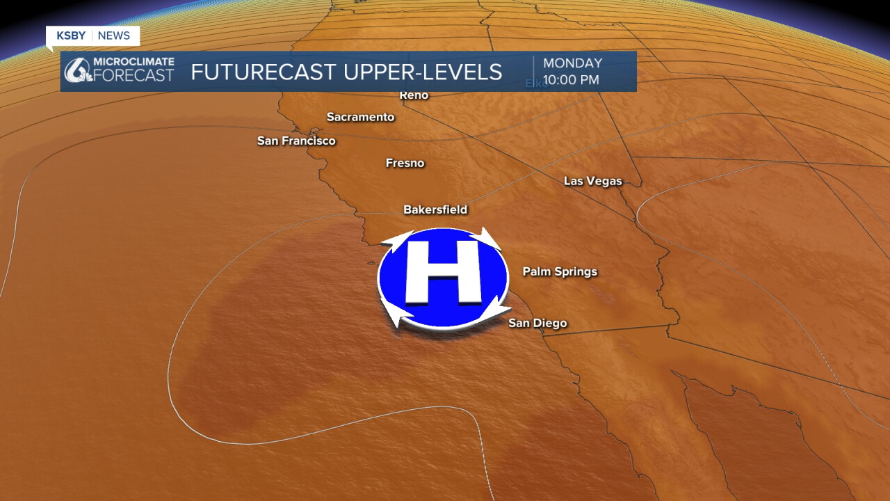
A major and long-lasting heat wave this weekend and it stretches through all of next week, bringing dangerously hot temperatures to San Luis Obispo County and Santa Barbara County, including the Santa Lucia Mountains, the Santa Ynez Range, and the Los Padres National Forest. Strong high pressure building over the eastern Pacific and the West Coast is driving the event, paired with weak offshore pressure gradients ranging.
While this setup features offshore winds, it is not a traditional offshore wind event pattern due to limited upper-level support, though brief periods of sub-advisory north to northeast winds will occur at times.
Coastal clouds and morning fog, occasionally dense, are expected along the immediate shoreline and into some coastal valleys, particularly on Saturday morning. However, building high pressure overhead will largely limit the marine layer to the coast, and weak offshore gradients mean sea breezes will be restricted. This dynamic allows the heat to push directly toward the ocean. While mid- to high-level clouds moving through the region may slightly temper warming across San Luis Obispo County and northern Santa Barbara County, the heat wave will fully encompass our area by the weekend.
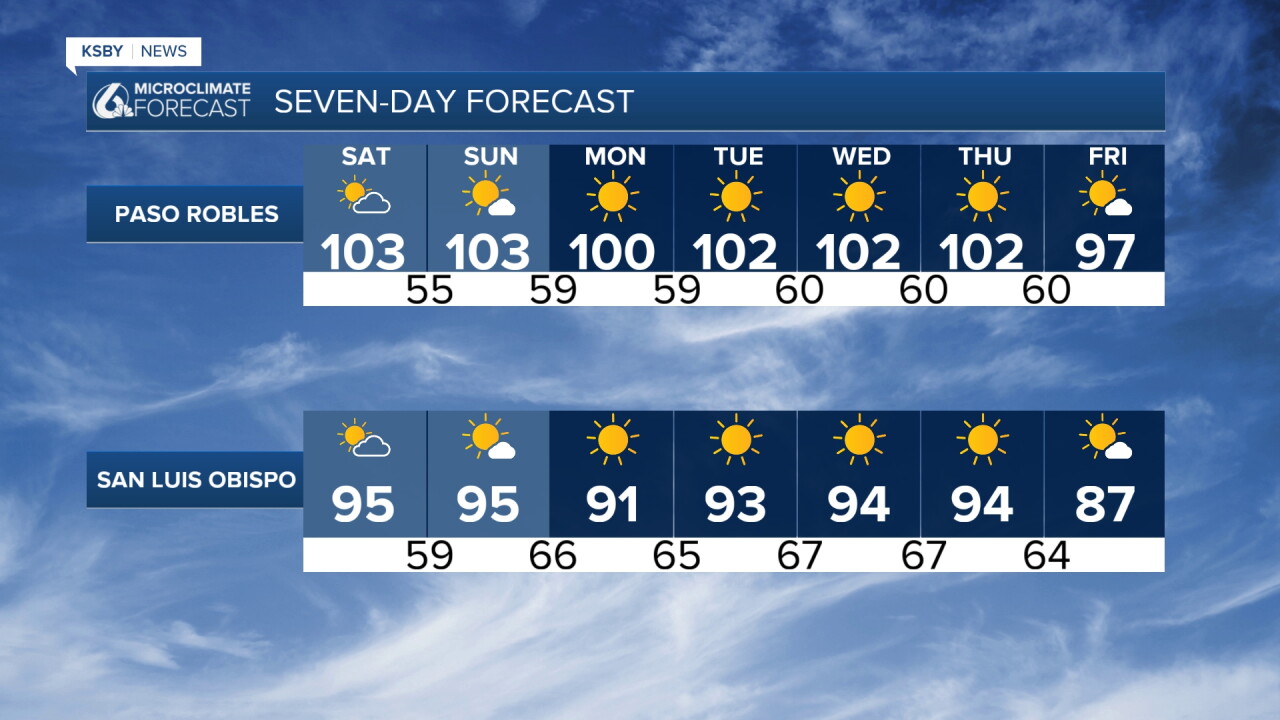
Temperatures across the interior valleys will soar well above normal, reaching the lower 100s by the weekend. Beach areas up to 5 miles inland will experience highs in the 70s, 80s, and a few lower 90s, with coasts from Santa Barbara southward reaching the upper 80s and 90s.
Looking ahead to Monday through Thursday, the long-term forecast shows little significant change as ongoing offshore winds and persistent high pressure maintain the heat. Minor temperature fluctuations are possible early in the week as the offshore gradient briefly weakens, but some model solutions indicate enhanced upper-level northeast wind support that could push temperatures even higher around Wednesday into Friday. Heat advisories may need to be extended into next week depending on how these trends evolve, though models suggest a potential shift toward cooler temperatures by the following weekend as tropical moisture and an upper-level trough approach the region.


Have a great weekend, Central Central.
-Jim
