


Good Wednesday evening, Central Coast!
CENTRAL COAST WEATHER OUTLOOK for San Luis Obispo & Santa Barbara Counties
TONIGHT THROUGH SATURDAY
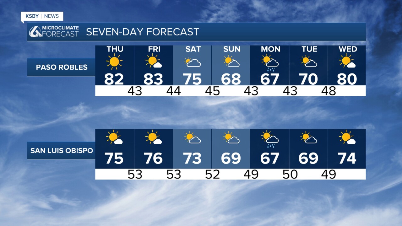
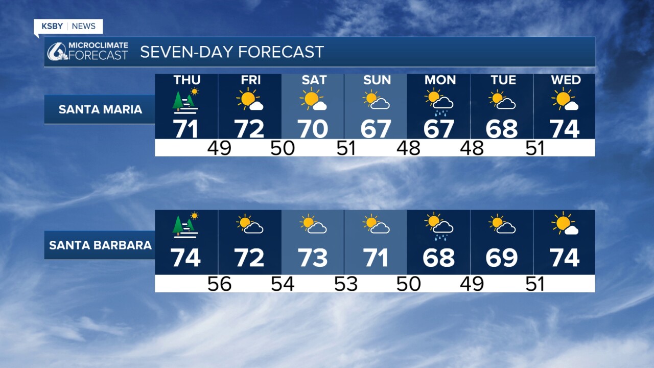
A remarkably quiet weather pattern will dominate the Central Coast through Saturday as the first of two upper-level disturbances moves through our region. This system will remain moisture-starved, with most precipitation staying well south of our viewing area.
Breezy west to northwest winds will develop at times, particularly affecting exposed areas of both mountain ranges and the coastal plains. These winds will be most noticeable during the afternoon hours.
Expect increasing marine layer development over the next couple of mornings, particularly affecting coastal valleys in both counties. Some low clouds may persist along beaches into Saturday afternoon, especially in southern Santa Barbara County. Mid and high-level clouds will occasionally drift across the Santa Lucia and Santa Ynez Mountains on Thursday.
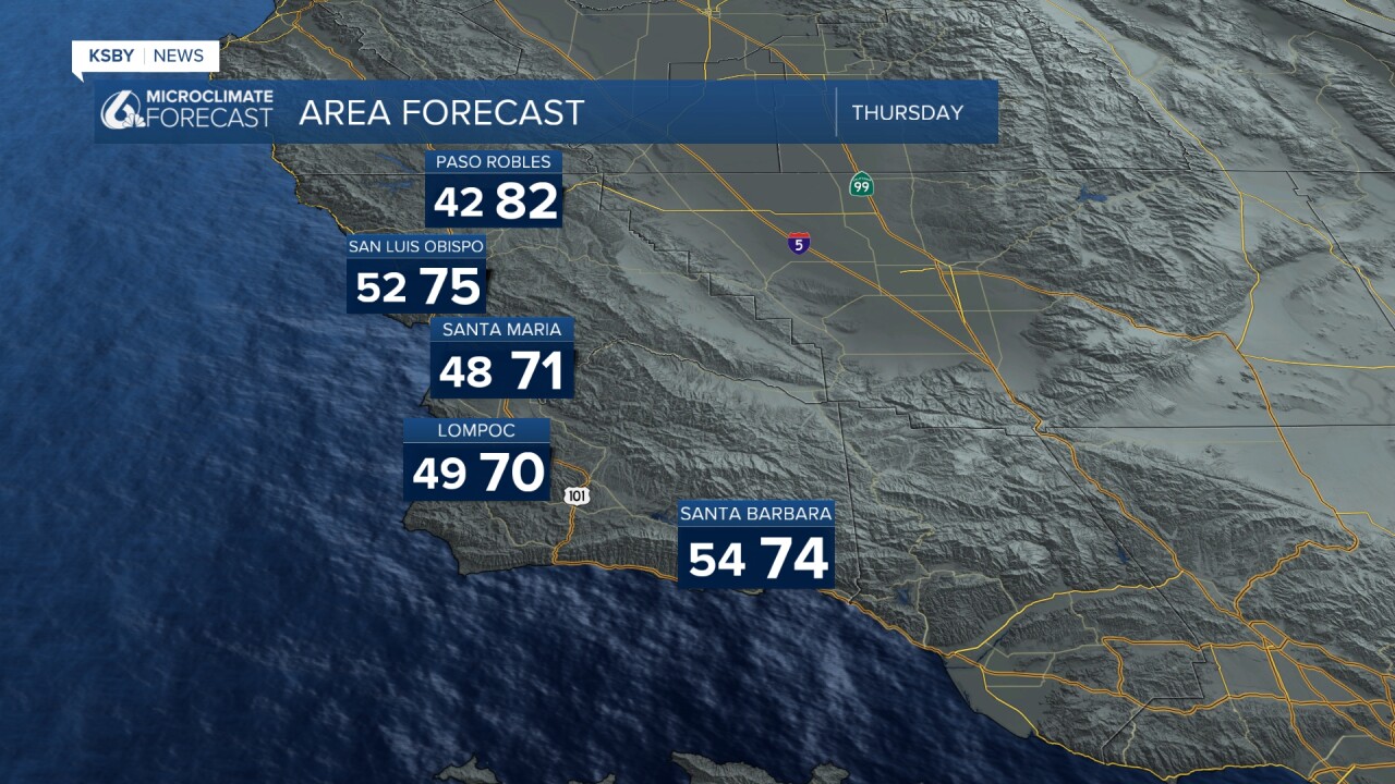
Temperature-wise, we saw a modest warming trend today, and that pattern continues, with either steady readings or a few moredegrees of warming for inland valleys through Saturday. Coastal areas will remain more stable.
SUNDAY THROUGH WEDNESDAY
A significant pattern change arrives Sunday as the second cut-off low-pressure system drops southward along the West Coast. This will bring notable cooling, especially pronounced in interior valleys and mountain areas of both counties.
The most interesting development: light shower activity becomes possible Sunday night into Monday. While rainfall amounts will generally stay under a quarter-inch, the best chances for measurable precipitation will be along our immediate coastline and in the orographically favored areas of the Santa Lucia, Los Padres National Forest, and the Santa Ynez Mountains, where terrain can help squeeze out additional moisture from this relatively weak system.
Any showers that do develop could provide brief periods of light to moderate rainfall, particularly in the Los Padres National Forest areas, where elevation enhances precipitation efficiency.
Tuesday and Wednesday should return to dry conditions with gradual warming each day, assuming the timing of the second system stays on track. However, if that upper-level low arrives later than expected, the warming trend could be delayed by an additional day.
Below is a snapshot of Monday at 11am. Rain chances begin late Sunday and continue into Monday.

Have a great night Central Coast!
-Jim
