

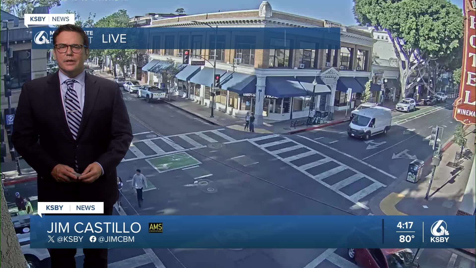


Central Coast Weather Outlook: San Luis Obispo & Santa Barbara Counties from Meteorologist Jim Castillo
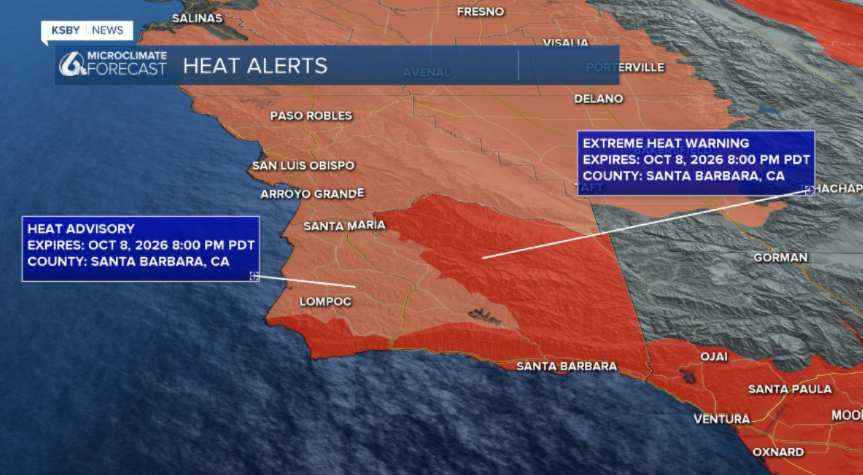
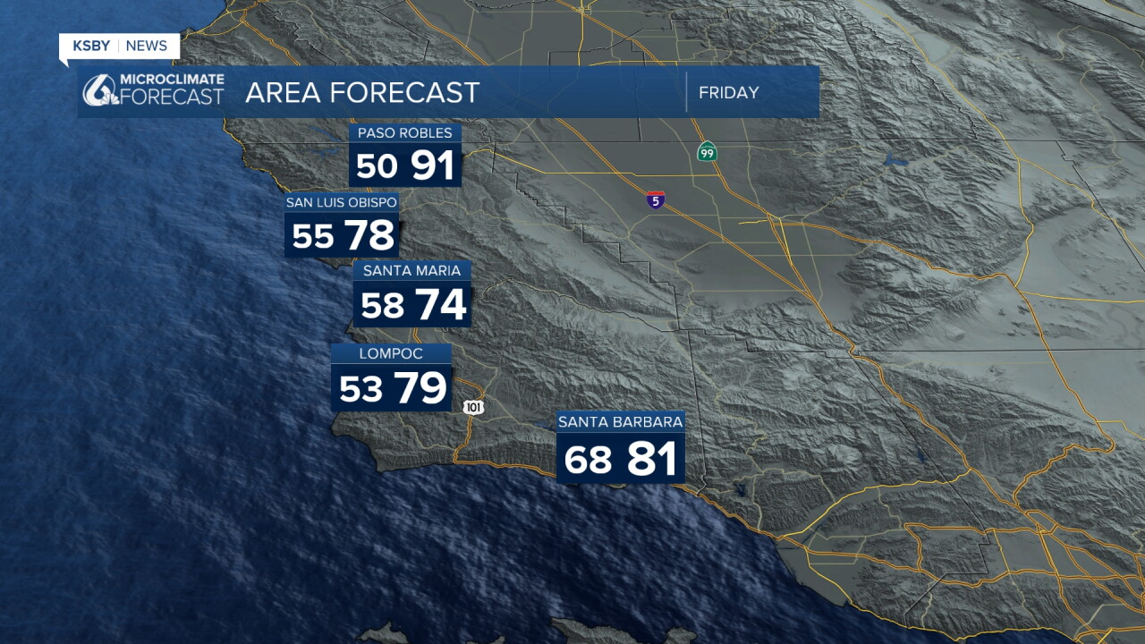
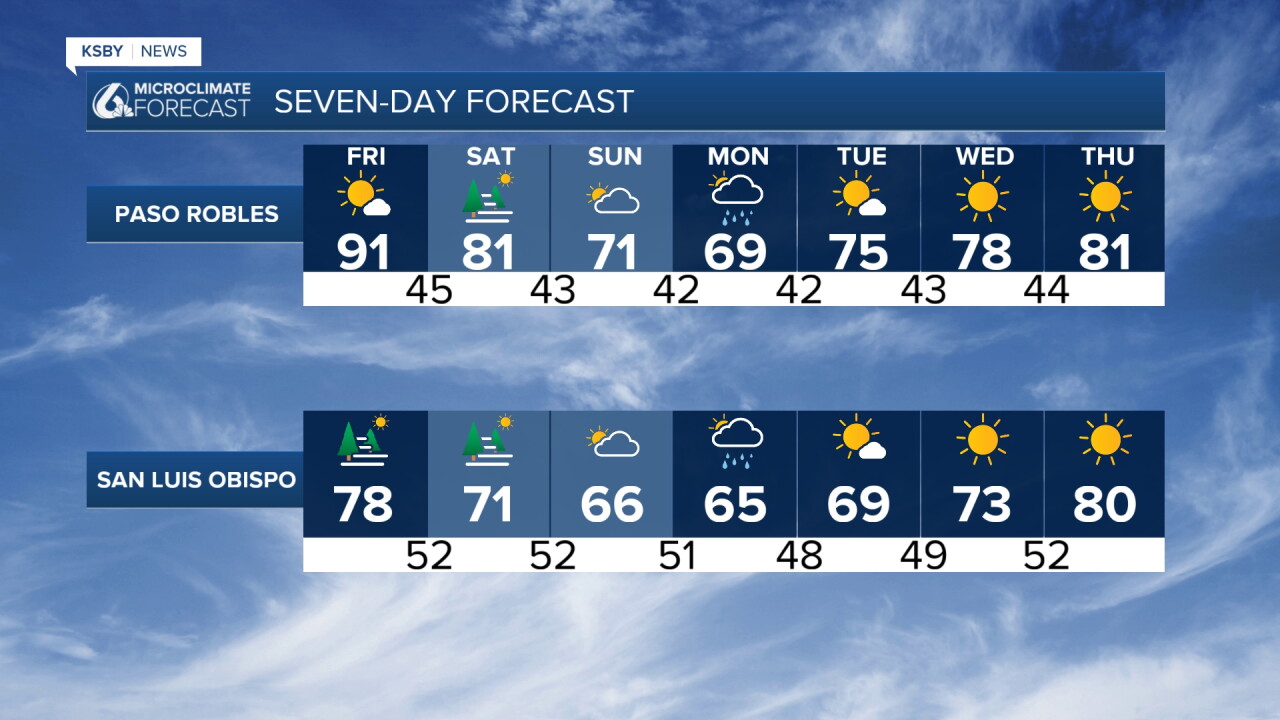
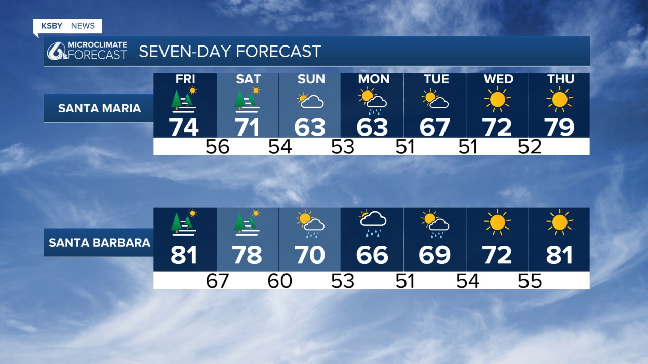
Transition to Cooler Conditions (Friday to Sunday): Lingering heat hazards expire at 8 pm Thursday as pressure gradients turn lightly onshore. A significant cooling trend begins Friday, driven by falling heights, increasing onshore flow, and a robust marine layer blanketing the coast and lower valleys. Most coastal areas will top out in the 60s, while interior valleys reach the 70s.
Major Pattern Shift & Tropical Moisture (Sunday night into Monday): Deep troughing builds across the West Coast, setting up a southwest flow that steers the remnant moisture of what was Hurricane Rachel toward the northeast. Saturday will turn mostly to partly cloudy with a deep marine layer and mid-level clouds streaming in. Dramatic cooling will overspread San Luis Obispo and Santa Barbara counties.
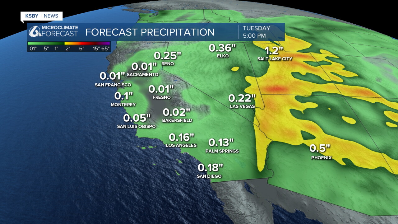
Complex Storm Interaction (Sunday night into Monday): A large trough stalls over the West Coast, featuring a cold upper low dropping down toward the Bay Area. Simultaneously, moisture associated with the remnants of Rachel surges north into Southern California. Expect a chance of rain to develop across Santa Barbara County, bringing trace amounts up to 0.20 inches, while San Luis Obispo County is expected to stay mostly dry Sunday with little to no accumulation. Maximum temperatures will remain locked in the 60s.
Upper Low Passage & Rainfall (Monday): The cold upper low tracks directly into the vicinity of Santa Barbara County, bringing widespread clouds and a fair chance of rain to both San Luis Obispo and Santa Barbara counties from midnight to midnight. Because the primary moisture plume shifts slightly east, most areas can anticipate general rainfall totals ranging from a tenth to a quarter of an inch. Highs will hover in the 60s.
Midweek Drying Trend (Tuesday /Wednesday): As drier northwest flow takes over behind the departing low, skies will turn sunnier with a gradual warming trend. Mountain areas may see a slight lingering shower chance, but overall conditions will be dry. Afternoon high temperatures will remain comfortably below normal.
Have a great night, Central Coast, and enjoy the cool down!
-Jim
