

We are still under the influence of a strong upper-level high-pressure system, which is bringing us warmer-than-average temperatures. The Polar Jet Stream dips all the way down into Northern Florida, bringing Polar air into the Ohio Valley and most of the East Coast.
No major changes to our forecast are expected over the next few days as we head into our weekend. A slow cooling trend will begin Friday, but above normal temperatures are still expected through the weekend.

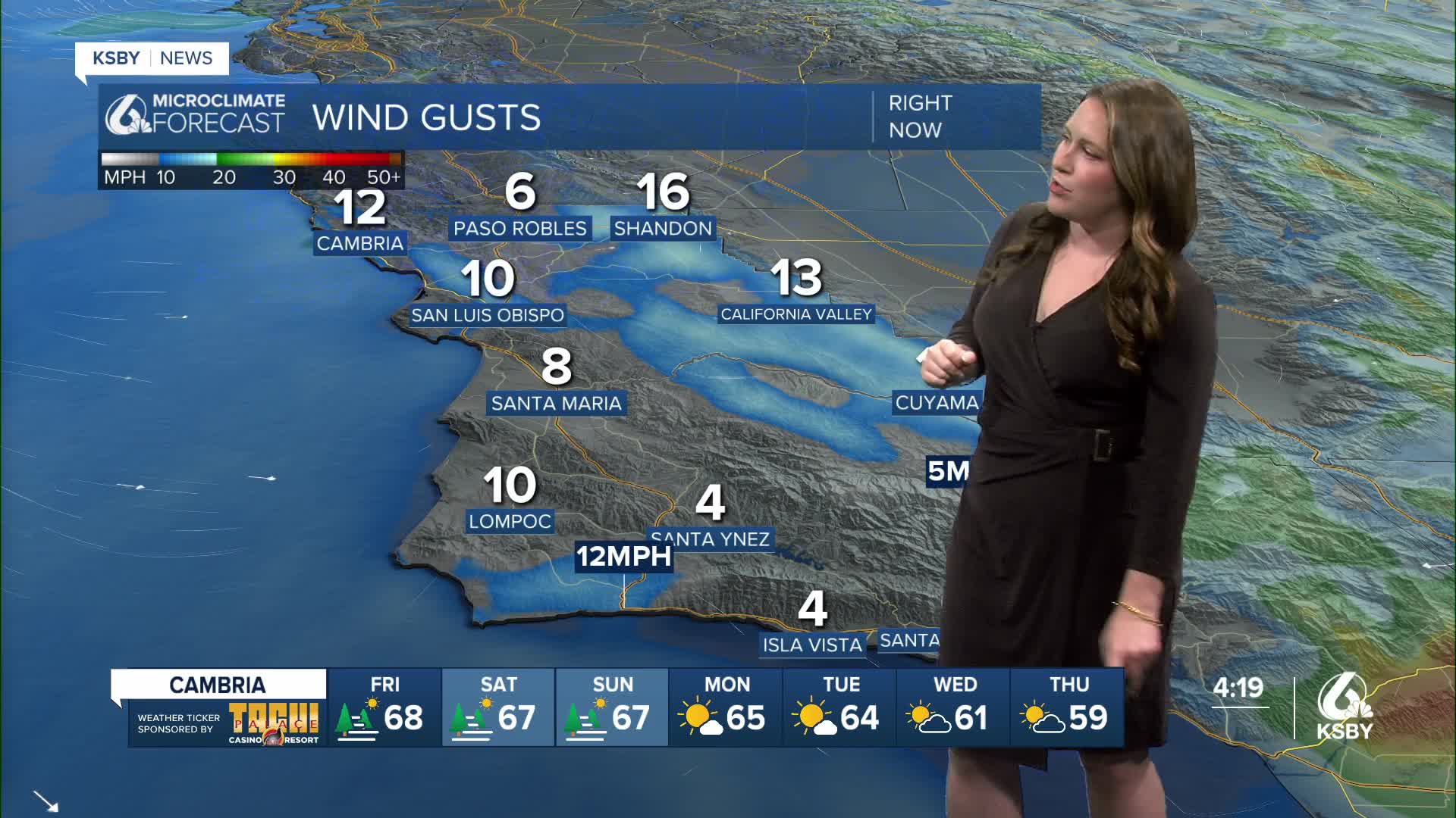
Highs on Friday will be about 10 degrees above normal.

The one big change to our forecast will be the return of some low stratus layer to the immediate coast. Weather models are mixed on whether fog will move on shore, but the best chance for some fog will be on Friday morning along the coast.


A moderate to strong offshore flow is expected to continue until Tuesday, when temperatures return to more typical readings for this time of the year. The next slim chance for rain is still possible later next week, but any rain will likely be light and have little impact on our daily activities.
