



Happy Friday, Central Coast!
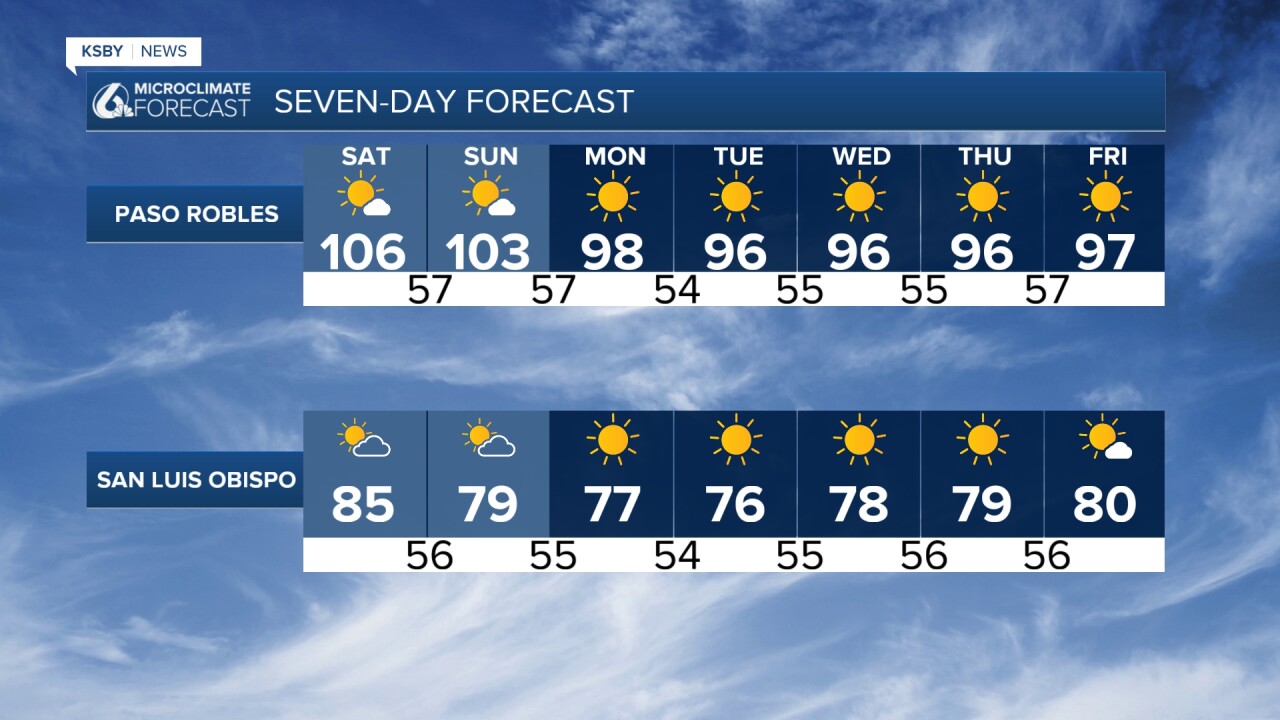
Saturday: Peak Heat Day
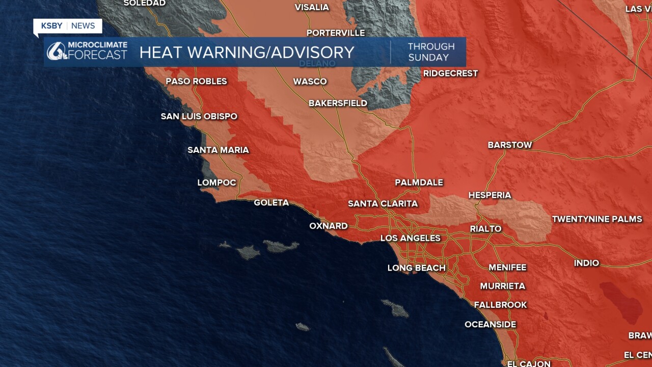
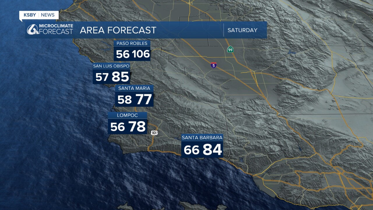
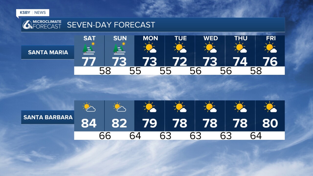
Temperature Outlook: Saturday will be the hottest day as the upper-level high strengthens. Temperatures will climb well above normal, with highs reaching the 100s in North County areas and the 80s in coastal valleys. It's a good idea to have any outdoor activities completed before 9 AM or after 7 PM in the hottest locations.
Despite the heat, onshore gradients will remain at least lightly onshore, allowing sea breezes to bring cooling ocean air inland by afternoon. Monsoon moisture will not be a factor, so humidity levels will remain manageable.
Overnight Conditions With sea surface temperatures in the 70s south of Point Conception, overnight lows will stay much warmer than normal, mostly in the 60s around Santa Barbara. This will limit overnight cooling in homes without air conditioning. Most of the Central Coast will have comfortable lows in the 50s.
Evening Sundowner winds across southwest Santa Barbara County may gust up to 35 mph Saturday evening.
A large south swell from Tropical Cyclone Genevieve will create enhanced waves and potentially deadly rip currents at area beaches through Saturday. While surfers may welcome the conditions, all beachgoers should exercise extreme caution.
Sunday and Beyond: Gradual Cooling
The slow cooling trend begins Sunday and continues into next week, with temperatures returning to near normal or slightly above average levels.
Mountain Areas
Conditions in the Santa Lucia Mountains, Santa Ynez Mountains, and Los Padres National Forest areas within San Luis Obispo and Santa Barbara Counties will follow similar patterns, with the highest elevations experiencing slightly cooler conditions but still well above seasonal norms Saturday.
Safety Reminders Always maintain proper hydration during outdoor activities and seek air-conditioned spaces during peak afternoon heat hours.
Have a great weekend, Central Coast!
-Jim
