

Happy Saturday, Central Coast!
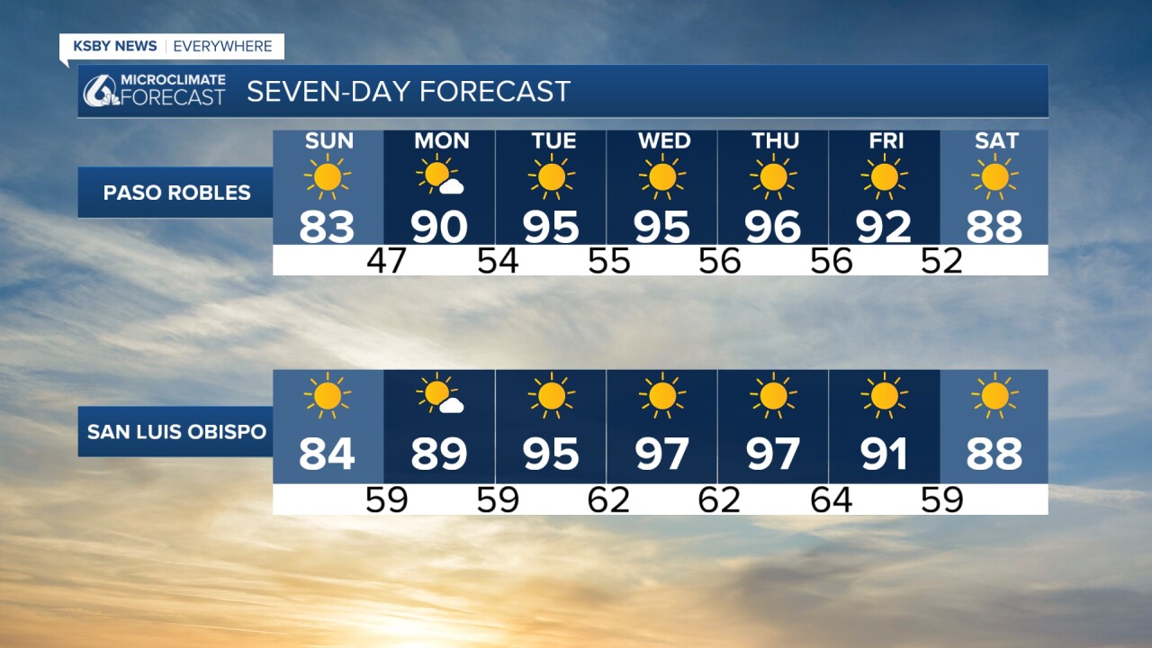
I hope you all took advantage of the slight drop in temperatures to go to the beach. We were still pretty warm, above the normal for this time of year. Expect a second round of intense heat to begin on Sunday and continue to intensify throughout the work week. Temperatures on Sunday will be warmer than today. Here is a preview of what you can expect tomorrow.

This ridge of high-pressure is here to stay all of next week! We'll experience very summer-like temperatures. It looks like this second round of intense heat will peak for several communities on Wednesday.
Please make sure to stay hydrated and wear light clothing. Avoid being in the sun for long periods of time, as the risk for heat-related illnesses is high.

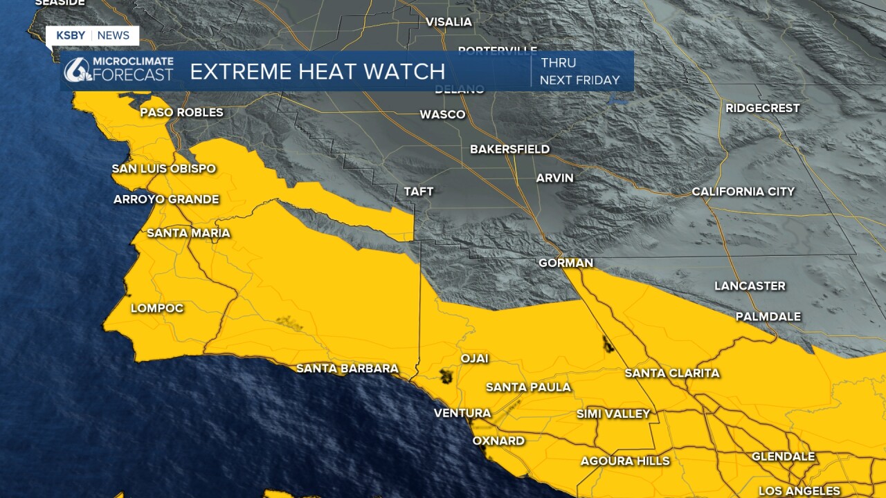
Ahead of this intense and unusual wave of heat for this time of year, an Extreme Heat Watch has been issued for all of next week.
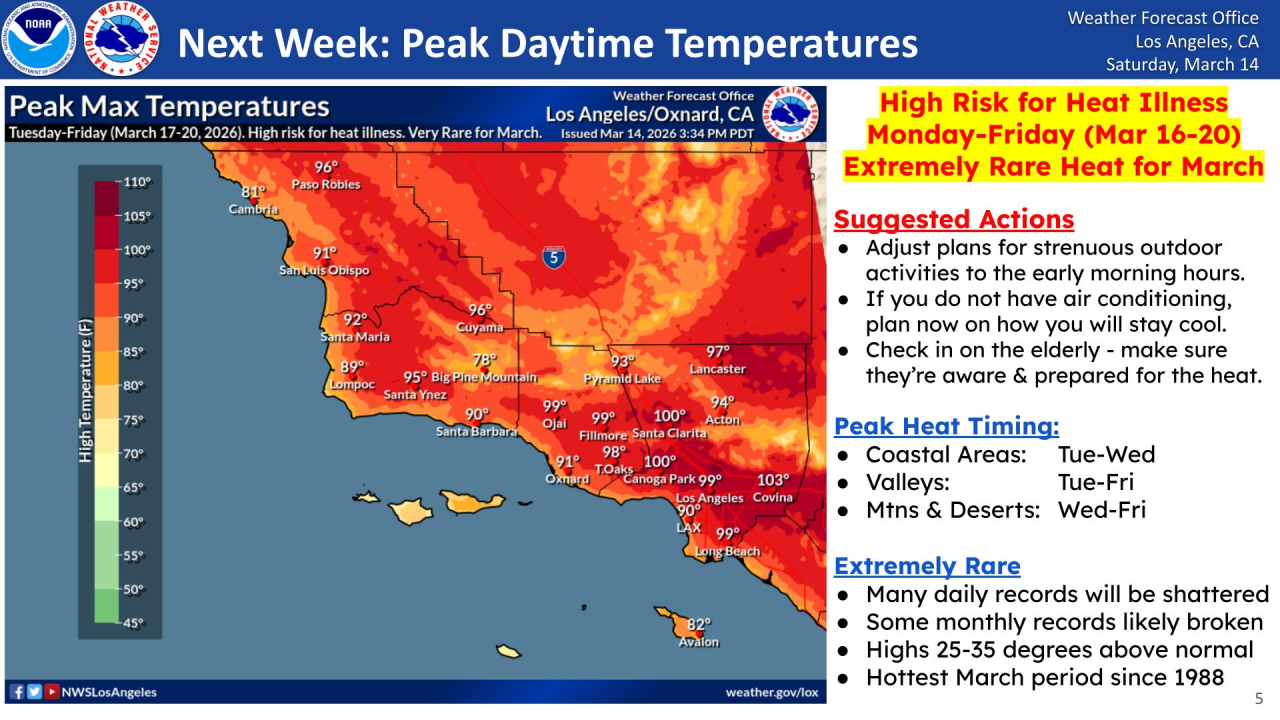
I'll leave this infographic from the National Weather Service about this intense heat wave.
Stay cool, Central Coast!
-Leslie Molina
