


Good evening, Central Coast!
Happy Friday! Low clouds and areas of fog are likely tonight into Saturday morning, then some afternoon clearing is expected for most of us. If you run into foggy areas, please take it slow on the roads where the visibility is reduced.
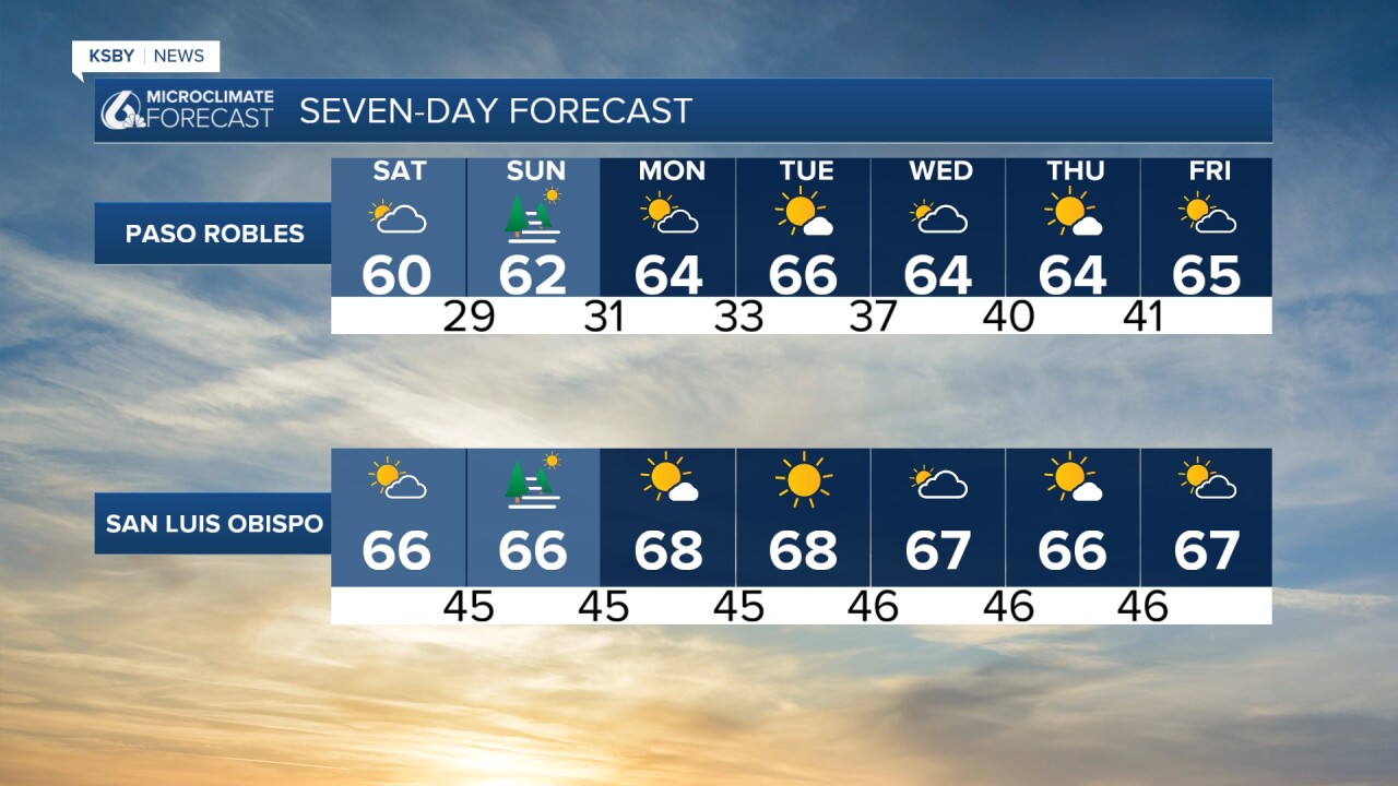
Saturday afternoon looks pleasant with highs near or right at average highs for this time of year. Highs should make it into the low and possibly mid 60s.

On Sunday, we may have a bit more clouds to deal with, along with areas of fog. We are not expecting any rain. Highs on Sunday should reach the low and mid 60s once again.
Below you will find the 7-day forecast.

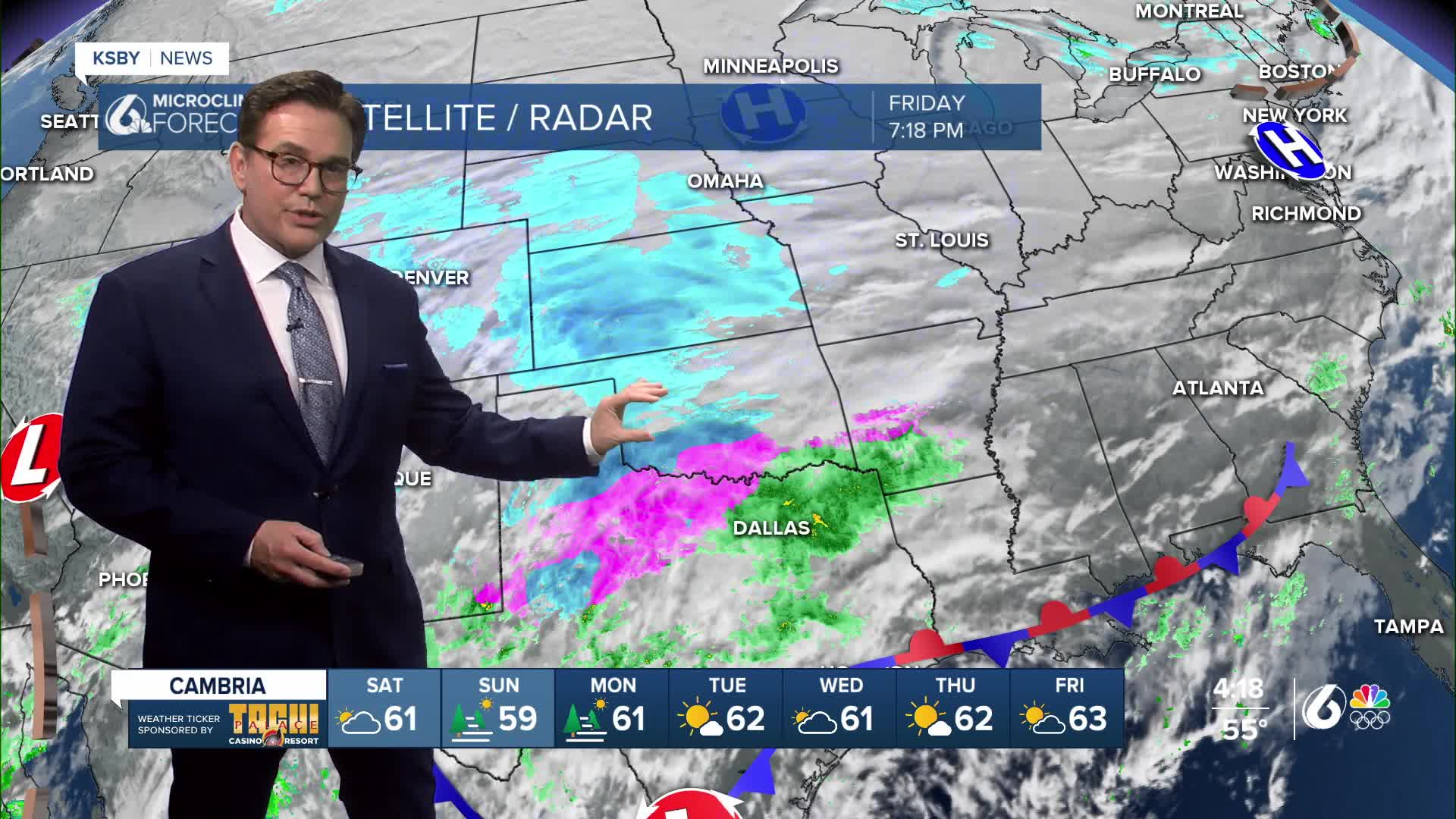
Much of the country has a record-breaking and strong Winter storm to deal with this weekend. This major Winter storm is likely to be the biggest in many years. Winter Storm Warnings extend from Albuquerque to Boston as much of the U.S. braces for a record-breaking storm.
Heavy snow is forecast across a large area from the Southern Rockies and Plains through the Mid-Atlantic and into the Northeast. Over a foot of snow is likely in these areas.
Catastrophic ice accumulation is looking widespread south of the heavy snow area. Ice will be affecting the Southern Plains, Lower Mississippi River Valley, Tennessee Valley, the Southeast, and the Mid-Atlantic. Long-duration power outages, extensive tree damage, and extremely dangerous roads are likely.
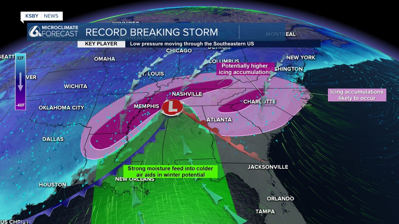
Frigid temperatures have already settled into the heatland behind a strong Arctic front. Gusty winds will lead to very dangerous wind chill reading.


Even our flights in and out of San Luis Obispo, Santa Barbara, and Santa Maria airports will likely see delays and cancellations due to this intense Winter storm.
Enjoy our pleasant weather this weekend, Central Coast!
-Jim
