


Good Friday evening, Central Coast!
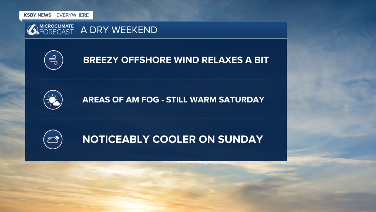
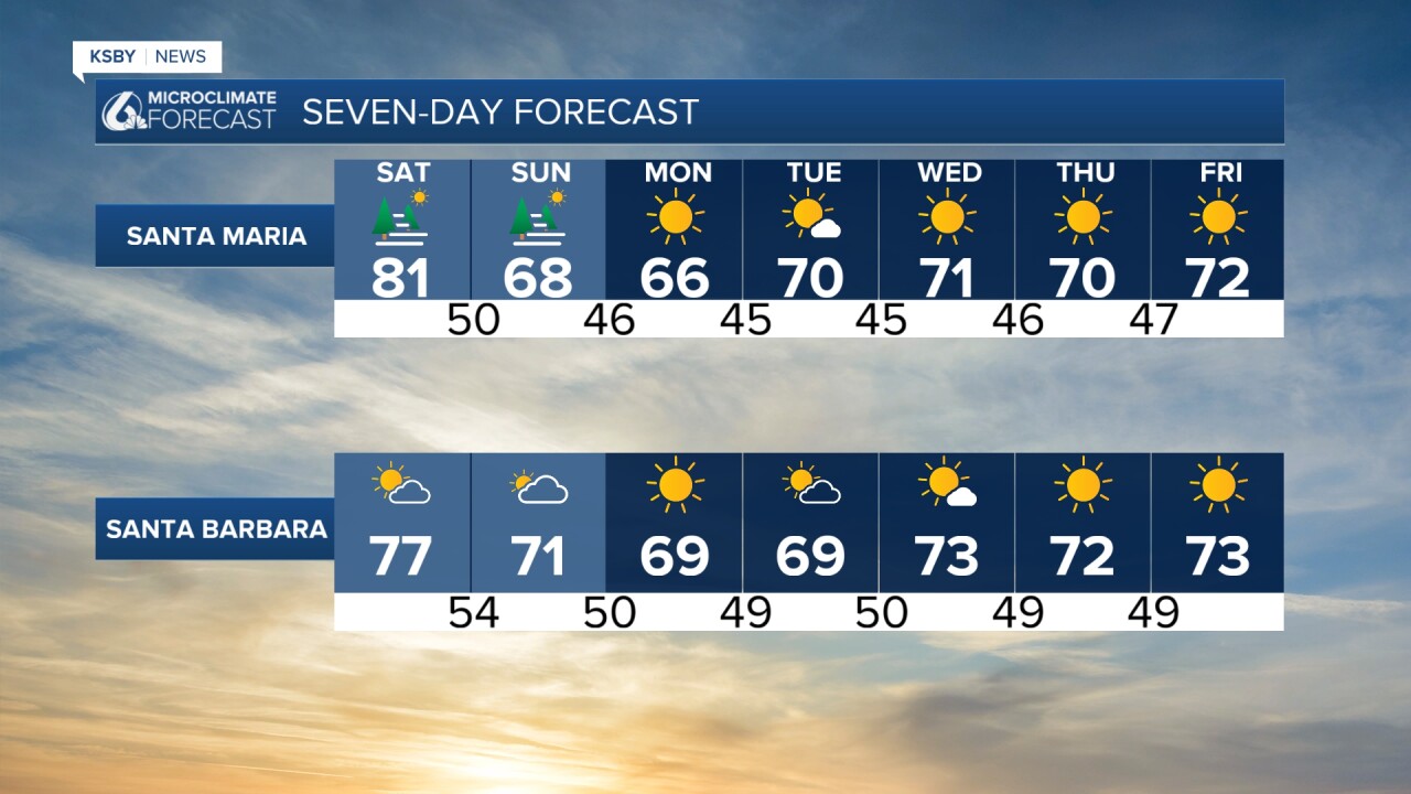
It was a hot day for the Central Coast on Friday, and just as expected, it was the warmest day of the week. We are slightly cooler on Saturday, but still warm. You will really notice the cooler air on Sunday with more clouds.
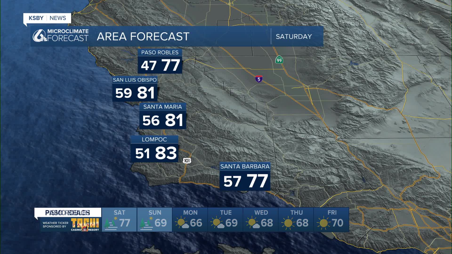
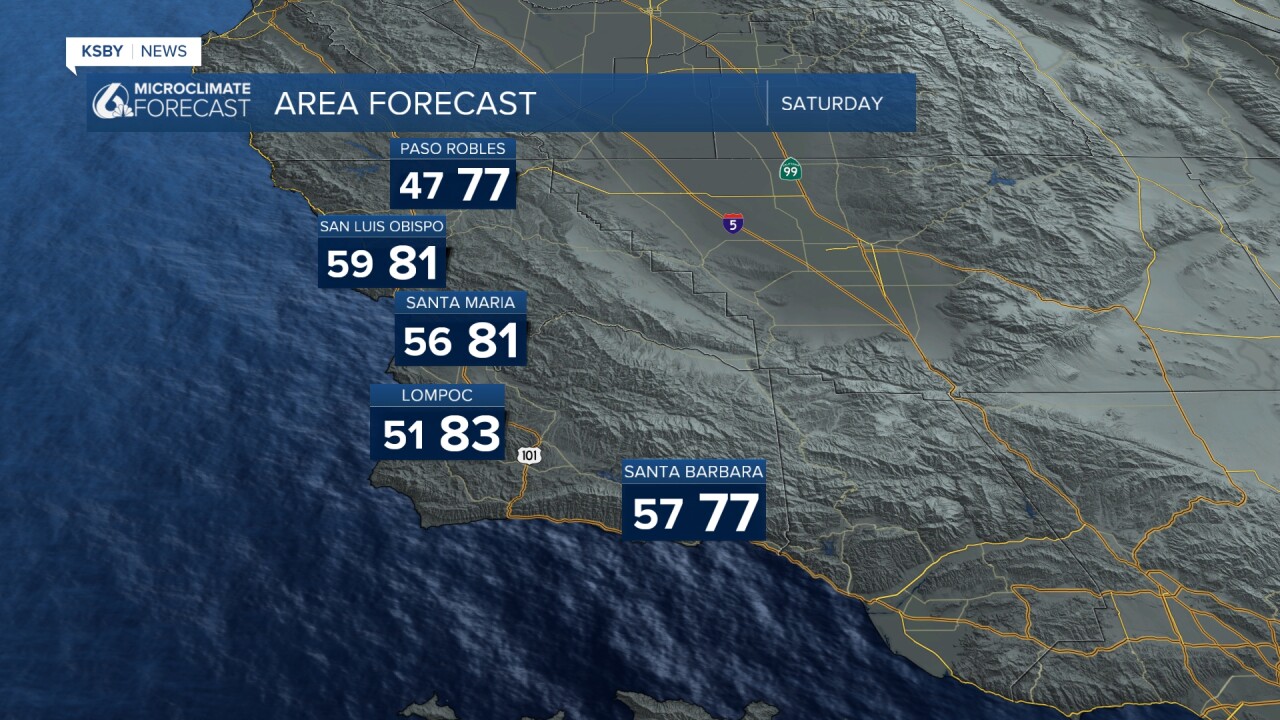
Saturday: Some low clouds and fog are likely along the South Coast and Central Coast and some inland valleys to start the day.
Temperatures will slightly drop near the coast as a storm system approaches Northern California and weakens the heat ridge. We stay dry, with many inland areas staying warm, with some locations popping into the low 80s.
Sunday: More morning clouds and areas of fog at the beaches. San Luis Obispo and Santa Barbara counties see the cooler and cloudier day of the weekend.
Monday: A passing weather system brings gusty northwest winds to the coast and mountains, which keeps the cooldown going for the Central Coast. No rain is expected as the storm is tracking further north. Some morning clouds and fog are likely along the Central Coast.
Tuesday & Wednesday: Sunshine returns. Temperatures gradually climb back up a few degrees, with most coastal and valley highs reaching the 70s by Wednesday, still slightly above normal.
Thursday: Another system brings cooler, breezier conditions to the region.

Looking ahead: Many weather computer models show the Central Coast forecasting a mostly dry stretch through mid-March.
Have a great weekend, Central Coast!
-Jim
