


Happy Friday from Meteorologist Jim Castillo, here is your Central Coast weather forecast
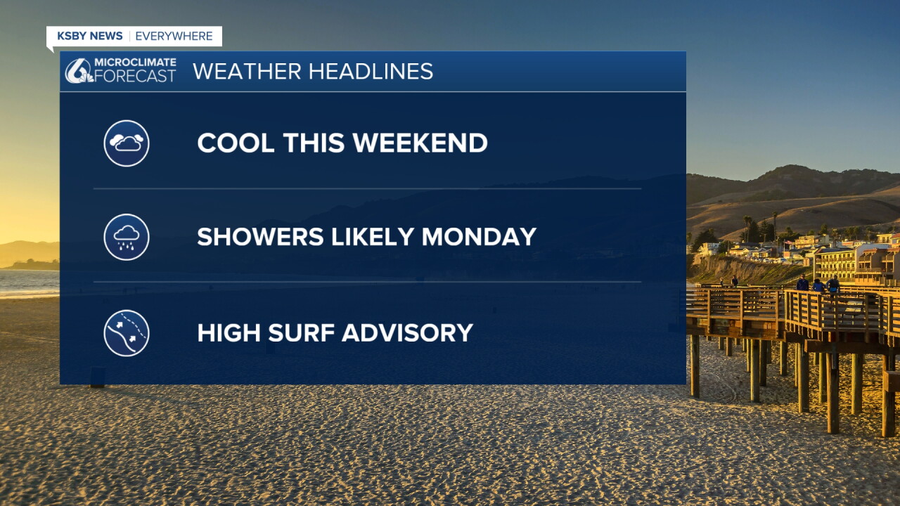
Cooling Trend, Moisture from Rachel, and Coastal Hazards are the headlines
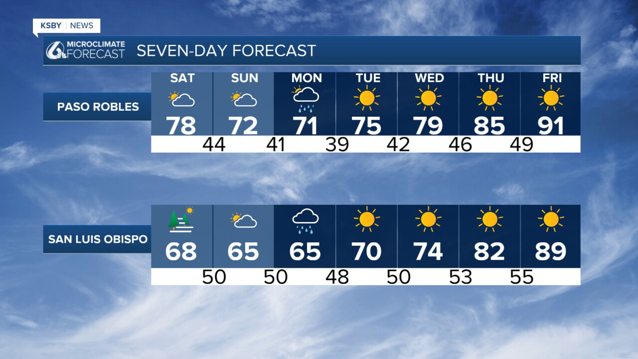
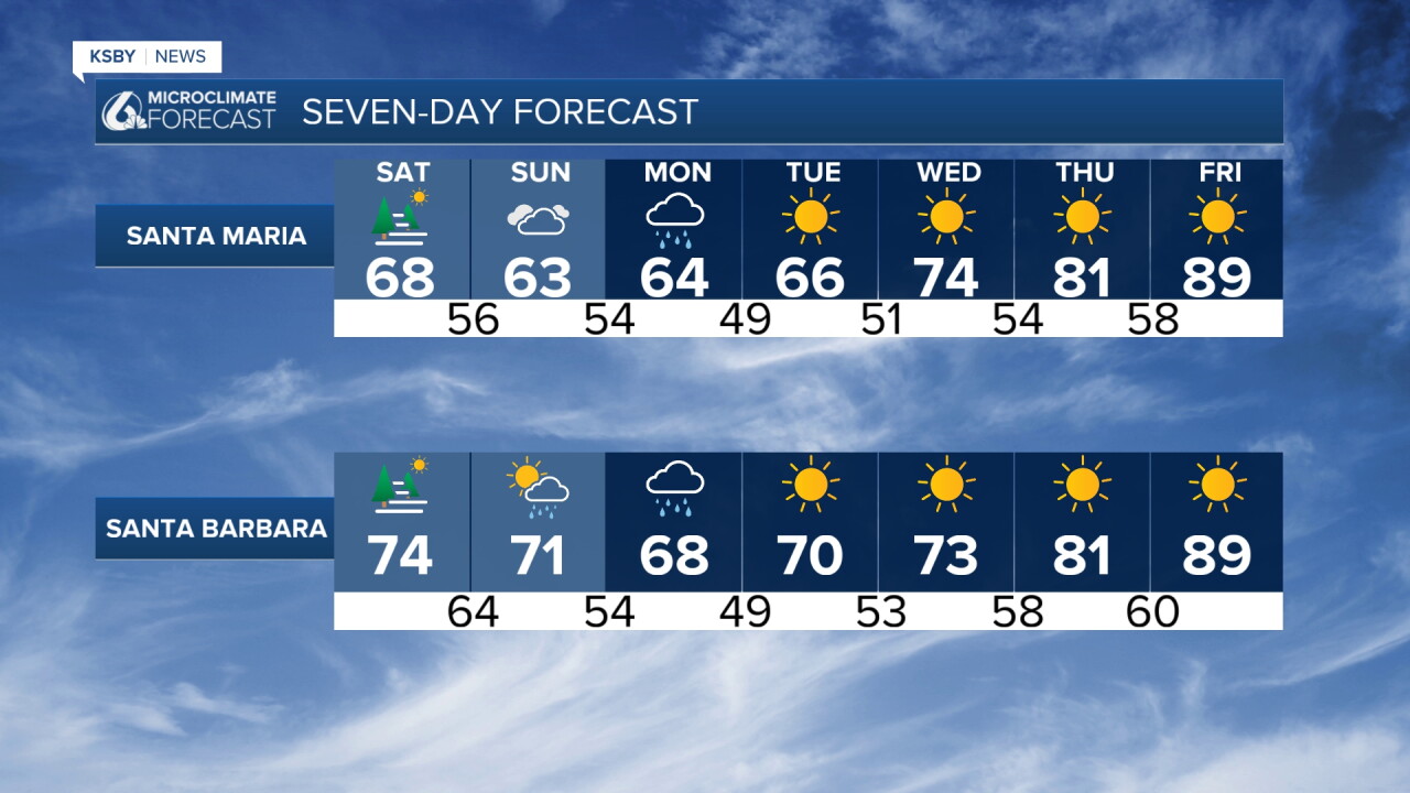
Temperatures are much cooler across San Luis Obispo County and Santa Barbara County through the weekend, offering a refreshing break from earlier heat.
An upper-level low dropping southward off the California coast tonight into Saturday will interact with moisture from Tropical Storm Rachel, bringing an increasing chance of showers, with the best chance Sunday night into Monday.
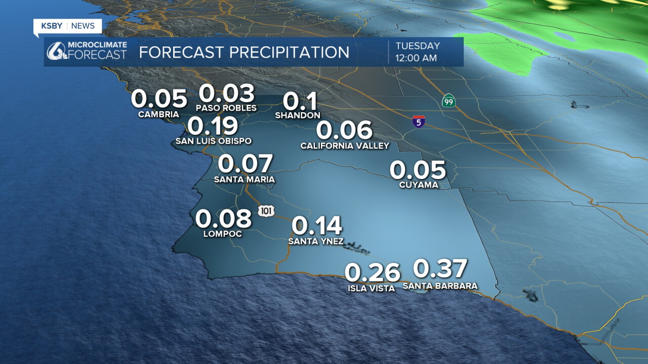
While the heaviest moisture will remain south and east of the Central Coast, light rainfall amounts totaling a few hundredths of an inch are expected, as an upper- level low tracks overhead. Right now, San Luis Obispo looks like .10" up to .25", and some areas below .10" and in Santa Barbara, .25" up to .40" could fall. Heavier rain over Los Angeles is very possible, and a Tropical Storm Watch has been issued for San Diego County, including the city of San Diego, for only the 2nd time in history. The last time San Diego had a Tropical Storm Watch was in 2023.
Gusty winds will accompany strengthening onshore flow, and a deepening, more widespread marine layer through the weekend.
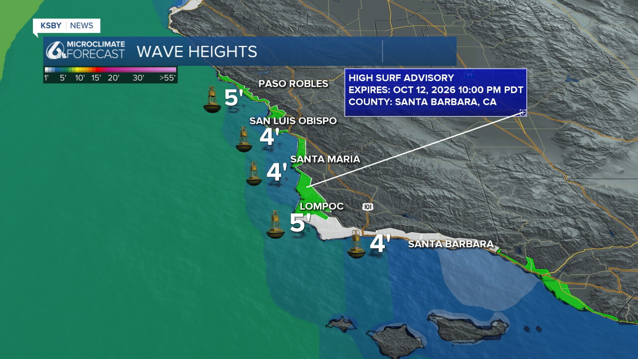
Beach Hazards Statement Saturday and a High Surf Advisory Sunday for large breaking waves of 8 to 12 feet.
Timing: In effect from Saturday morning through Monday afternoon for San Luis Obispo County beaches and Santa Barbara County beaches.
Impacts: Minor tidal overflow flooding, pooling of seawater around high tide in uncommon beach and harbor areas, and enhanced beach erosion.
Marine Risks: Dangerous rip currents, breaking waves due to elevated surf, and high tides reaching 6.6 to 7.2 feet each morning, with large secondary evening high tides, create an increased risk of ocean drowning, minor coastal flooding, and hazardous conditions for small boats nearshore.
Mid-Week Trend
High pressure and offshore pressure gradients will build on Wednesday and Thursday.
Temperatures will trend warmer Wednesday through Friday, though conditions will remain moderate until Friday when it could back into the 80s and 90s.
Below: Our potential rainfall amounts will vary, and the best chance for rain looks to be Sunday night into Monday.
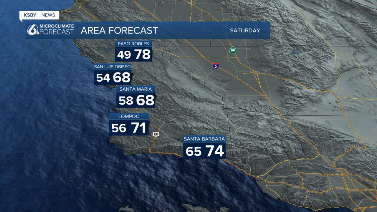
Enjoy the Autumn temperatures and have a wonderful weekend!
-Jim
