


Good Thursday evening, Central Coast!
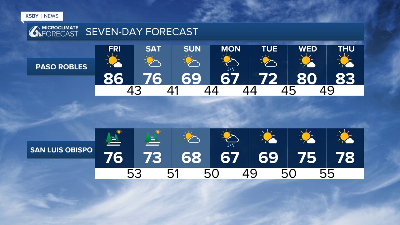
REST OF THE WEEK - QUIET & SEASONAL High pressure will dominate our weather pattern through Saturday, bringing very calm conditions across both San Luis Obispo and Santa Barbara counties. Marine layer clouds with areas of fog will continue to develop each night and morning along the coast and in some valleys, then clear to sunshine by late morning and early afternoon. Temperatures will run right around normal for late April - 60s at the beaches, upper 60s to low and mid 70s inland.
TONIGHT THROUGH SATURDAY The only weather concern will be gusty north winds across southwestern Santa Barbara County this evening, potentially reaching 25-35 mph between 6 PM and midnight. Otherwise, expect typical spring weather with marine clouds returning tonight and likely continuing through the weekend.
SUNDAY - PATTERN SHIFT A cut-off low-pressure system moving down the West Coast will increase onshore flow, deepening the marine layer and cooling temperatures by several degrees, especially inland. This will also generate gusty west to southwest winds across interior areas of both counties, particularly in the Santa Lucia and Santa Ynez Mountains and through gaps in the coastal ranges.
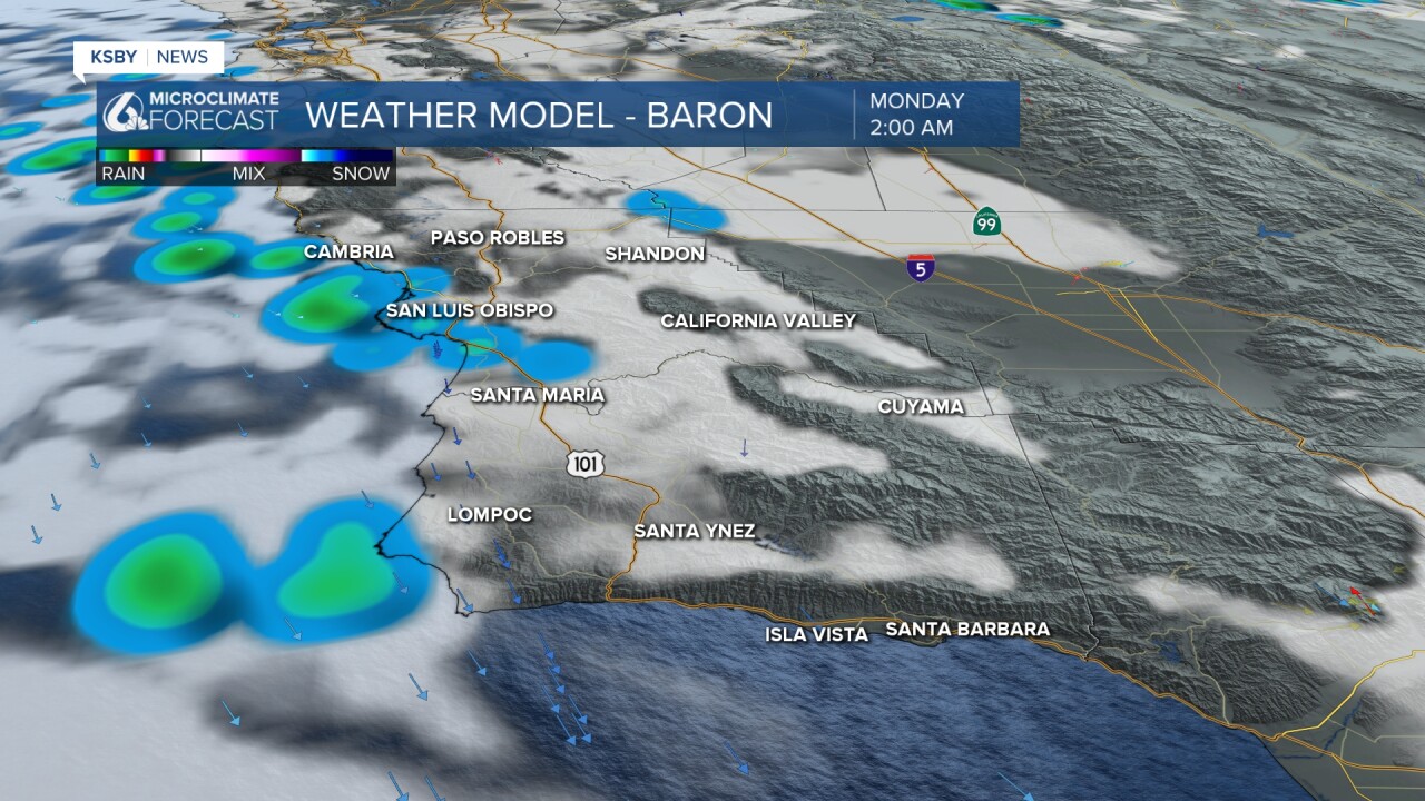
MONDAY- and early TUESDAY - Mainly light rain possible as the low-pressure system will move closest to our area late Sunday into Tuesday, positioned just offshore of the Central Coast. While moisture is very limited with this system, there's a chance for mainly light rain showers, particularly in the mountains of the Los Padres National Forest and the Santa Lucia Range. Any rainfall will likely be light - most areas will see less than a tenth of an inch of rainfall, though the mountains could pick up a tenth to two-tenths of an inch.
Expect cooler than normal temperatures Monday and Tuesday with highs mostly in the 60s along the coast and inland valleys, about 5-10 degrees below average for early May.
WEDNESDAY-THURSDAY - WARMING RETURNS The upper-level low exits Tuesday night, allowing high pressure to rebuild. This will bring 4-8 degrees of warming both Wednesday and Thursday, returning temperatures closer to seasonal normals.
This remains a low-impact weather week overall, with the most significant change being the brief cooling and slight rain chance early next week.
Below are the high temperatures on Thursday.


Below is a Small Craft Advisory along the Central Coast for combined seas up to 10 feel until 3 am Friday morning, May 1st!

Below is a snapshot of Monday at 2 A.M., when the chance for showers ramps up.
It's Reservoir Thursday, so below are the levels and the change from last week. Notice Gibraltar is up +2.0% at 100.0%. The others are no change to slightly lower levels.


Have a nice night, Central Coast!
-Jim
