



Happy Friday, Central Coast!
The stormy stretch we saw Wednesday night into Thursday is coming to an end, with a break from the rain expected to wrap up the workweek.
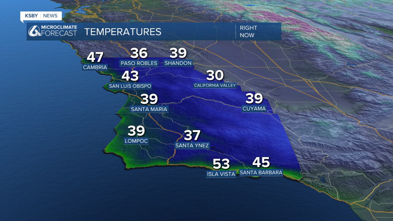
Our Friday is kicking off on the cold side, with many spots in the low 30s in the interiors and coasts in the low 40s. Grab that extra layer but also keep an umbrella handy; there is more rain on the way.
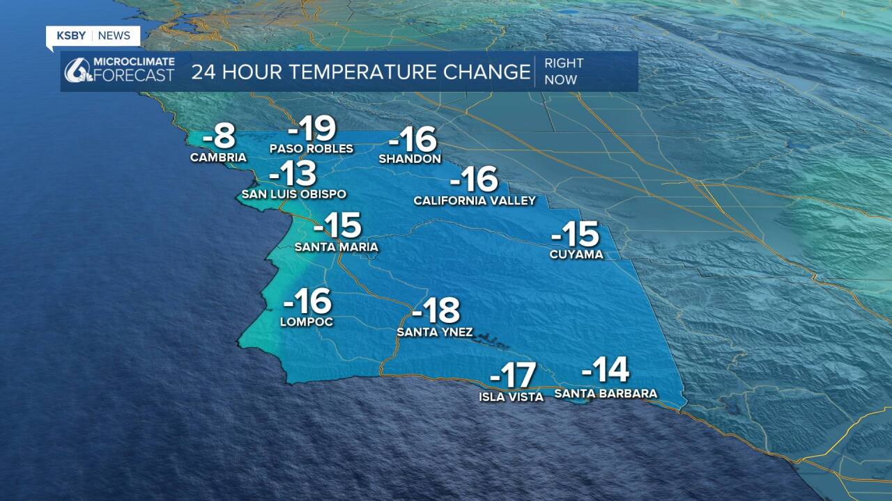
Compare those temps to Thursday morning and you can see the difference. Thursday the storm brought in warmer air, today without that it is cool again.
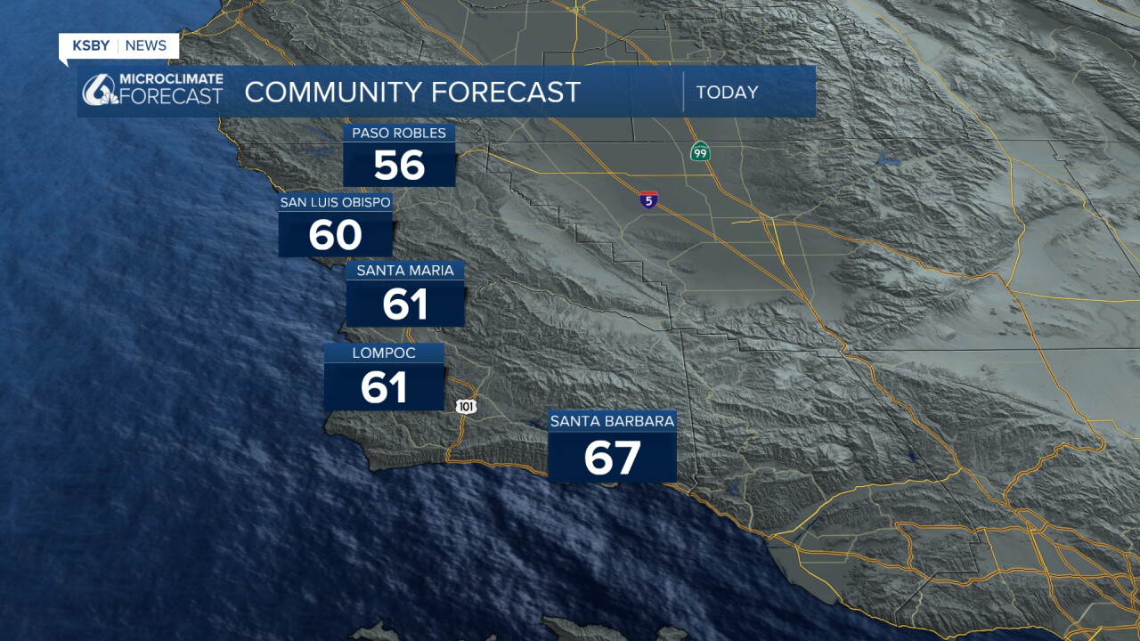
Temperatures will remain on the cooler side through the day Friday. Here is a look at the high temps we can expect today.
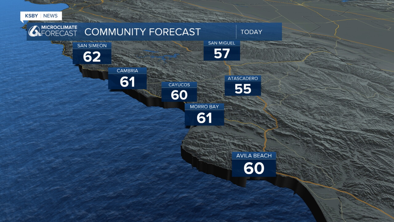
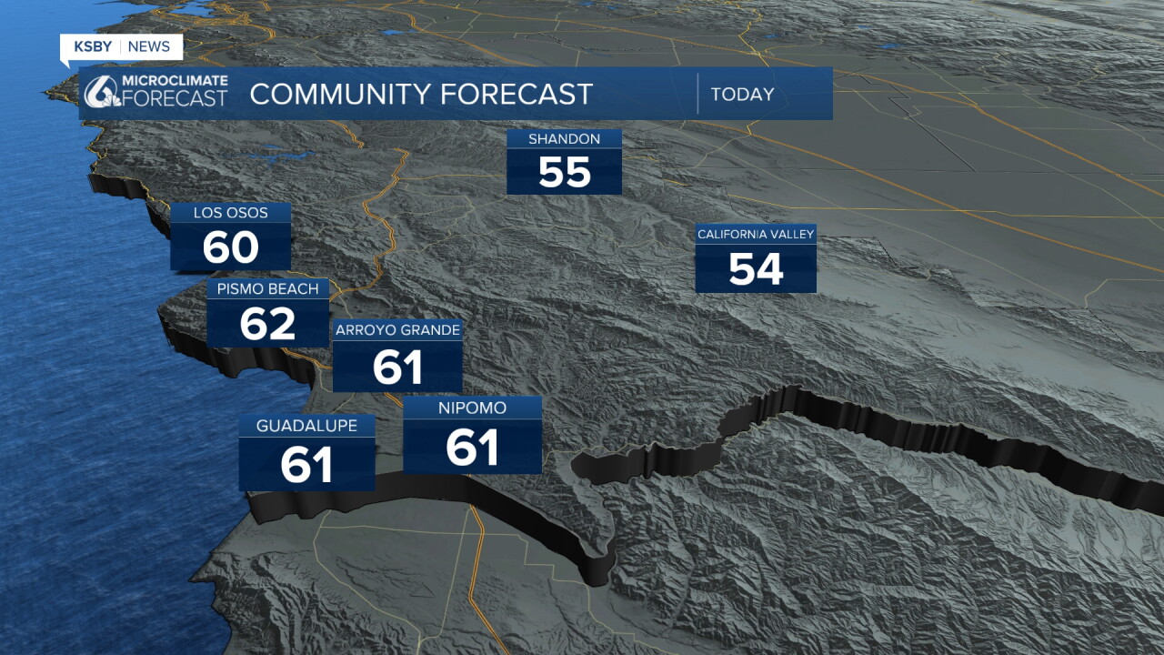
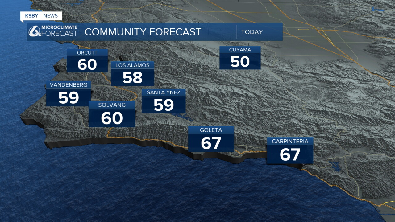
While widespread rain is not expected Friday, a few very light showers could move through parts of the interior valley during the afternoon. Any rainfall is expected to be minimal.
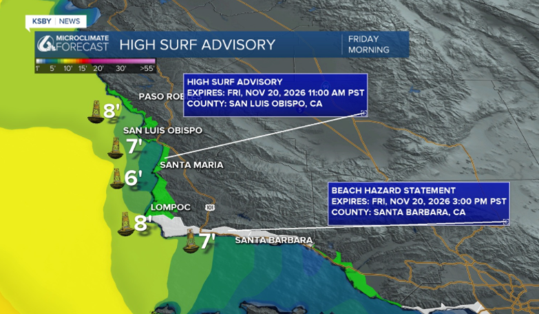
Along the coast, a High Surf Advisory remains in effect Friday morning for San Luis Obispo County, with waves potentially reaching 8 to 12 feet through the day.
A Beach Hazard Statement has been issued for Santa Barbara County through the afternoon due to rip current concerns.
The larger concern is coastal flooding from potential record-breaking king tides next week Tuesday through Thanksgiving.
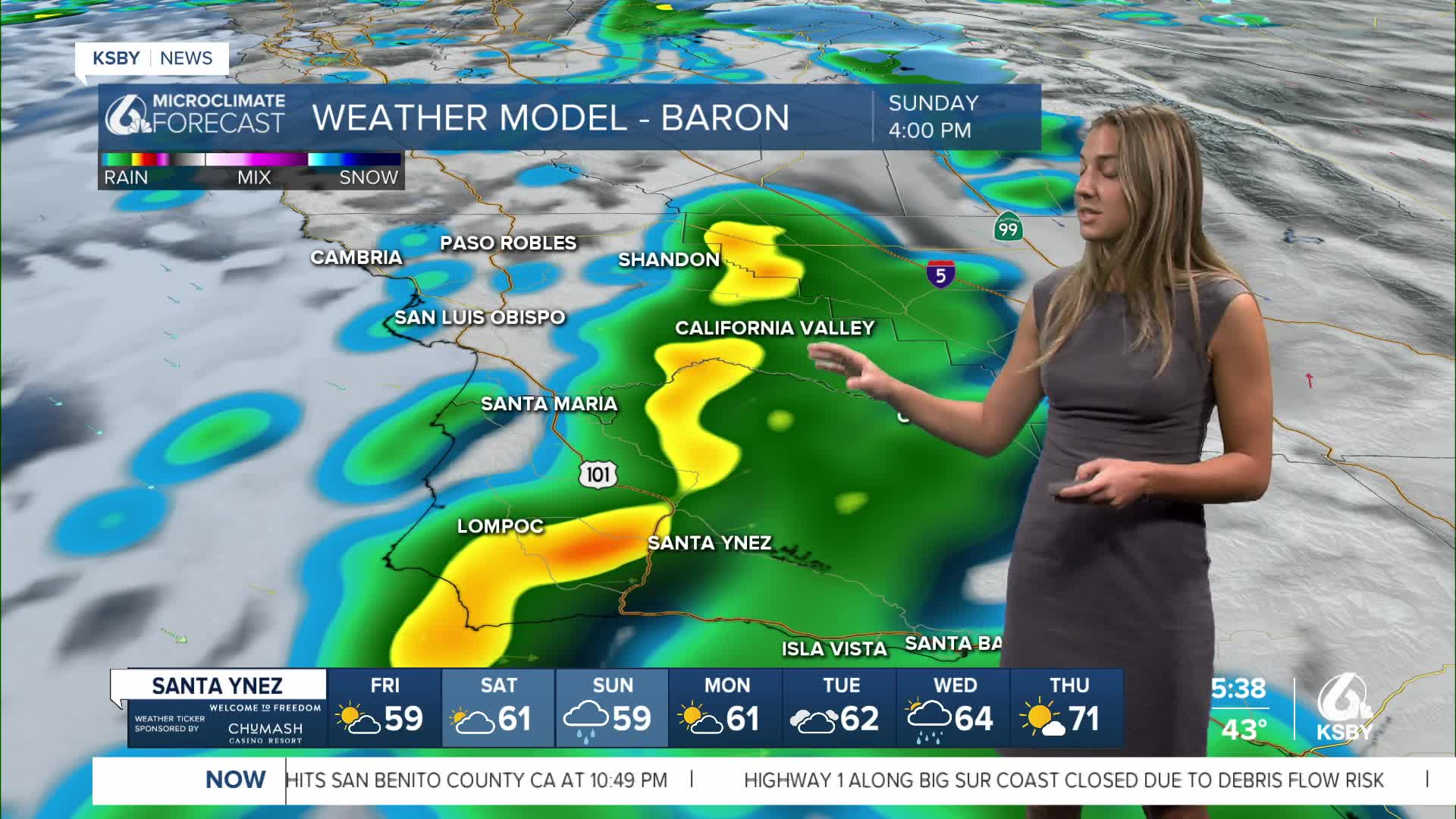
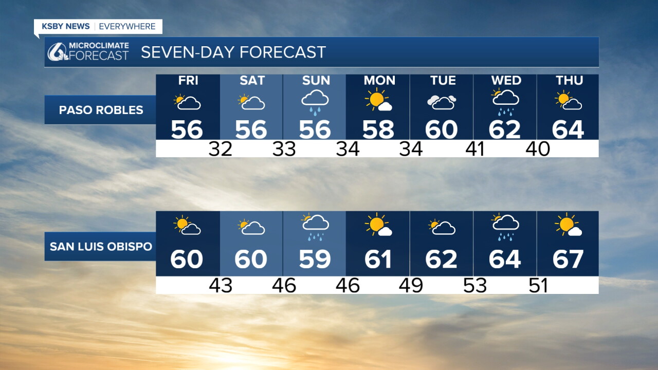
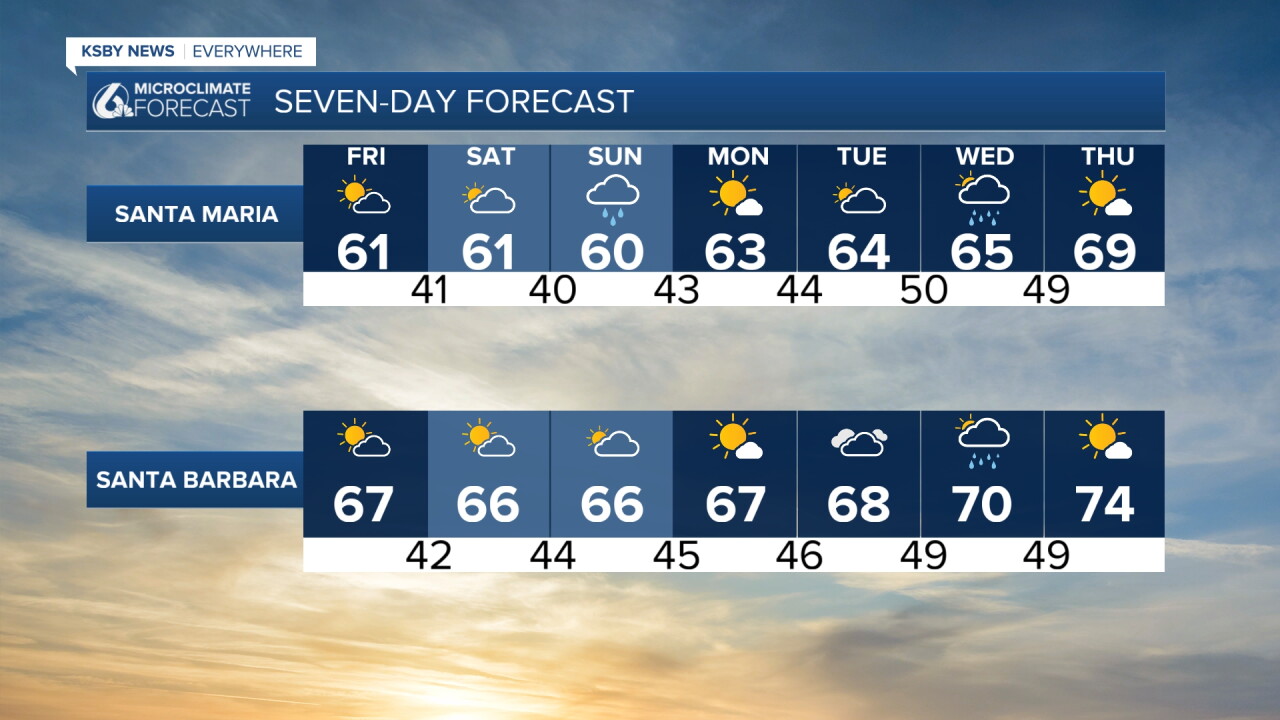
The forecast remains dry through Saturday, with another chance for light rain Sunday night. That system is expected to bring less than a quarter of an inch of rainfall for most areas.
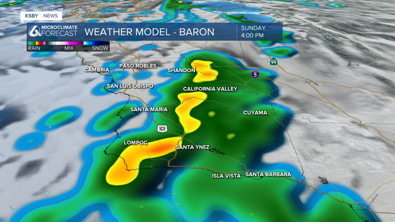
Looking ahead to Thanksgiving week, another system is expected to move through Tuesday into Wednesday.
Current forecasts indicate that the system will be relatively weak, with limited impacts expected during the holiday travel period.
Temperatures are also expected to stay cooler, potentially rising to the low seventies for some communities on Thanksgiving.
Have a great weekend, Central Coast!
- Vivian & Chloe
