

Happy Saturday, Central Coast!
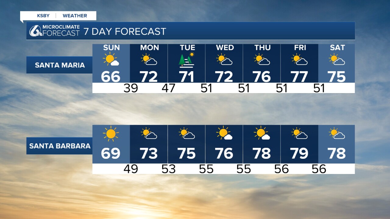
Last weekend was looking drastically different weather-wise. For a minute, it seemed like we were going to get more rain. Luckily, that does not look to be the case. Here are some of the temperatures you can expect on Sunday.
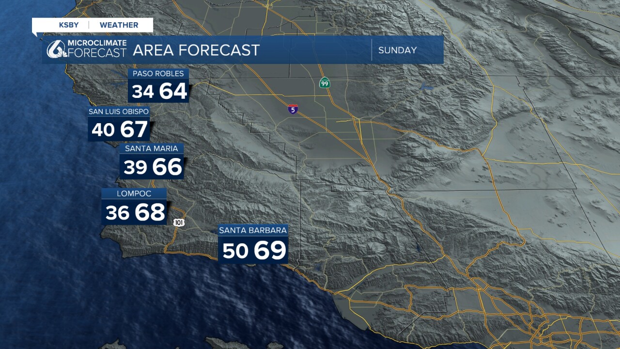
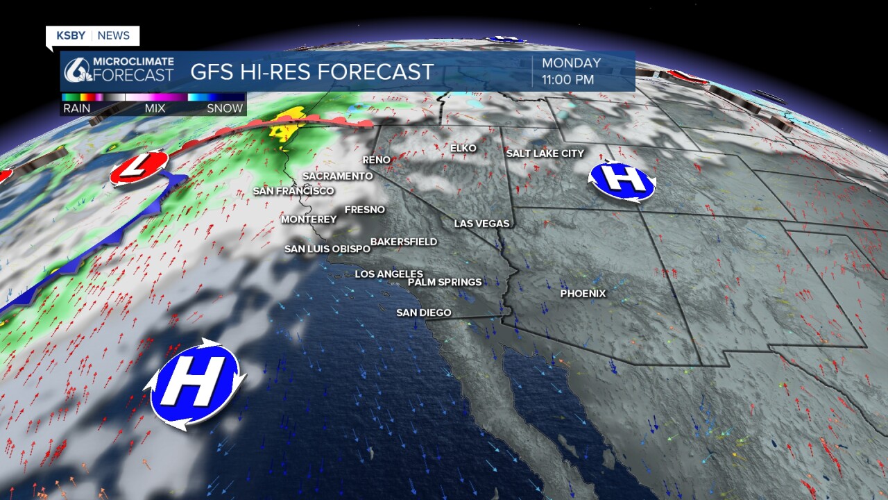
We're officially kicking off a warming trend on Sunday! Thanks again to a ridge of high-pressure. There is a small chance some areas on the Central Coast could experience light precipitation Tuesday through Wednesday. There is an atmospheric river bringing rain to Northern California, but it will weaken significantly. As of now, our models show that this precipitation will stay to the north of us.
Overall, this high-pressure system will bring us back to 70s temperatures by Tuesday.
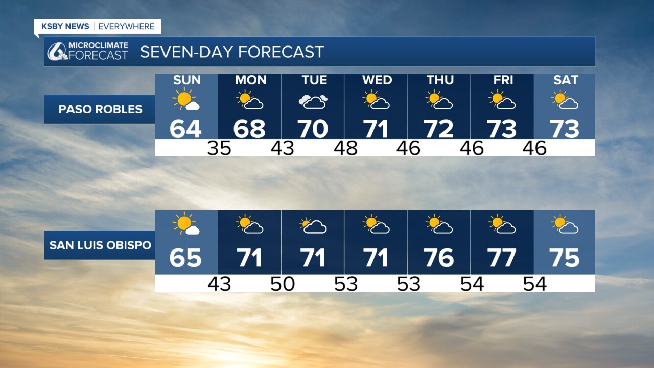
We will also see the return of our marine layer in some areas by Tuesday. Overall, next week is looking mostly dry and with seasonally above-average temperatures.
Enjoy the rest of your evening!
—Leslie Molina
