


Happy Friday evening, Central Coast!
Below is a graphic of the timeline of when the stronger wind gusts arrive and when the heaviest rain is more likely heading to the Central Coast. The KSBY weather team believes Sunday night into early Monday is a time to really stay weather aware, also another strong wave Monday night into early Tuesday, and showers continue into Wednesday.

Here are some great weather details so you can plan your weekend!
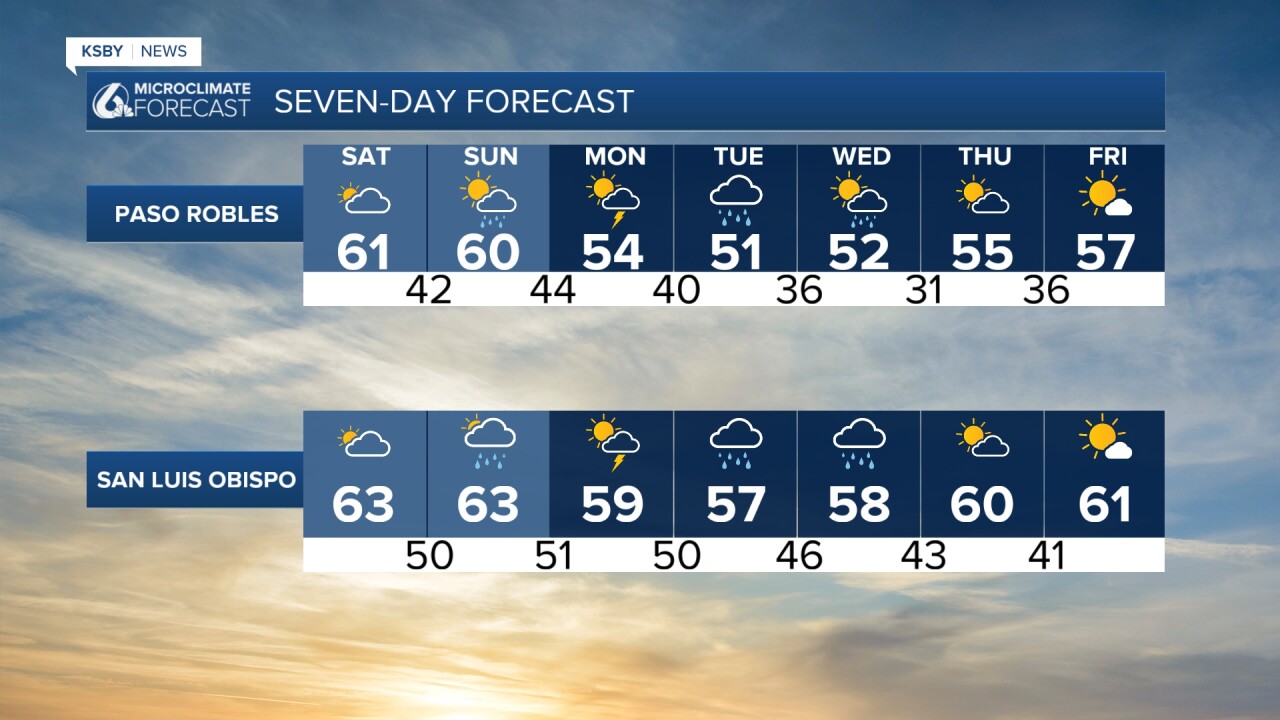
Dry through Saturday. Some sun to start, then clouds increase.
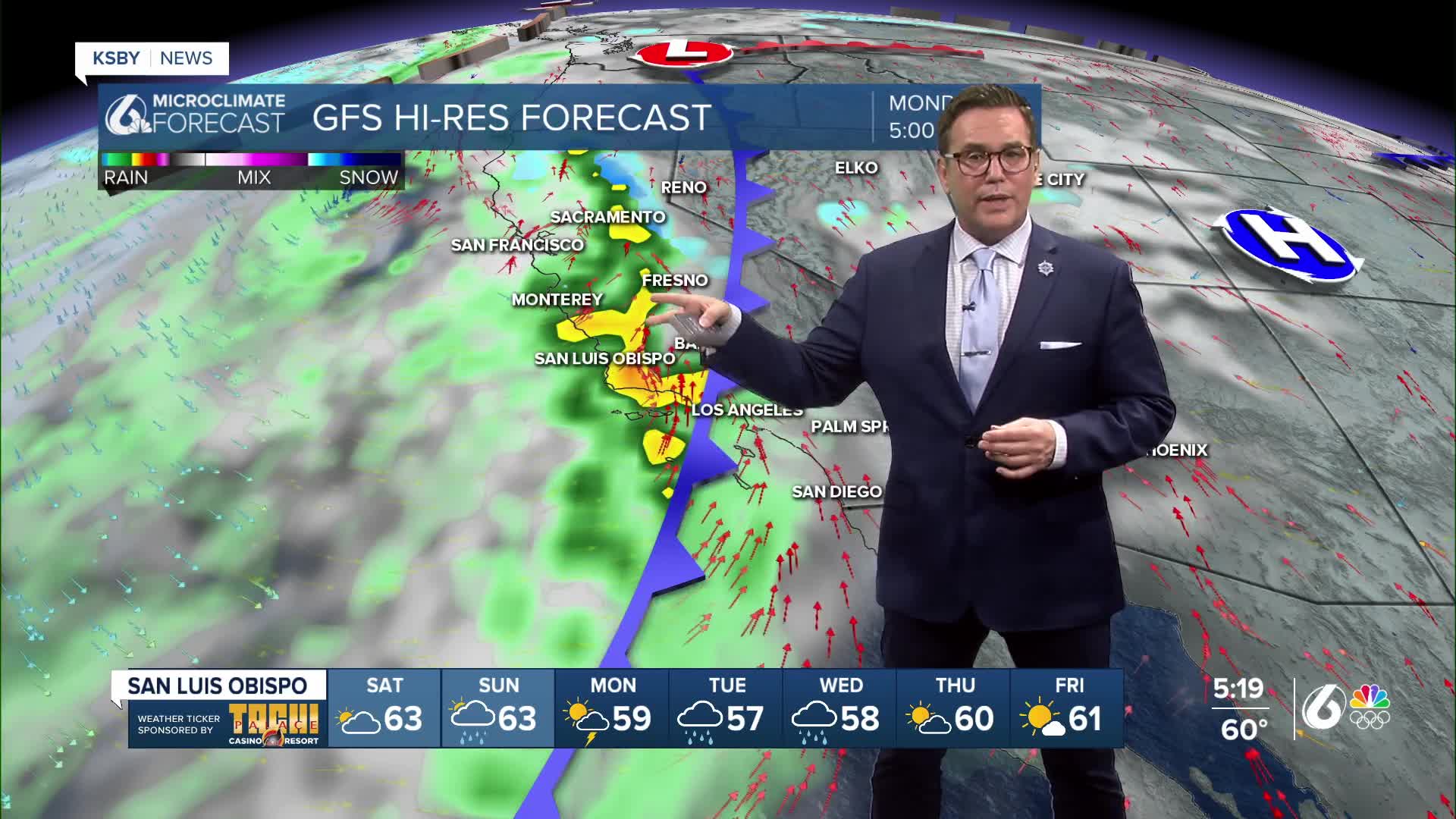
Sunday morning looks dry, then a strong storm system moves in Sunday pm, Sunday night into Monday, bringing moderate rain and some downpours again with ponding on roads and highways, possible thunderstorms, gusty winds, and hazardous beach and marine conditions. Impacts could last into much of next week as a few waves of rain are expected through Wednesday.
Sunday marks a transition as the storm approaches. Light showers are possible by afternoon, mainly across northwestern San Luis Obispo County and possibly into Santa Barbara and Ventura counties by evening. Highs will cool into the 60s. Sunday night, showers and thunderstorms ramp up.
(Monday–Thursday)
The strongest impacts are expected on Monday, with widespread rain. Rain totals of 2 to 4 inches are likely for coasts and valleys.
Rain will taper to showers Tuesday, then a colder system arrives Tuesday night into Wednesday with downpours & possible thunder.
If you are traveling into the mountains, dropping snow levels to 3,000 feet or lower is possible Tuesday night into Wednesday. Travel could be difficult on mountain roads, including Interstate 5.
Thursday still looks like we get a break from the rain, but it will be chilly and mainly dry.
Below is a snapshot of Saturday, some sun is expected in the morning, then clouds increase, and we stay dry with high temperatures in the 60s.

Below is a snapshot of Sunday, with an expected dry start to Sunday, then clouds thicken and rain develops, especially later in the evening and at night.


Have a great weekend, Central Coast!
-Jim
