

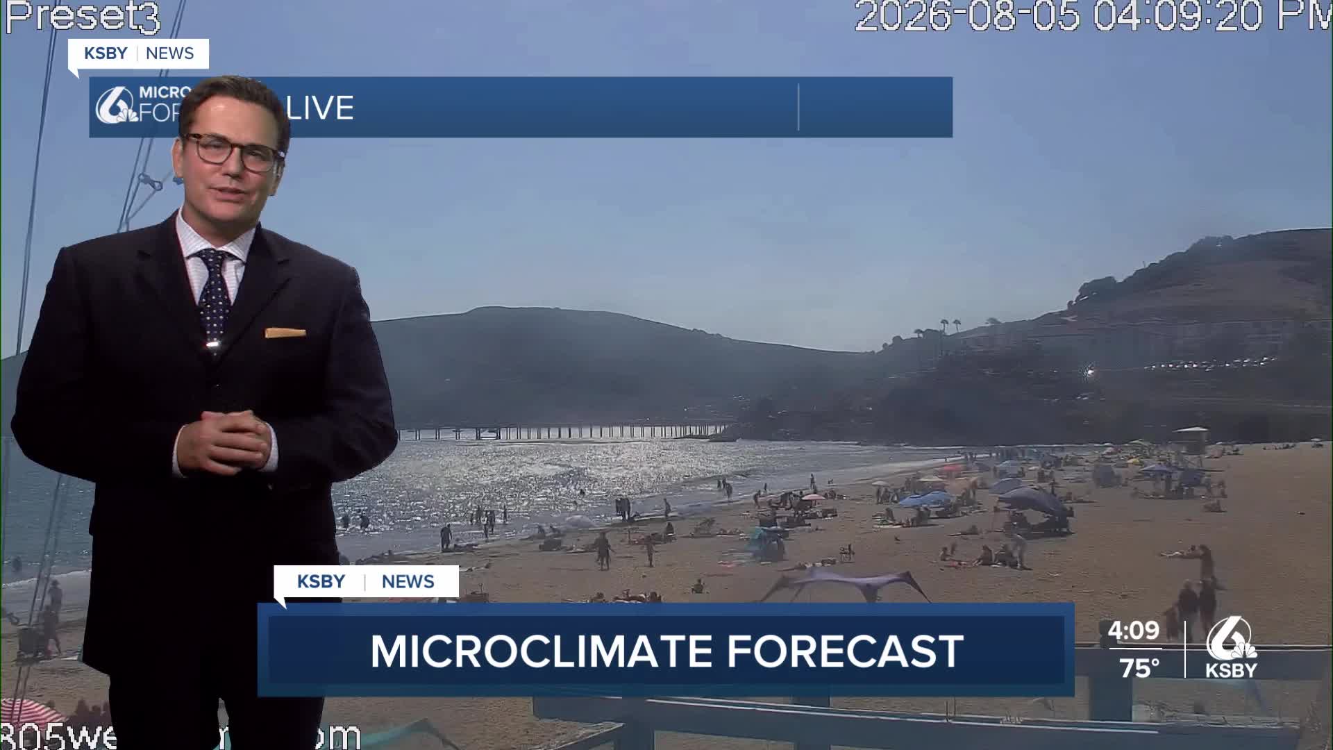


Good Wednesday evening, Central Coast, from Meteorologist Jim Castillo
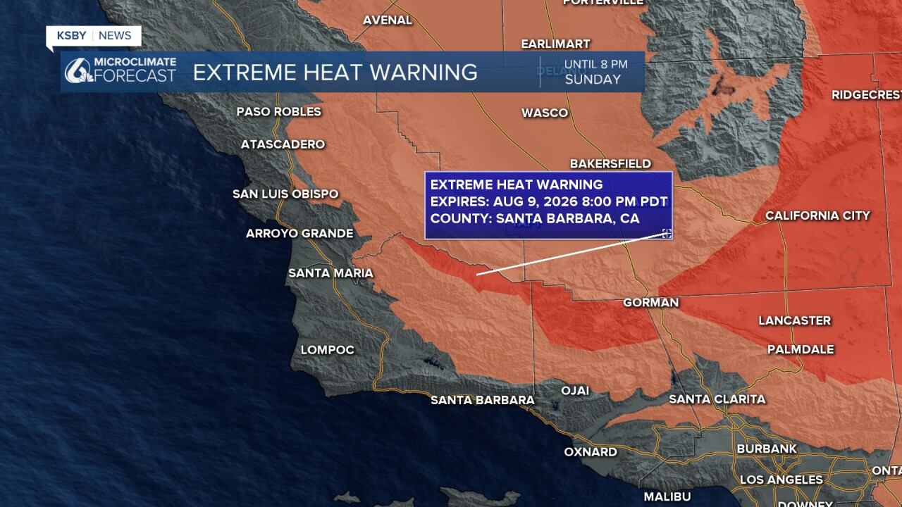
Heat Advisories and Extreme Heat Warnings remain in effect through Sunday for far interior valleys before gradual relief arrives.
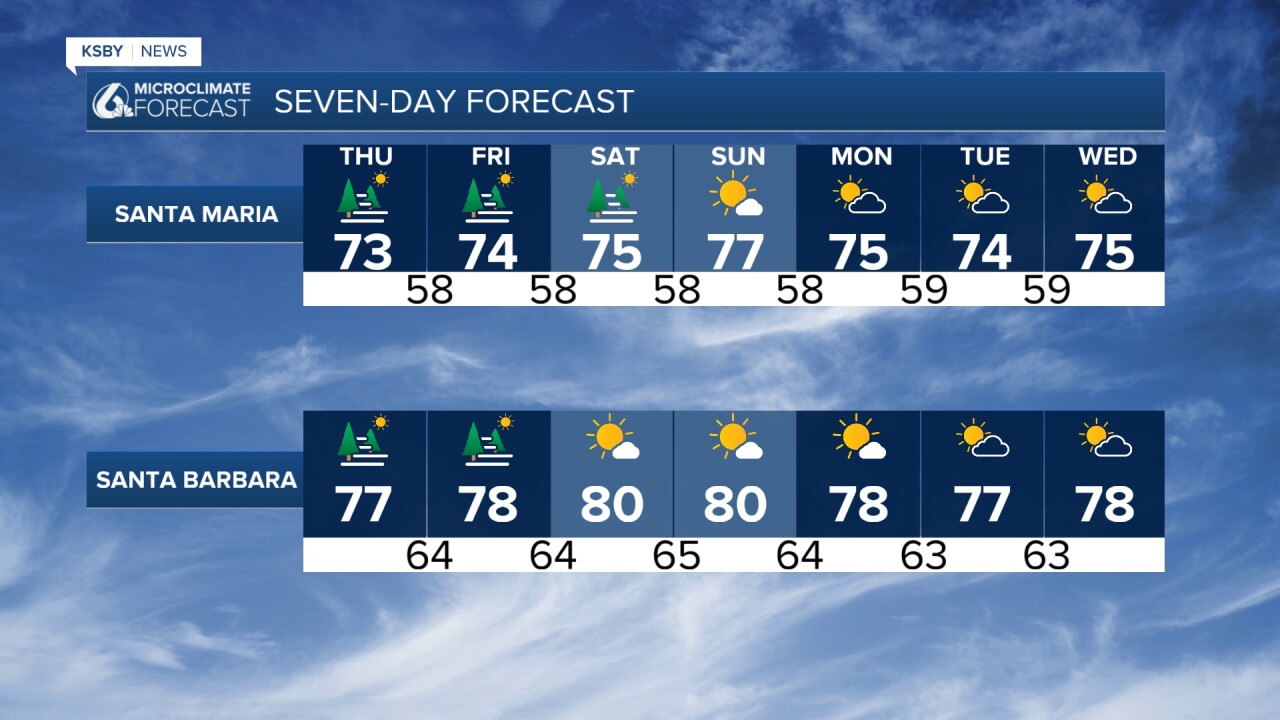
Tonight Through Weekend: Persistent marine layer will bring nightly fog and low clouds to coastal areas and coastal valleys, with afternoon clearing expected daily. The marine layer depth sits around 1,400 feet, affecting visibility through morning hours before gradual improvement.
Interior Heat Advisory: Dangerous heat continues through the weekend for interior valleys away from the coast. A strong upper-level high-pressure system anchored over Arizona and Southern California maintains hot, dry conditions inland while coastal areas stay moderated by marine influence.
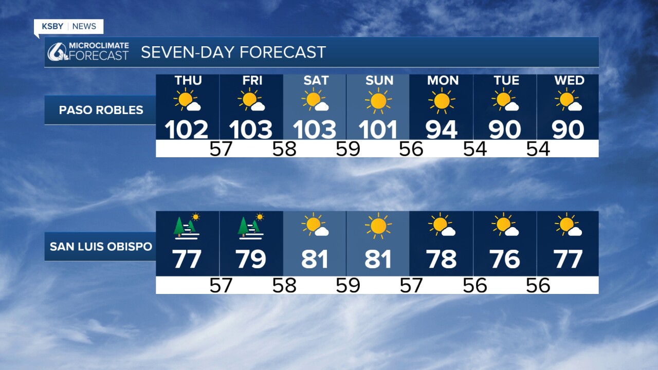
Daily Pattern: Expect slow morning clearing near the coast due to a stronger onshore wind. Far interior sections will see rapid afternoon heating with temperatures climbing well above seasonal normals by Friday. Coastal temperatures remain near average due to the persistent marine layer's influence.
Wind Conditions: Strong onshore flow will generate gusty afternoon sea breezes. These winds, combined with hot and dry conditions, create elevated fire weather concerns for areas away from immediate coastal influence.
Mountain Areas: The Santa Lucia Mountains, Santa Ynez Mountains, and Los Padres National Forest sections within San Luis Obispo and Santa Barbara Counties will experience the heat gradient between coast and interior. Dry conditions dominate overall.
Extended Outlook: The ridge pattern begins weakening Monday, initiating a cooling trend through mid-week. Heat Advisories and Extreme Heat Warnings remain in effect through Sunday for far interior valleys before gradual relief arrives.
Marine Layer Timing: Expect fog development after sunset with thickest coverage during pre-dawn hours. Coastal valleys may hold low clouds longer into afternoon hours, especially areas with direct marine exposure.

Have a great night, Central Coast!
-Jim
