

Good morning, Central Coast, and happy Monday!
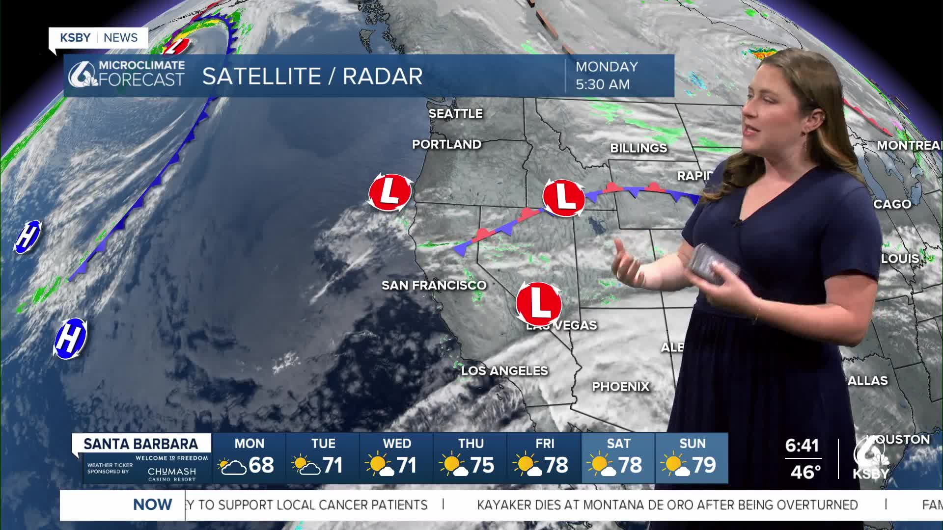
To kick off the week, we have a bit of a mixed bag. Three low-pressure nodes are rotating around the Central Coast and will make for a cool day with small showers offshore.

The energy from the low pressure will move onshore and bring more clouds and the potential for a stray shower into the afternoon and early Tuesday. Accumulations, if any, will just be hundreths of an inch.
Bottom line, it will be mild Monday with a tiny chance for a shower. Don't worry about it.
Temps today are on the cool side with all highs in the mid 60s.

By Wednesday, the core low pressure will have moved on, and we will start to warm up fast. 80-degree temps are expected for interiors for mid-week, 70s for coastal valleys.
The heating trend will intensify Friday into the weekend. 80s for coastal valleys, upper 70s for the south coast and for the interiors we can expect 90s. This paired with abundant sunshine will make it really feel like summer.

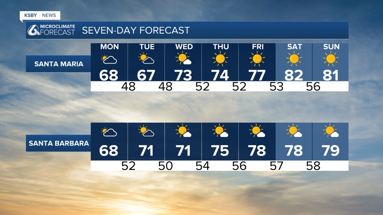
Even into the 8-14 day outlook, hot temps are the story across the West Coast. Check those AC units; there is no cooldown in sight.

Have a wonderful week, Central Coast!
-Vivian
