

Happy Saturday, Central Coast!
We're starting our weekend with slightly cooler temperatures. We are experiencing some cool and foggy mornings, but by midday, we experience a slight warm-up. Layering is the key because we will see these same conditions on Sunday. These are the temperatures we have recorded for our region as of 3:07 PM.

A few advisories have been issued for our area. The portions highlighted in blue are under a wind advisory and could experience wind gusts up to 45 mph. This advisory is set to expire Sunday morning when we experience a slight break. These winds will start picking up in the afternoon, so you can expect a second wind advisory to be issued by then.
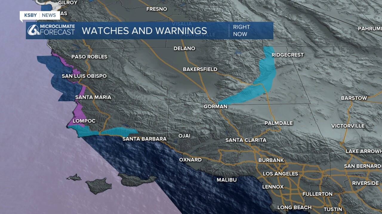
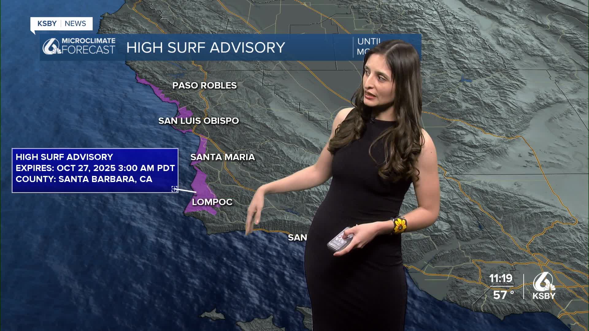
The regions highlighted in dark purple are under a high surf advisory until Monday morning. This means wave heights could reach up to 13 feet, and could be accompanied by dangerous rip currents. Here is a look at some of the wave heights our region is experiencing as of 3:07 PM.

Overall, this weekend's weather can be described as slightly cooler than normal but relatively comfortable. Make sure to wear your layers!
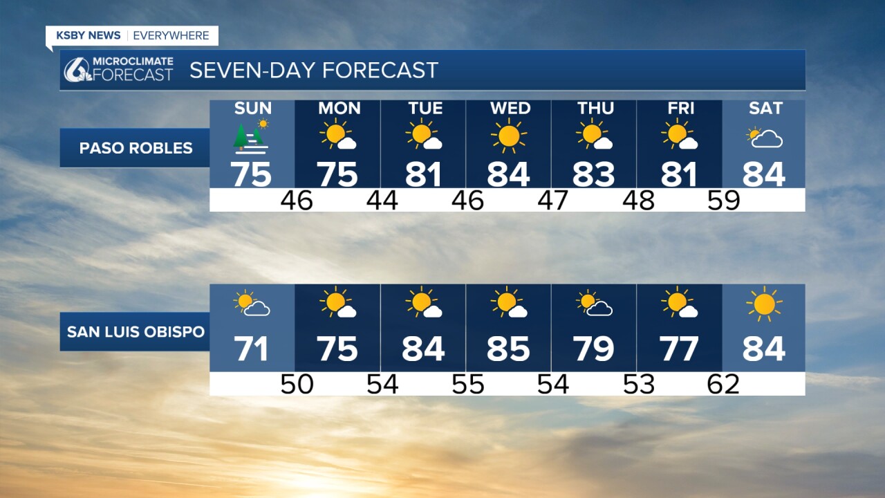
The Central Coast will return to a more seasonal weather pattern on Monday. It's looking like the warmest days of the week will be Tuesday and Wednesday.

Enjoy your evening, Central Coast!
