



Good Thursday evening, Central Coast, from Meteorologist Jim Castillo
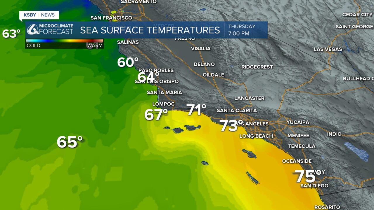
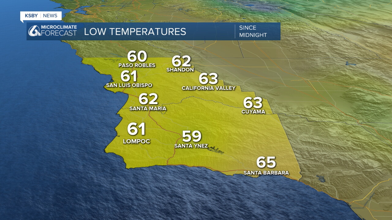
Below: The warm overnight lows are around 60 degrees, with the higher sea surface temperatures off the Central Coast in the 60s, and we continue with 70s off the south coast - Santa Barbara County.
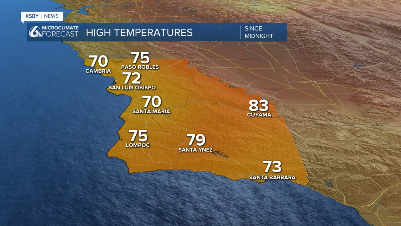
Below: The high temperatures felt more like Autumn. 70s were widespread on Thursday and it was very cloudy. It will continue mostly cloudy on Friday with below-average mid-August high temperatures.
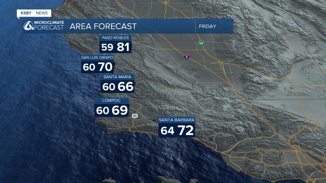
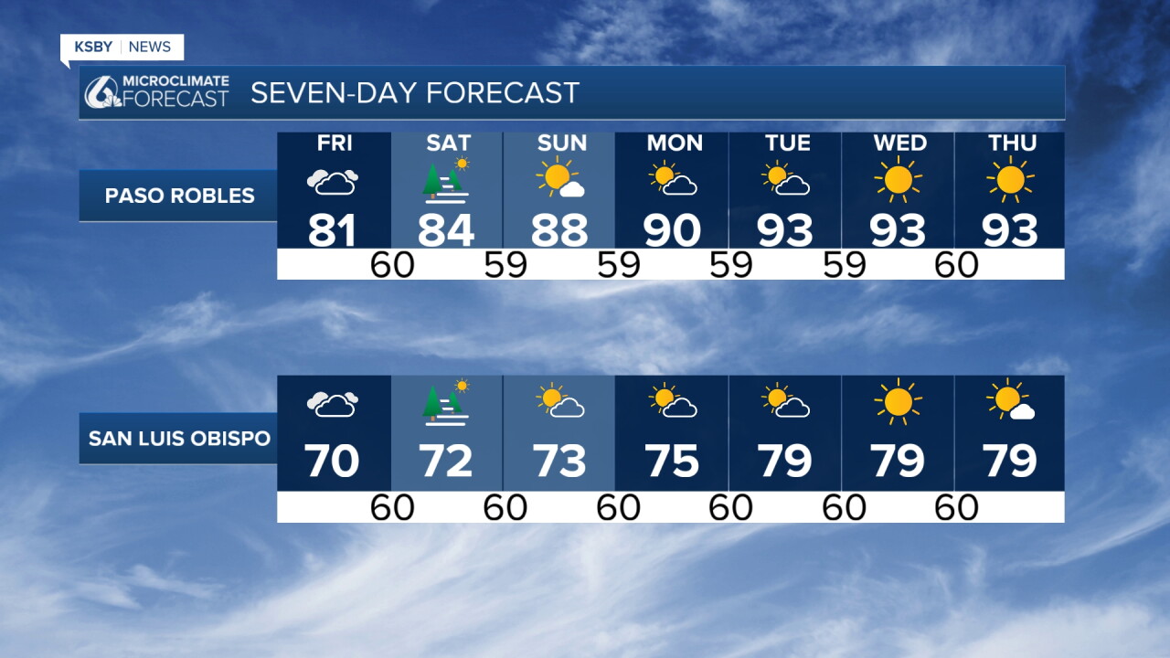
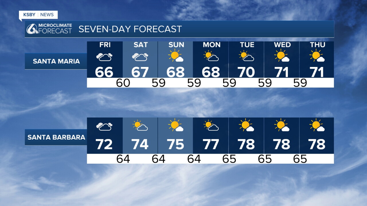
Here is your forecast for San Luis Obispo and Santa Barbara Counties
Cooler-than-normal temperatures and widespread marine layer clouds continue through the weekend. With a weak upper-level trough moving into the Central Coast this morning, we had areas of light rain and drizzle.
The most significant aspect remains the continued below-normal temperatures for mid-August. Friday's high temperatures will look a lot like Thursday's readings, staying below seasonal averages. Saturday brings slight warming but remains well below normal.
The deep marine layer has expanded into many valleys. Friday expects similar coverage, with slightly less Saturday due to shrinking marine layer depth. Clouds will burn off late morning to early afternoon, though west-facing beaches may see persistent cloudiness due to strong onshore flow. Patchy drizzle remains possible Friday morning.
Enhanced onshore flow produces gusty west to southwest winds across interior areas, strongest in foothill regions.
The weather pattern becomes more benign relative to typical mid-August conditions. An upper-level ridge over the southern United States will push the coastal trough westward, increasing 500-millibar heights with dry southwest flow aloft. Heights peak Tuesday and Wednesday.
Marine layer clouds will shrink daily with rising heights and weakening onshore flow, likely retreating to coastal areas by early next week. Increasing northwest flow Tuesday will eliminate the marine layer from southern Santa Barbara County.
As 500-millibar heights rise and onshore flow weakens, temperatures will climb toward normal mid-August readings. The most noticeable warming occurs across valleys and interior areas, while coastal zones remain under marine influence.
Increasing northwest flow next week brings gusty afternoon through late evening winds to southwestern Santa Barbara County and interior mountains, including higher elevations of the Santa Lucia and Santa Ynez Mountains within Los Padres National Forest boundaries.
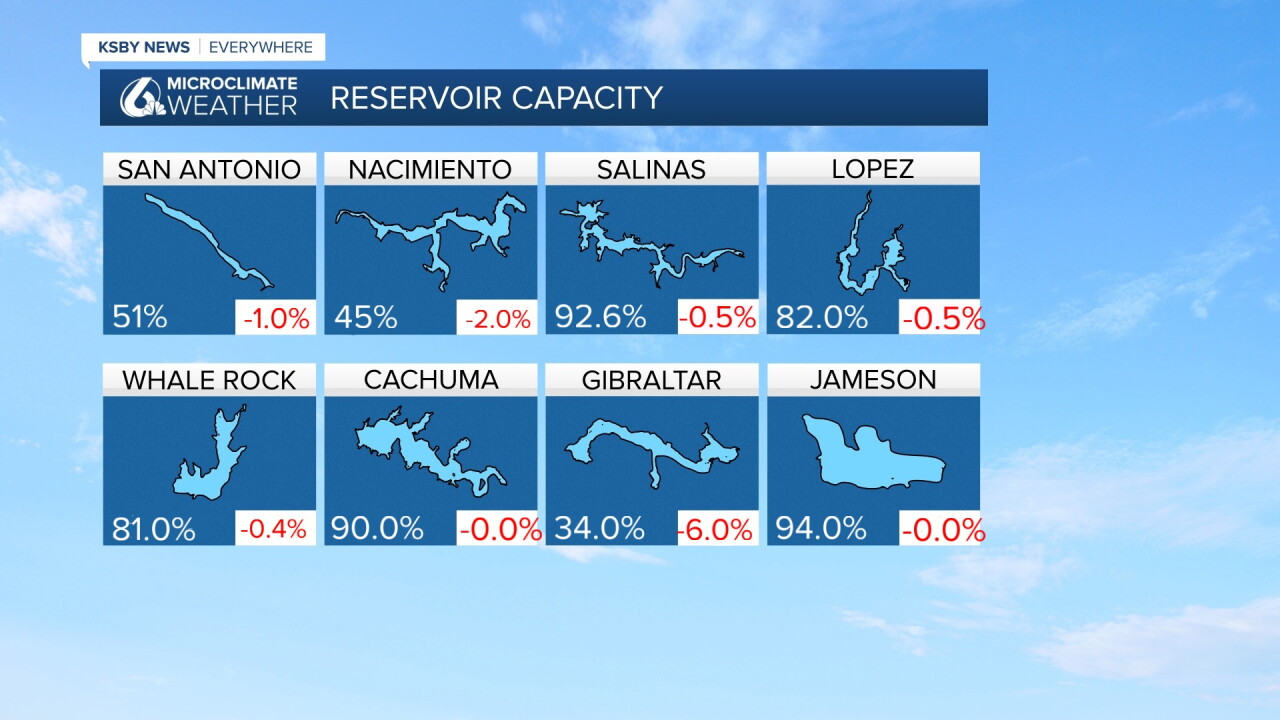
Below: Our reservoir levels and the change from a week ago.
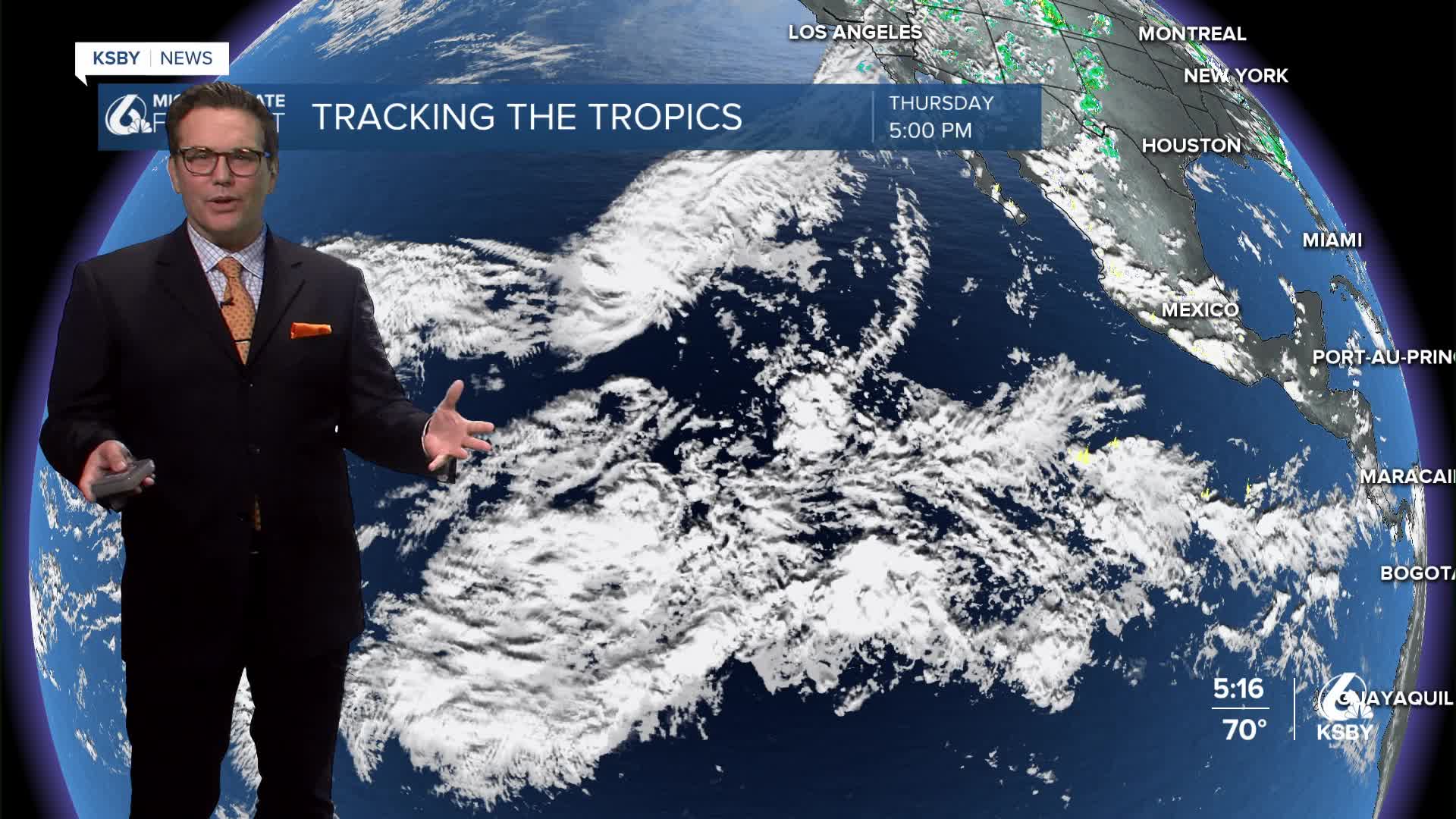
Below: Tropical Storm LALA has formed in the Pacific Ocean. Friday night into Saturday, LALA may strengthen into a minimal hurricane as the cyclone nears the Big Island of Hawaii.

Have a great night, Central Coast!
-Jim
