


Happy Sunday, Central Coast!
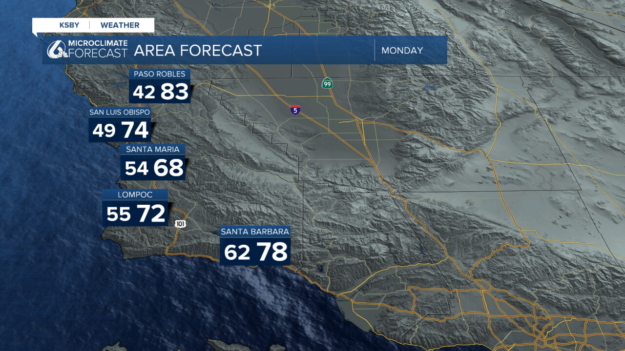
Were in the midst of a brief cooling trend. Temperatures cooled down a bit on Sunday and will stay that way through Monday. Enjoy the mild conditions!
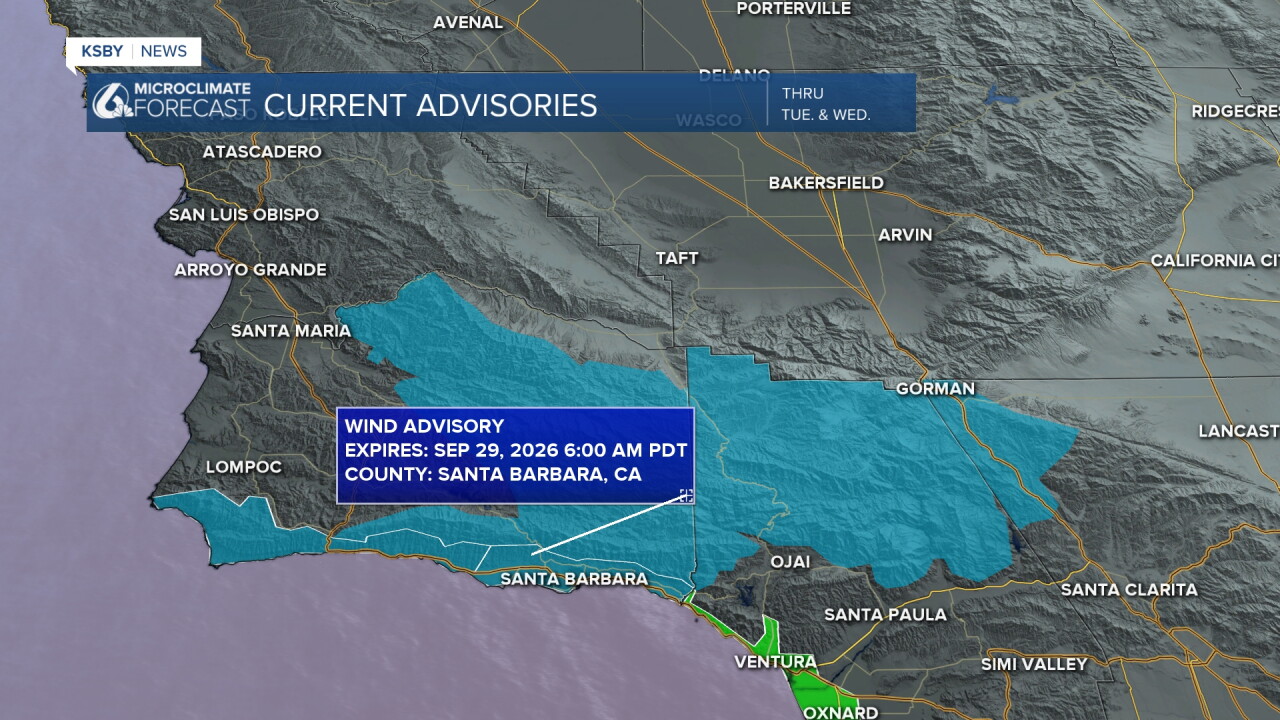
Now, on to advisories, we have two in place. There is a Wind Advisory in place through Tuesday for the areas highlighted in blue. The Beach Hazard Statement for the South Coast will also continue to be in place through Wednesday, as a result of the high surf activity and a high risk of rip current. These conditions will peak Monday and Tuesday.
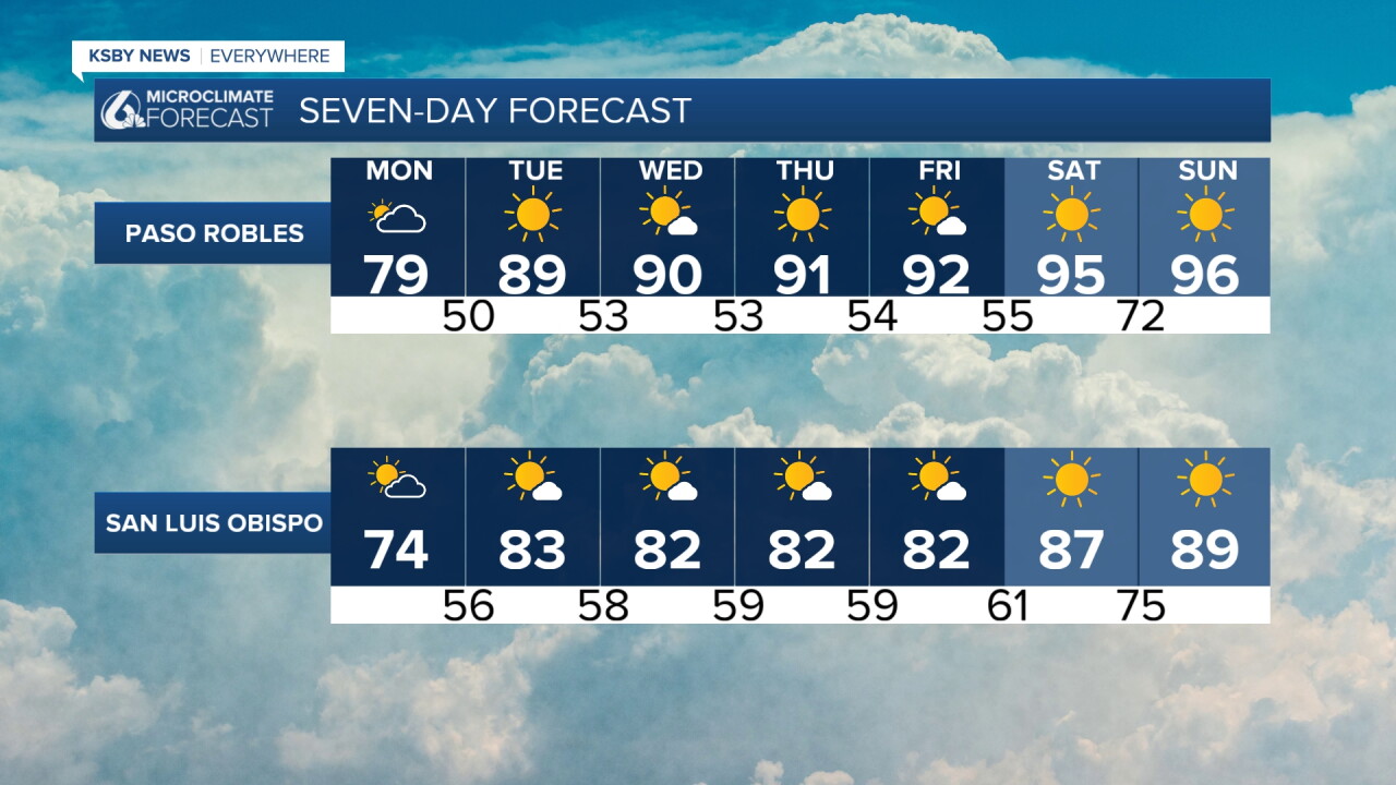
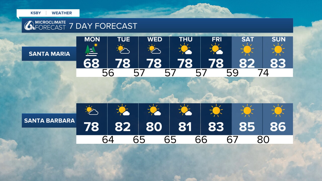
As for the cooling, it will be short-lived. Temperatures will start trending upward again on Tuesday. It seems we'll stay warm into next weekend.
Enjoy the rest of your evening!
—Leslie Molina
