

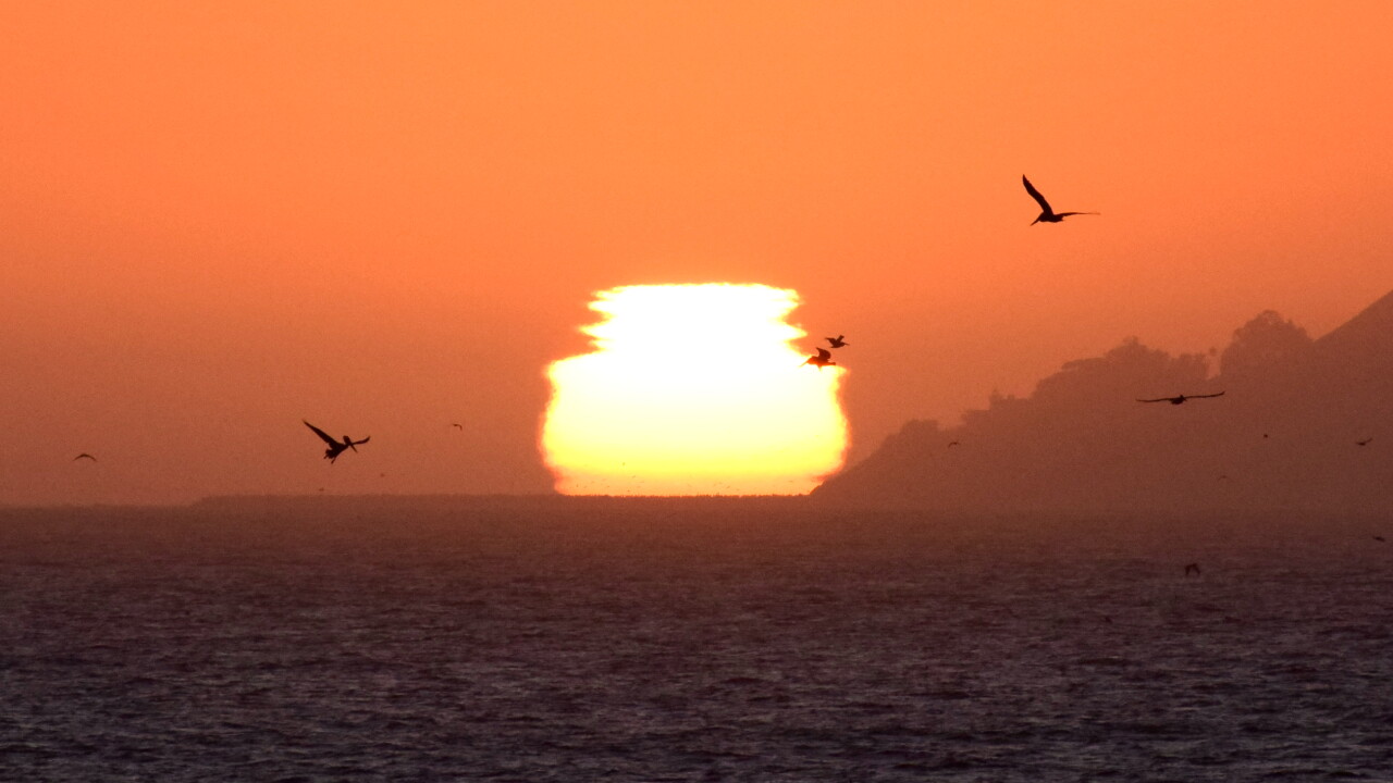


Good Monday evening from Meteorologist Jim Castillo
Here's your Central Coast weather forecast for San Luis Obispo and Santa Barbara Counties
San Luis Obispo was the hot spot on Monday with temperatures in the mid 80s.
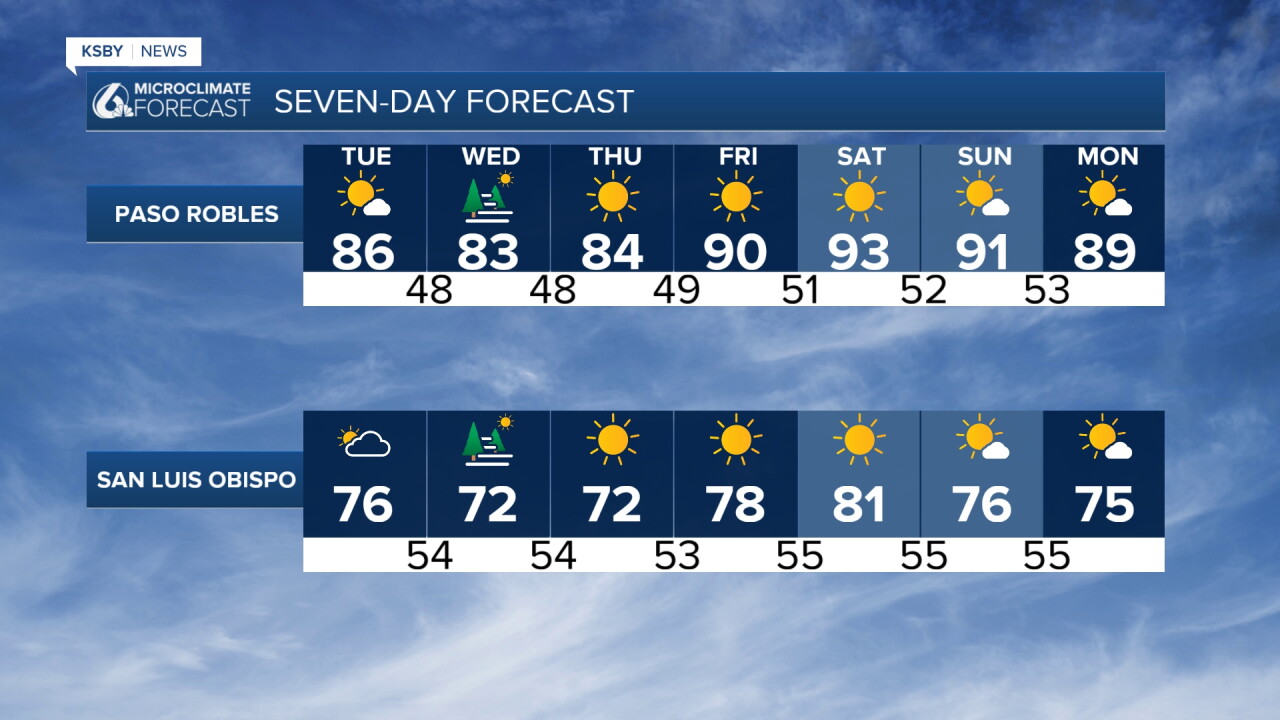
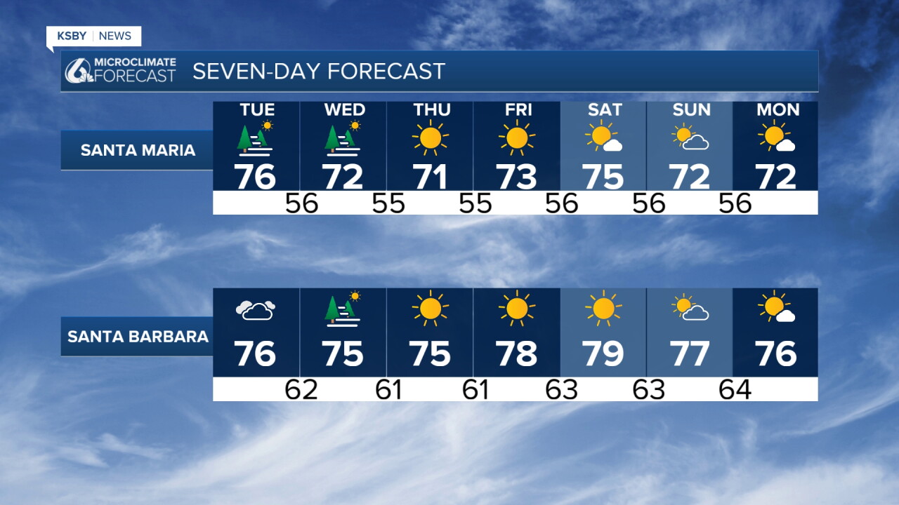
TONIGHT THROUGH THURSDAY Cooler Tuesday through Thursday with mostly below normal temperatures with expanding coastal morning low clouds and morning drizzle in spots.
THE PATTERN AHEAD Fairly benign conditions are expected. Temperatures will steadily lower a little each day through Wednesday with little change into Thursday. Three key factors are driving this trend:
An upper level trough of low pressure over the western United States will amplify each day. Surface pressure gradients will keep coolish ocean air pushing inland. Northwest winds over Santa Barbara County will decrease sharply over the next two days, allowing the marine layer to flex more and expand.
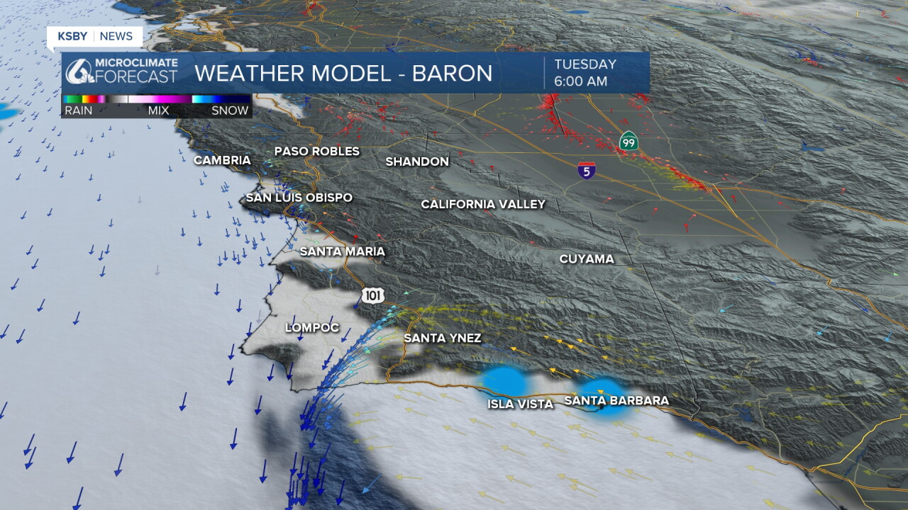
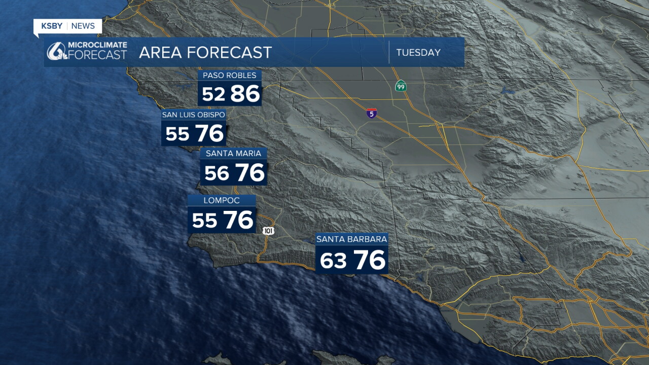
TUESDAY'S MARINE LAYER EXPANSION A strong coastal eddy off Southern California is still on track to form Tuesday, which should expand cool marine layer air into coastal valleys and lower mountain valleys. This may bring spots of pavement-wetting drizzle to some areas. Highs will generally range from the mid 70s to upper 80s, which remains far from cold but not hot either, running below normal by 5 to 10 degrees.
END OF WEEK WARMING High pressure over the southeastern states will expand westward Thursday through Saturday, battling a small yet potent closed low spinning north of southwest California. The majority of forecast models show warming for the area, but the low will limit high pressure expansion and resulting temperature rise.
Moderate northwest winds over Santa Barbara County, combined with higher pressure aloft, will likely reduce the marine layer's cooling effects. Highs should bump up around 5 degrees and settle in the 80s by Friday, which is right about normal for this time of year. Heat Advisories or warnings look unlikely.
MOISTURE OUTLOOK The tropical systems off western Mexico remains active, but no significant moisture surge signals are showing for California.
WEEKEND AND BEYOND A weak, likely moisture-starved trough may approach the region Sunday or Monday, bringing increasing mid to high clouds and kicking off a slow cooling trend with increased marine layer influence.
Have a great night, Central Coast!
-Jim
