


Happy Saturday, Central Coast!
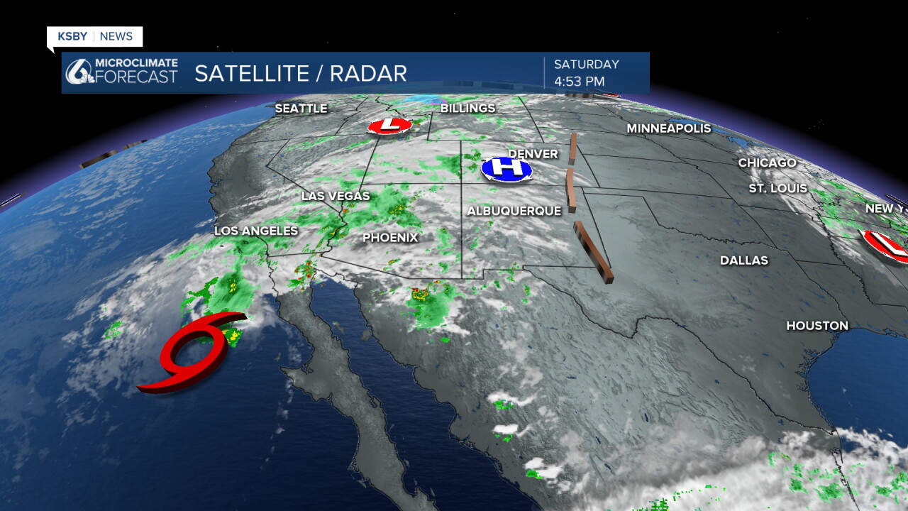
We're trending much cooler today, thanks to an upper-level low. We're also tracking Tropical Storm Rachel, which is bringing moisture to several Southern California communities.
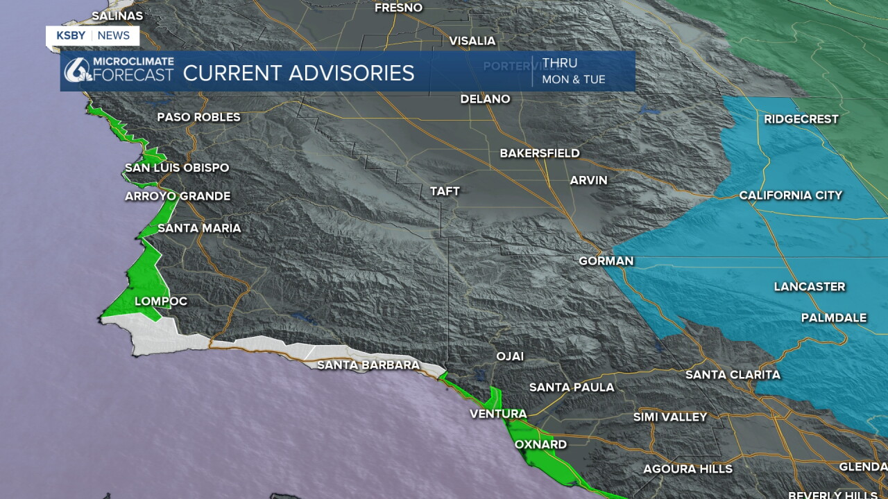
For the Central Coast, the main impacts over the next few days will be mostly marine-related. A Small Craft Advisory, Beach Hazards Statement, and High Surf Advisory are all in effect. Wave heights could reach 8 to 12 feet, with an elevated risk of rip currents along the coast.
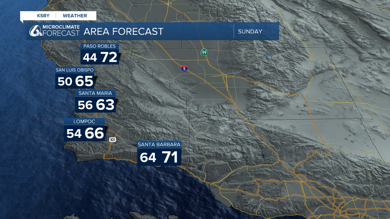
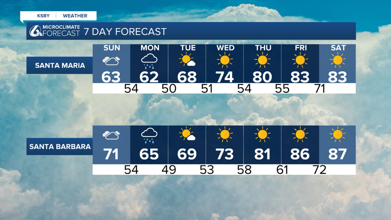
As for temperatures, we'll continue cooling into Sunday. Here is a glimpse at some of the conditions you can expect tomorrow.
As for rain, the bulk of the precipitation is expected across Southern California. However, the Central Coast could see a few showers, with Monday bringing the best chance for our region. Some models do show the potential for scattered showers in parts of Santa Barbara County through tonight and into Sunday.
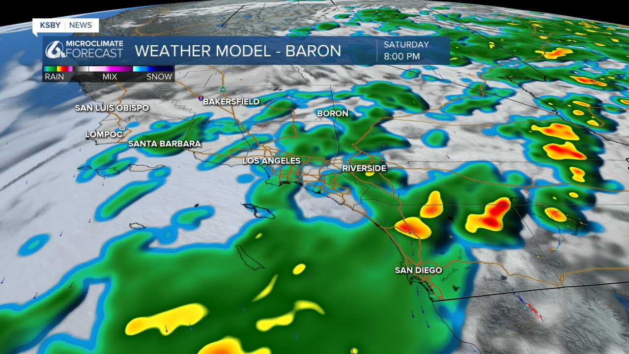
For San Luis Obispo County, the best chance for showers arrives Sunday evening into Monday. Rainfall totals across the region are expected to remain light, with most areas picking up less than 0.25 inches through Tuesday.

Starting Wednesday, a warming trend follows and will likely stick around into next weekend.
Goodnight!
— Leslie Molina
