



Happy Friday from Meteorologist Jim Castillo
Here is your Central Coast weather forecast for San Luis Obispo & Santa Barbara Counties
Remnants of offshore tropical moisture (former tropical system Iselle) continue to pump a humid, unstable airmass into the region, maintaining very warm, muggy conditions alongside high precipitable water (PW) values (upper-level moisture).
Active Weather Alerts
Heat Warnings & Advisories: Remain in effect across interior valleys and coastal slopes until 8:00 PM tonight.
Convective Risk: Marine enhancements and isolated coastal-fringe activity could clip portions of San Luis Obispo County through early evening. The highest potential for afternoon mountain convection remains focused north of Point Conception.
Primary hazards from any rogue cells include lightning, gusty, erratic winds, and localized fire starts, with a very minimal risk for heavy or flooding downpours.
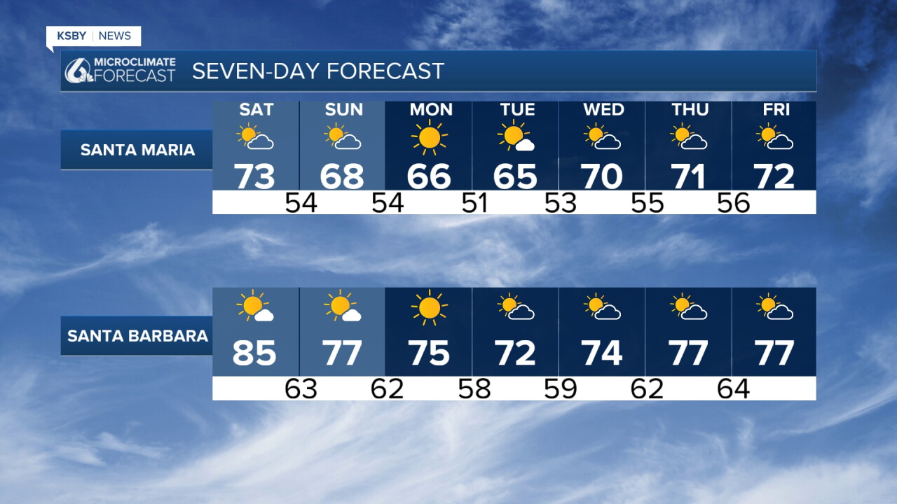
Regional Weekend Cooldown Forecast
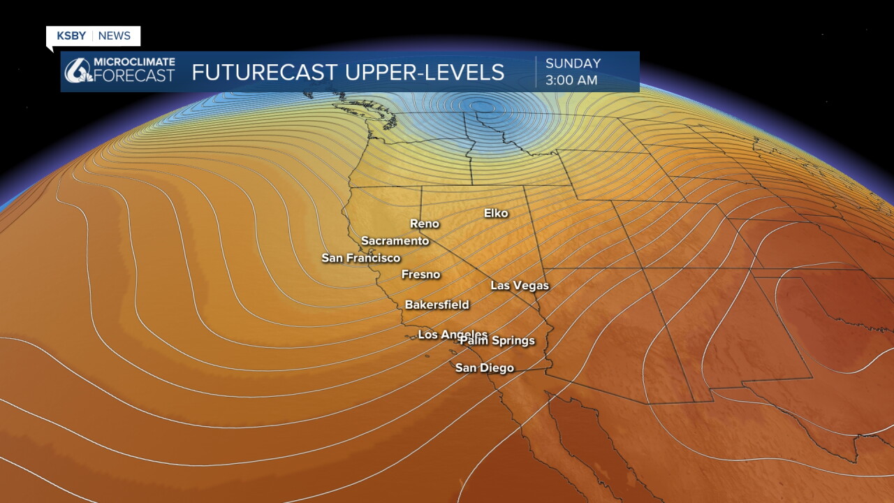
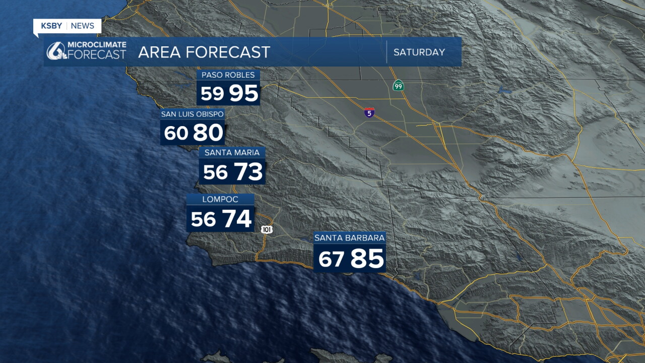
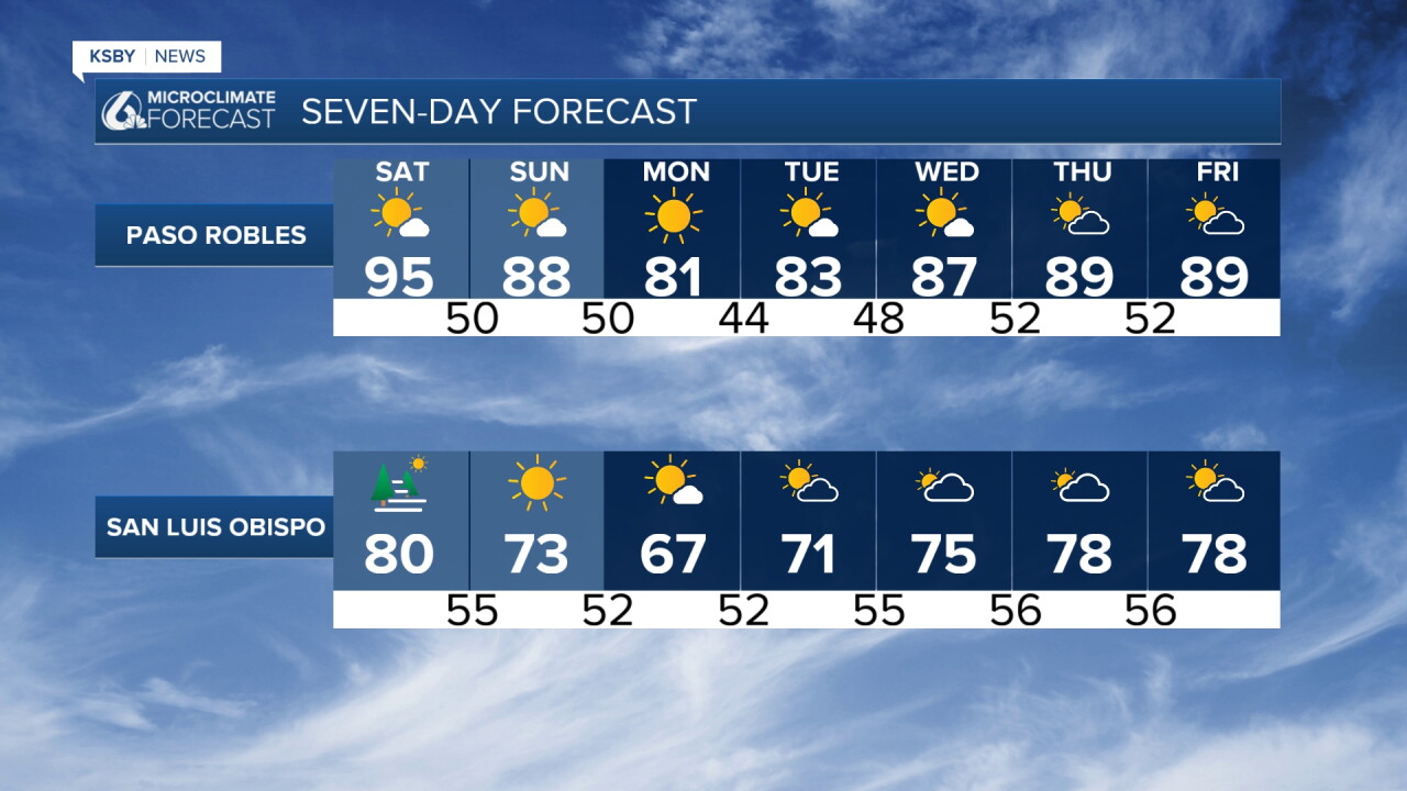
Relief is on the horizon as a robust West Coast trough pattern drives a significant cooling trend into the Central Coast. Unlike areas further south down the state, San Luis Obispo and Santa Barbara Counties will experience a sharp, welcome drop in both temperatures and humidity starting this weekend.
Extended Outlook (Next Week)
Sunday & Monday: High pressure eases as troughing solidifies, bringing comfortable, near-normal temperatures and dry, pleasant humidity levels.
Have a great weekend, Central Coast!
-Jim
