

Happy Sunday, Central Coast!
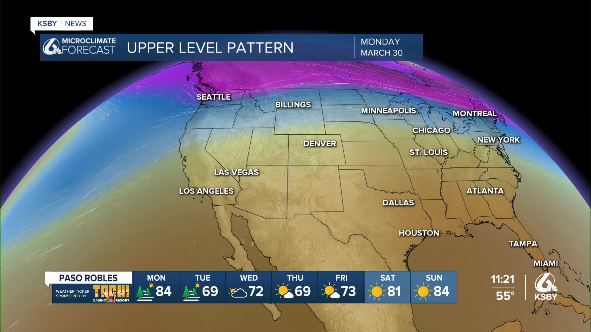
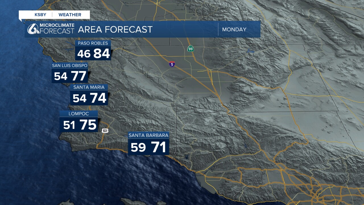
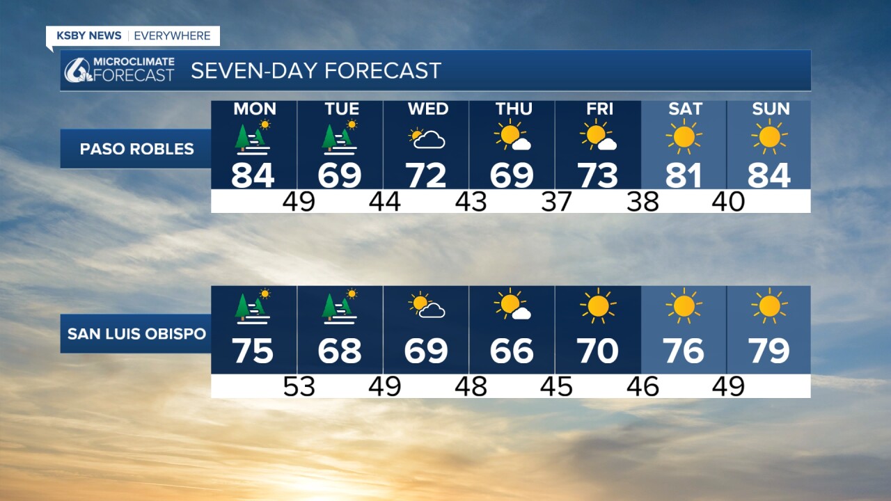
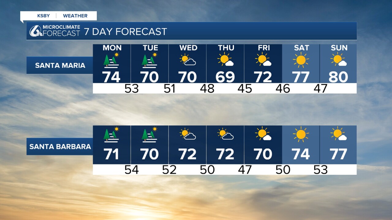
We're about to kick off a cool-down! These are the temperatures you can expect on Monday. By Tuesday, this cool-down will bring us closer to normal temperatures, following a prolonged period of historic heat. This trend will continue through Thursday.
Coastal communities will continue experiencing foggy conditions. This Sunday night, there is a chance for some pockets of dense fog. If you're driving overnight, visibility could be reduced. Drive with caution.
In addition to this cool-down, the big story is those rain chances. The models grow drier by the day; at most, there could be showers sometime Tuesday. In addition, we could see some more wind activity on Monday and Tuesday.
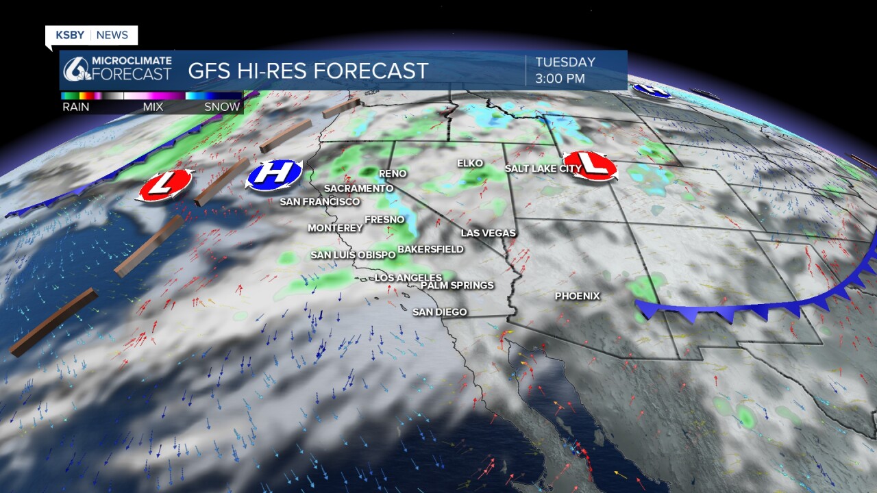
Here is what one of our models is showing Sunday night. It's looking like those showers could happen Tuesday afternoon.
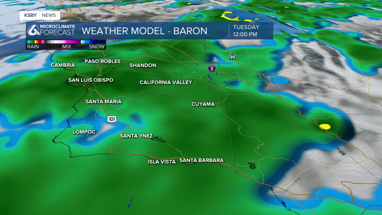
Here is a different model, which showcases that the bulk of these showers could happen on Tuesday afternoon. Again, they grow drier by the day. Just in case, carry with you a light jacket and an umbrella.
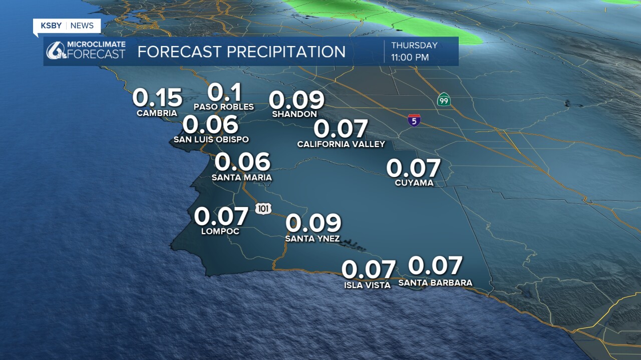
A look at some of the possible barely there rain totals. Other models show similar amounts, all less than 0.25 inch.
Enjoy the rest of your evening!
—Leslie Molina
