

Happy Saturday, Central Coast!
Hope you enjoyed your Valentine's Day! Despite the gloomy look outside, we stayed relatively dry. These dry conditions will not last much longer; there is a great chance of rain in the near future! Before we talk about the upcoming storm, here are some of the temperatures you can expect tomorrow.

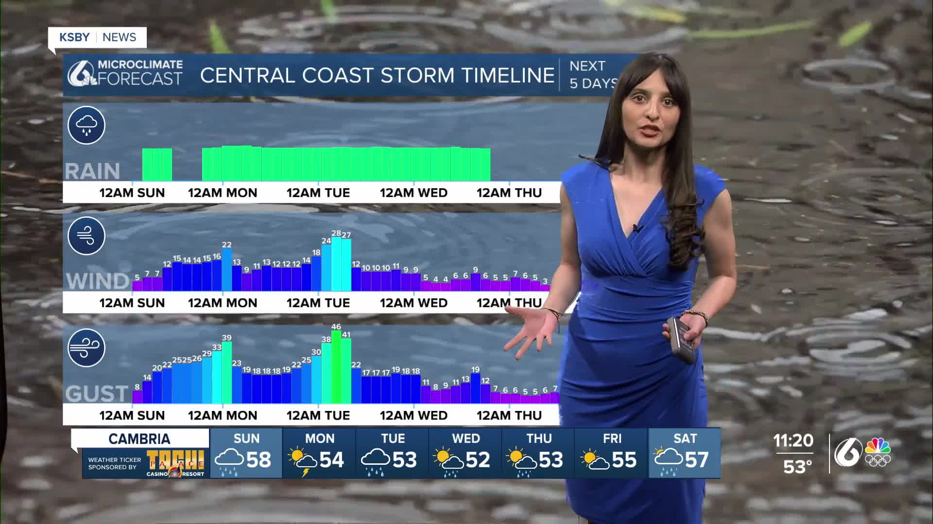
Okay, now that's out of the way, let's discuss the storm. It will happen in two to three rounds; the first round of rain could arrive as early as Sunday night. Below is a timeline of when the heaviest rain and strongest wind gusts will arrive on the Central Coast. The KSBY weather team believes Sunday night into early Monday is a time to stay weather aware. This is when the first round of the heaviest rain will take place. The second round of rain will likely happen Monday night into Tuesday, followed by showers that will continue into Wednesday.

Alright, now let's cover more details of how this rain could develop on Sunday. We'll have a dry start to our day with an increase in cloud coverage. Then, there is the possibility of some scattered or very light showers late morning into the afternoon. The bulk of the rain will arrive in our region late Sunday evening, close to midnight.

This heavy downpour will continue into Monday morning. Road conditions could be hazardous for your morning commute. The image below shows what the rain will look like around 6 AM. This will then be followed by scattered showers or light rain. The next heavy round of rain will most likely arrive on Tuesday morning.

Ahead of this storm, several advisories and watches have been issued. The areas highlighted in green, which cover a bulk of Santa Barbara County, are under an Areal Flood Watch until Monday morning. The areas highlighted in the darker blue, which cover the interior valleys, are under a High Wind Watch until Monday evening. A Wind Advisory has also been issued for the areas highlighted in the lighter blue.
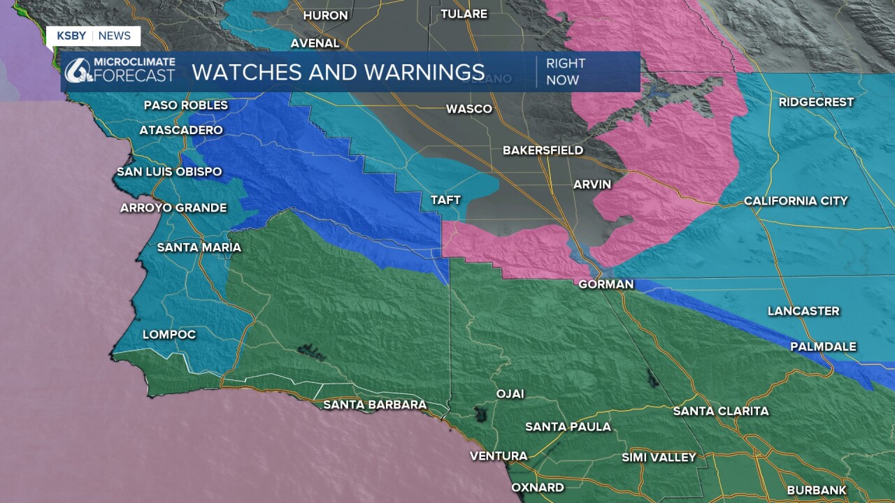
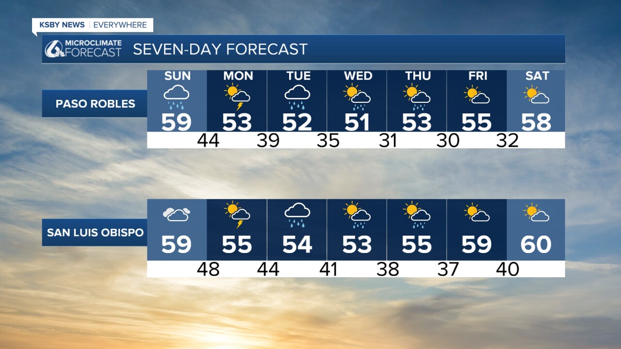
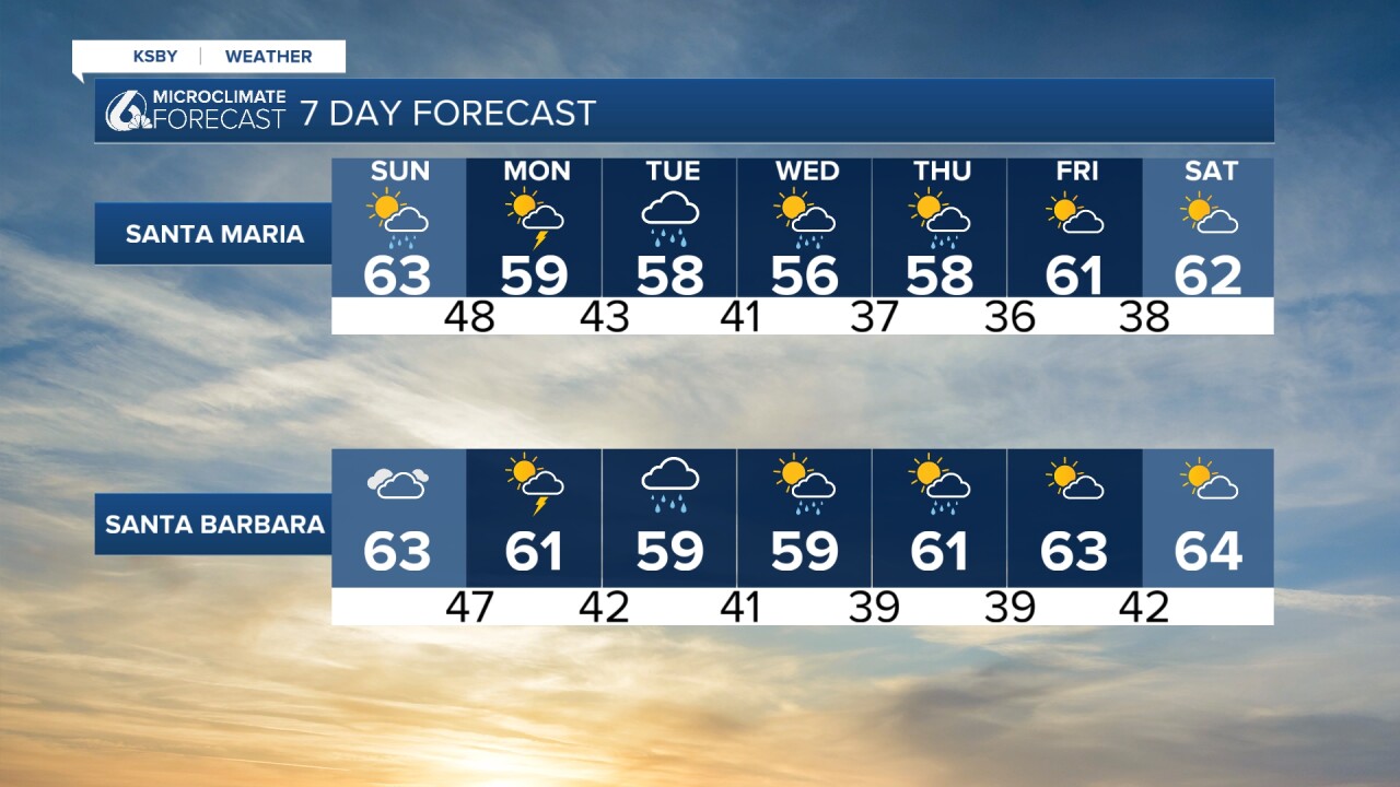
I am aware this is not in our region, but I want to make a note of it since it is a heavily traveled region. The Grapevine portion of the I-5 is under a Winter Storm Watch until Thursday. There is a 40 to 50% chance that the Tejon Pass gets an inch of snow (possibly Tuesday night). Travel delays could happen in that region; in previous incidents, closures have been issued due to inclement weather. Now, back to us, here is your seven-day forecast!
This has been quite an article, but here are two good infographics from the National Weather Service on rain timing and safety hazards.


Enjoy the rest of your evening!
—Leslie Molina
