


Good Tuesday evening, Central Coast!
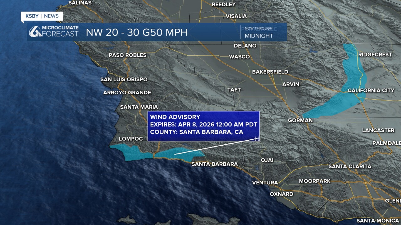
A Wind Advisory remains in effect through midnight for the western Santa Ynez Range and southwest Santa Barbara County coast. Expect northwesterly winds of 20 to 30 mph with gusts reaching 50 mph.
Tonight brings low clouds and patchy fog, giving way to sunshine Wednesday afternoon. Thursday stays mostly cloudy but dry.
Friday marks a big change as a strong April storm system arrives from the Pacific. Showers and scattered thunderstorms develop - slight chance during the day, better chance Friday night. Temperatures drop into the 60s and low 70s.
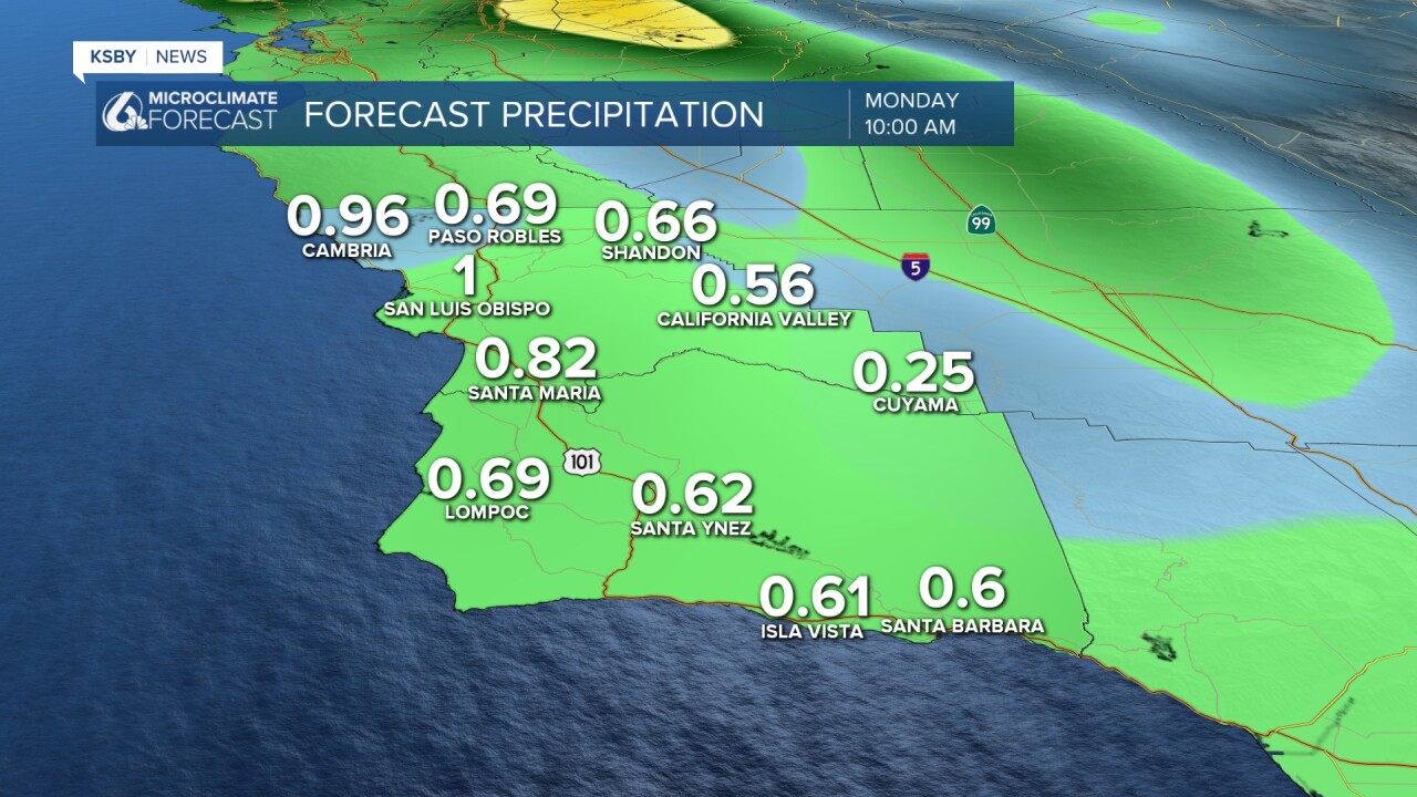
Saturday ramps up the rain and thunderstorm activity. Total rainfall from late Friday through early Monday could range from half an inch to over an inch, with areas seeing thunderstorms potentially receiving several inches.
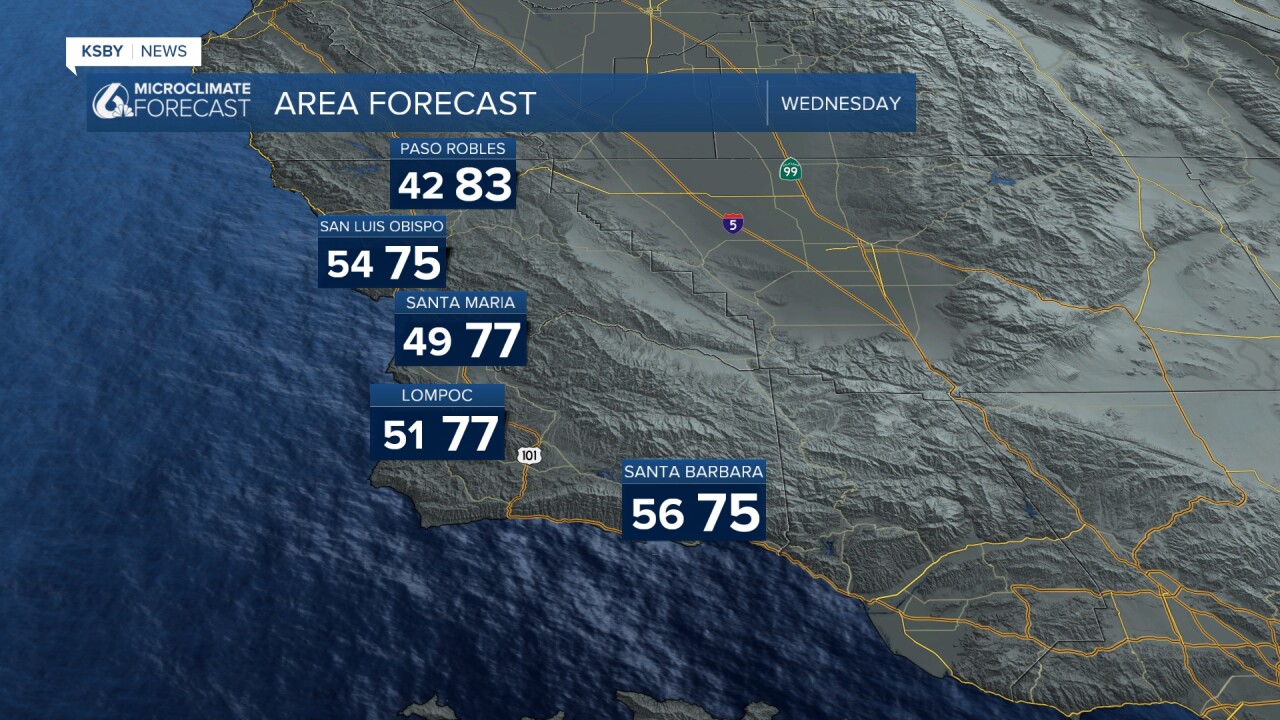
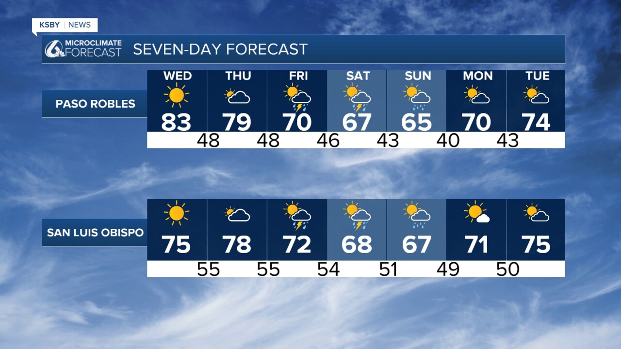
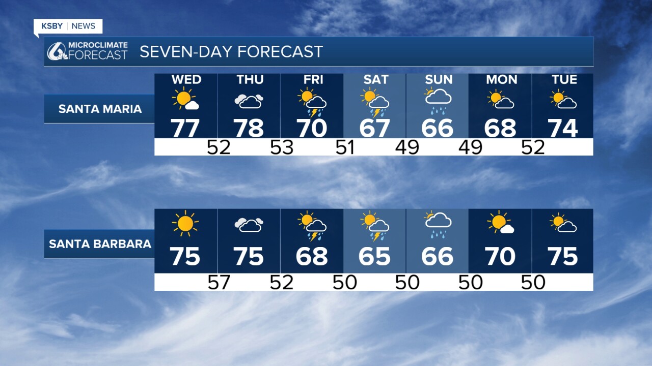
Wednesday: Warmer temperatures return briefly as a ridge builds over the area. Expect highs in the 70s and low 80s range with limited morning marine layer due to weak offshore flow from the north.
Thursday: Continued pleasant conditions with similar temperatures before changes arrive.
Friday: A strong April storm system moves in from the northwest, bringing:
- Showers and scattered thunderstorms (slight chance during the day, a better chance at night)
- Temperatures are cooling to 70-75°F, with the warmest readings early in the day
- Possible isolated heavier downpours
- Gusty winds develop, especially in the interior valleys and foothills
Weekend:
Saturday: Storm system continues moving through with showers and thunderstorms more likely. Expect:
- Rainfall totals of 0.5 to 1.5 inches
- Cooler highs in the 60s
- Peak rainfall rates of 0.25 to 0.75 inches per hour are possible
Sunday-Monday: Additional shower chances continue as a second disturbance passes to the north, with scattered activity possible through Monday.
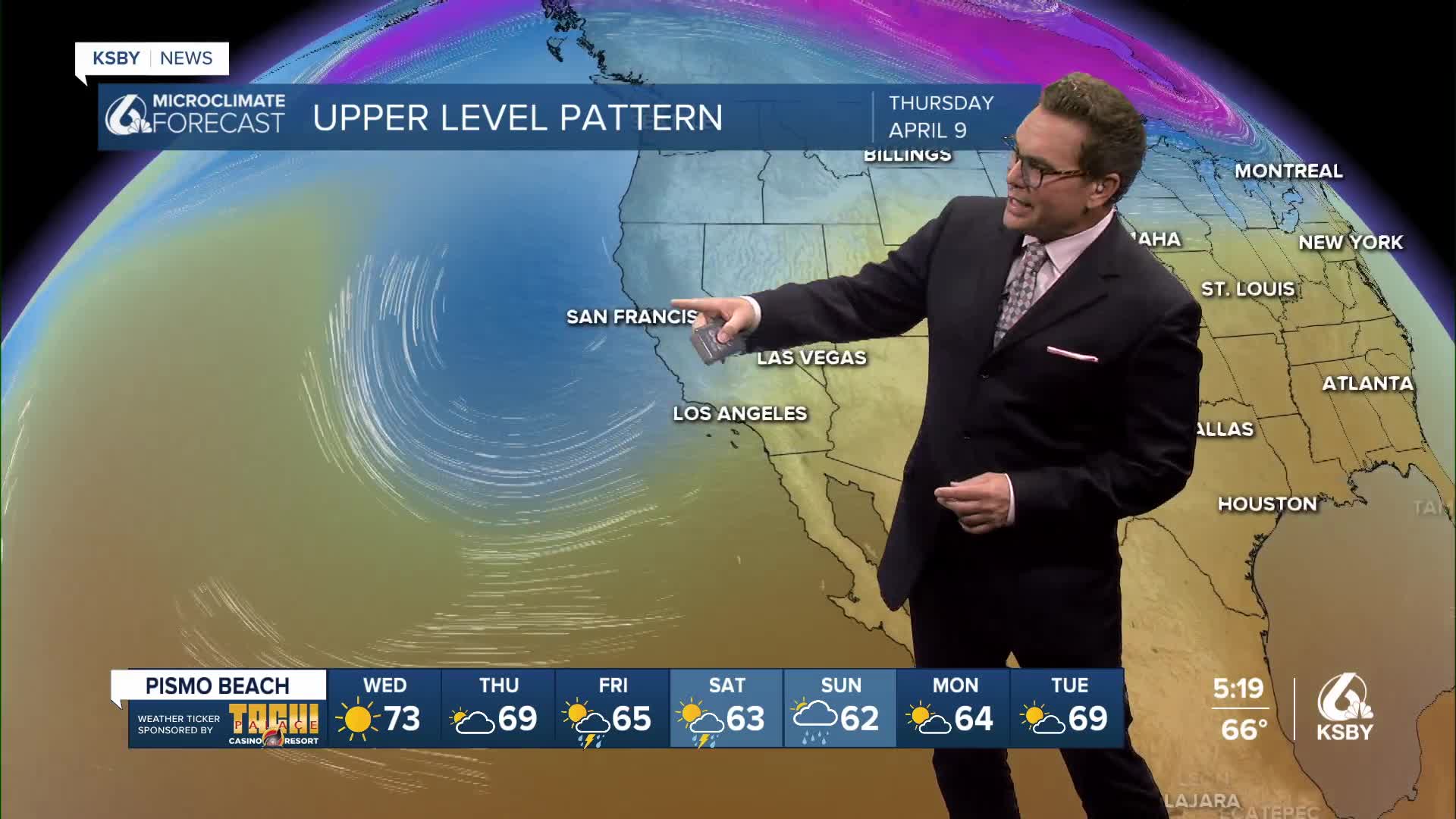
Two separate upper-level low-pressure systems with cold air aloft move towards the Central Coast Friday through early Monday.

Scattered rain chances and isolated thunderstorms later on Friday as two separate upper-level lows push towards the Central Coast.

Below is a snapshot early Saturday morning with rain looking likely.

Below: One weather computer model showing the potential rainfall totals from later Friday into early Monday.
This unusually strong April storm system is more typical of winter weather patterns, bringing the potential for significant rainfall to the Central Coast after a brief warm-up.
Early Next Week: Drier conditions return with temperatures rebounding well into the 70s
Have a great night, Central Coast!
-Jim
