

Happy Wednesday, Central Coast!
It's a chilly day for us here! This morning, temperatures ranged from the upper 30s to the upper 40s across our region. Overall, it's shaping up to be a cold and dry day for us here. We are getting a nice break after getting a lot of rain this weekend and on Monday!
There is also a High Surf Advisory for our region, which expires Sunday, November 23, at 9:00 PM. Keep in mind that it's best to stay out of the water during this time because there is a high risk of drowning.

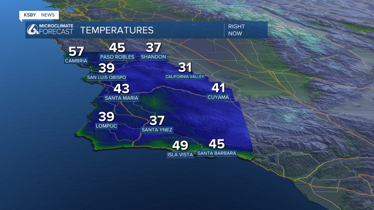
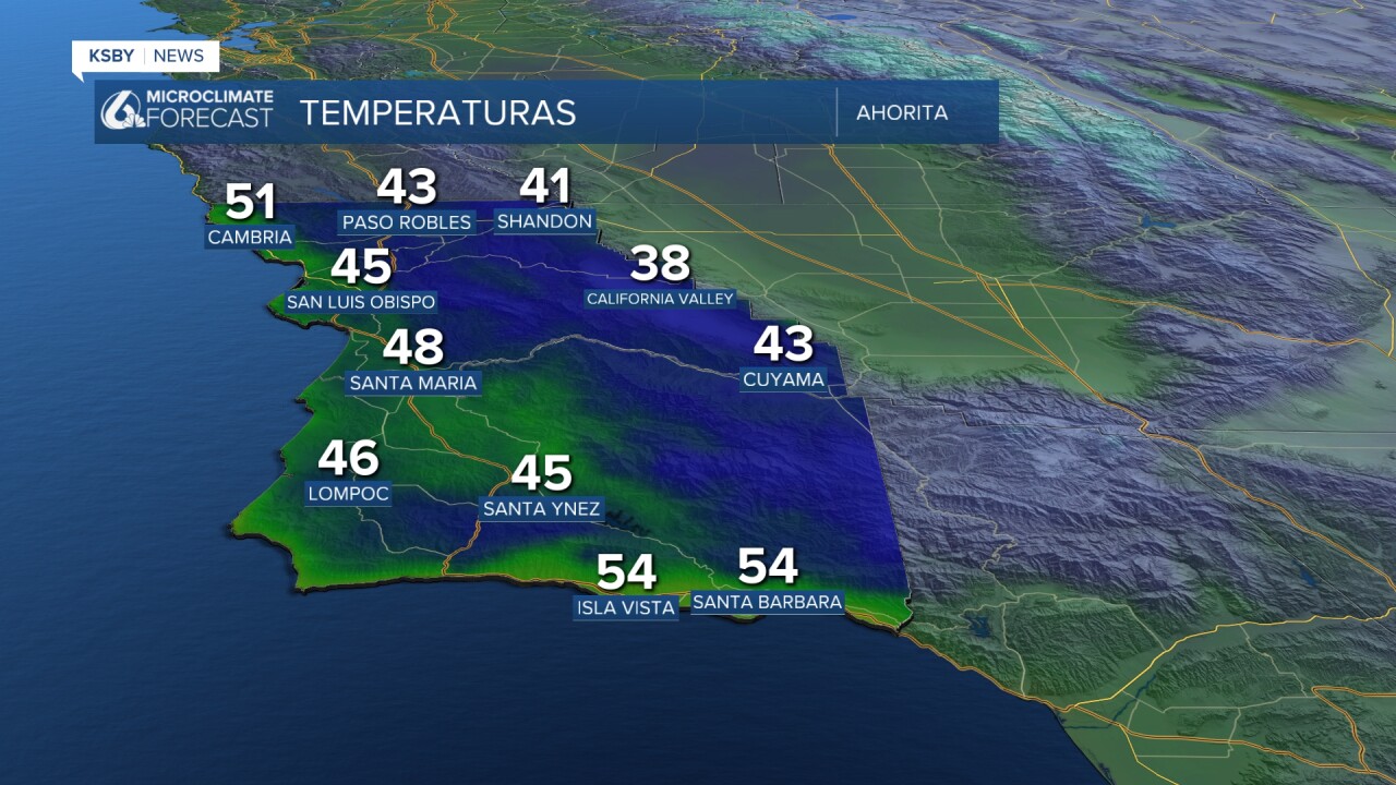
Here is a look at some of the temperatures we can expect on Thursday. Heads up, you will need a jacket and an umbrella!

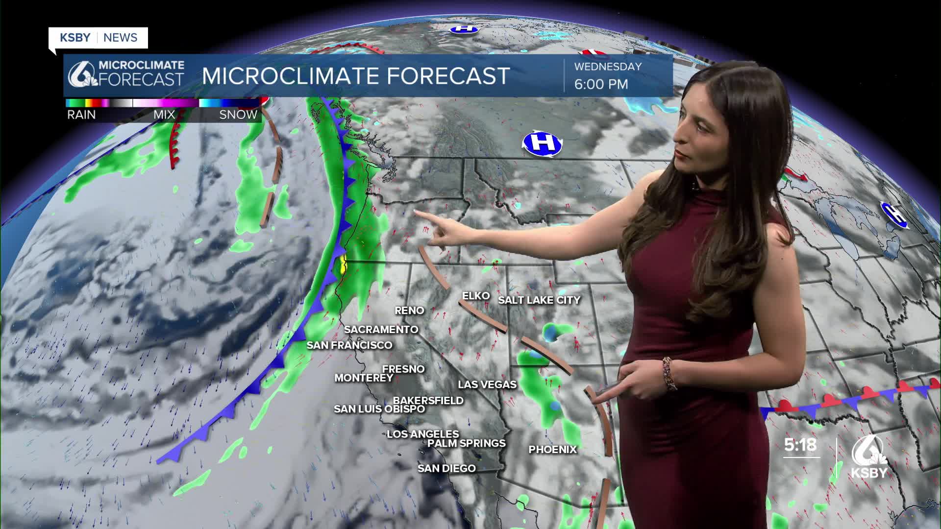
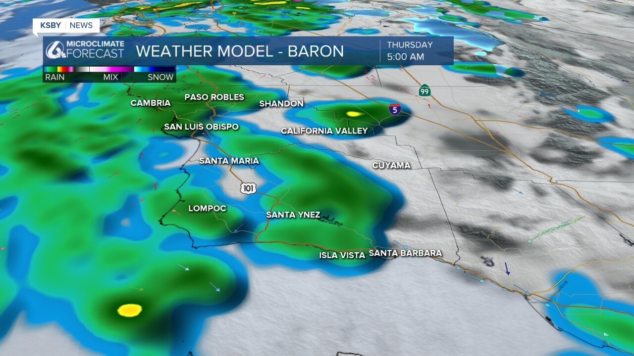
The reason? A new system from the north will bring in additional moisture to most of the state. This is what our models are showing as of Wednesday morning. This system will first hit the top half of California, then make its way down to us on Thursday morning.

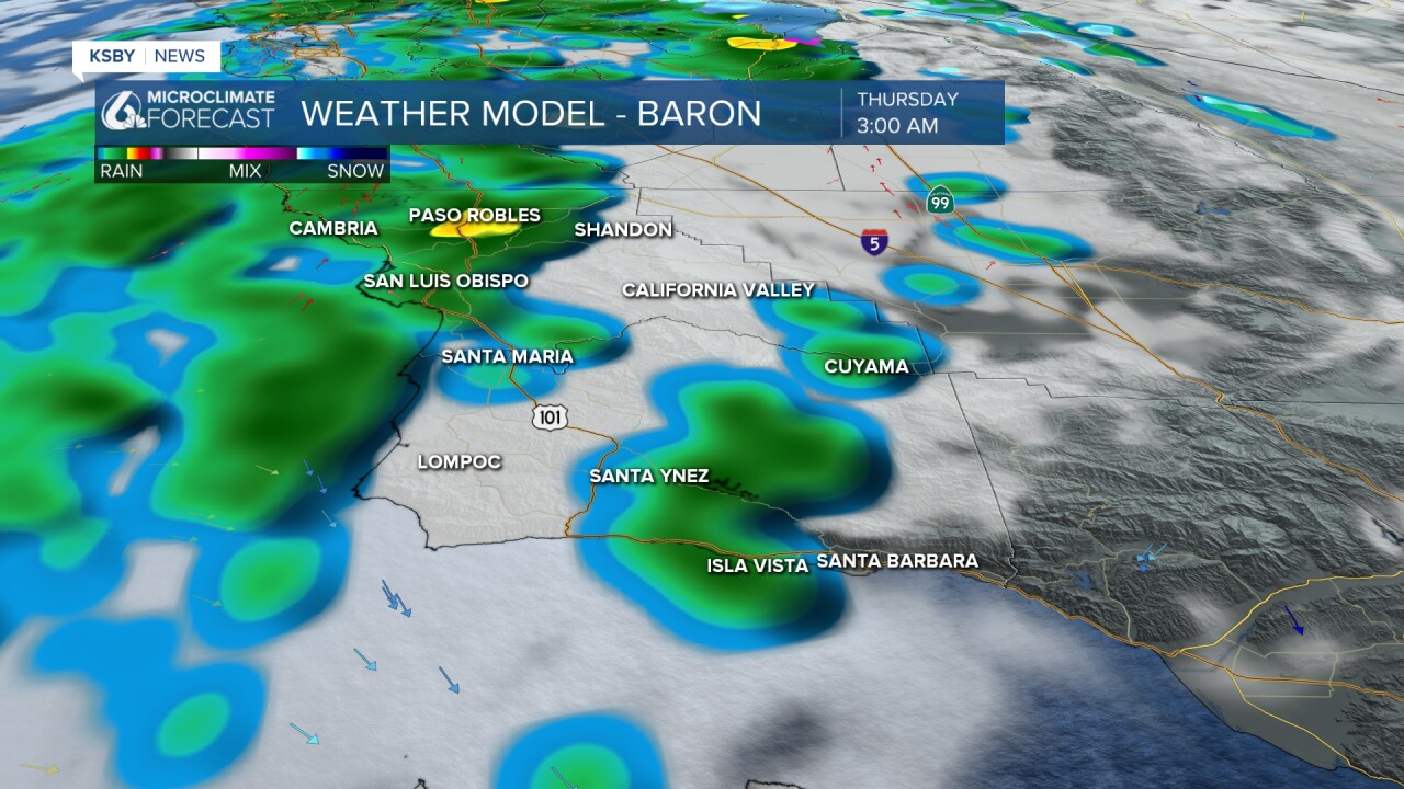
Here is a closer look! This new batch of rain could arrive during our morning commute hours. Keep that in mind as you head to work on Thursday!
These are just some of the rain totals we could see by Friday. Again, it is not a big amount of rain compared to what we have previously seen, especially for the south coast.

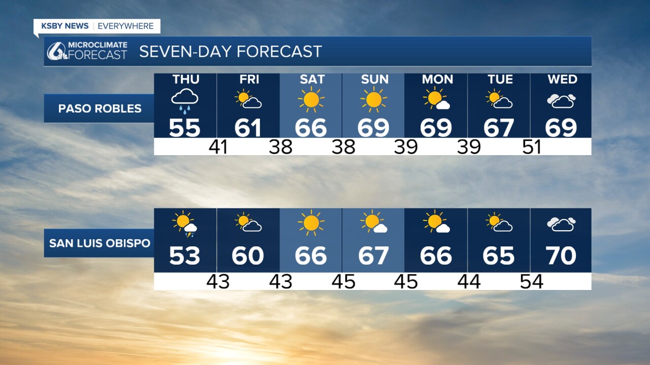
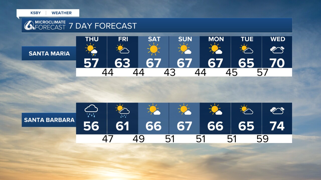
The weekend is shaping up to be a dry one with slightly warmer temperatures. For now, it is looking like these dry conditions will stick with us through the Thanksgiving holiday.
We will keep you updated with any changes, especially as we get closer to the holidays.
Enjoy your day!
— Leslie Molina
_______________________________________________________________________
¡Feliz Miércoles, Costa Central!
Empezamos el día con temperaturas entre los 30s y 40s. Este miércoles, tenemos un respiro de las lluvias que experimentamos el fin de semana y el lunes.
También hay una Advertencia de Oleaje Fuerte para las zonas marcadas en morado, que incluyen las playas de Pismo y Ávila. No tomen riesgos innecesarios: hay un alto riesgo de ahogarse.

Volveremos a ver el regreso de lluvias el jueves, gracias a un nuevo sistema de baja presión que avanzará hacia nuestra región.

La próxima imagen, nos muestra que estas lluvias llegarán a la Costa Central el jueves después de las 3:00 AM y continuarán durante las horas en que la gente esté manejando al trabajo. Por favor, manejen con cuidado en las autopistas.
Ahora, estas son las temperaturas que pueden esperar para el jueves.

El pronóstico de 7 días indica que veremos el regreso de condiciones secas el fin de semana, que continúan durante la próxima semana.
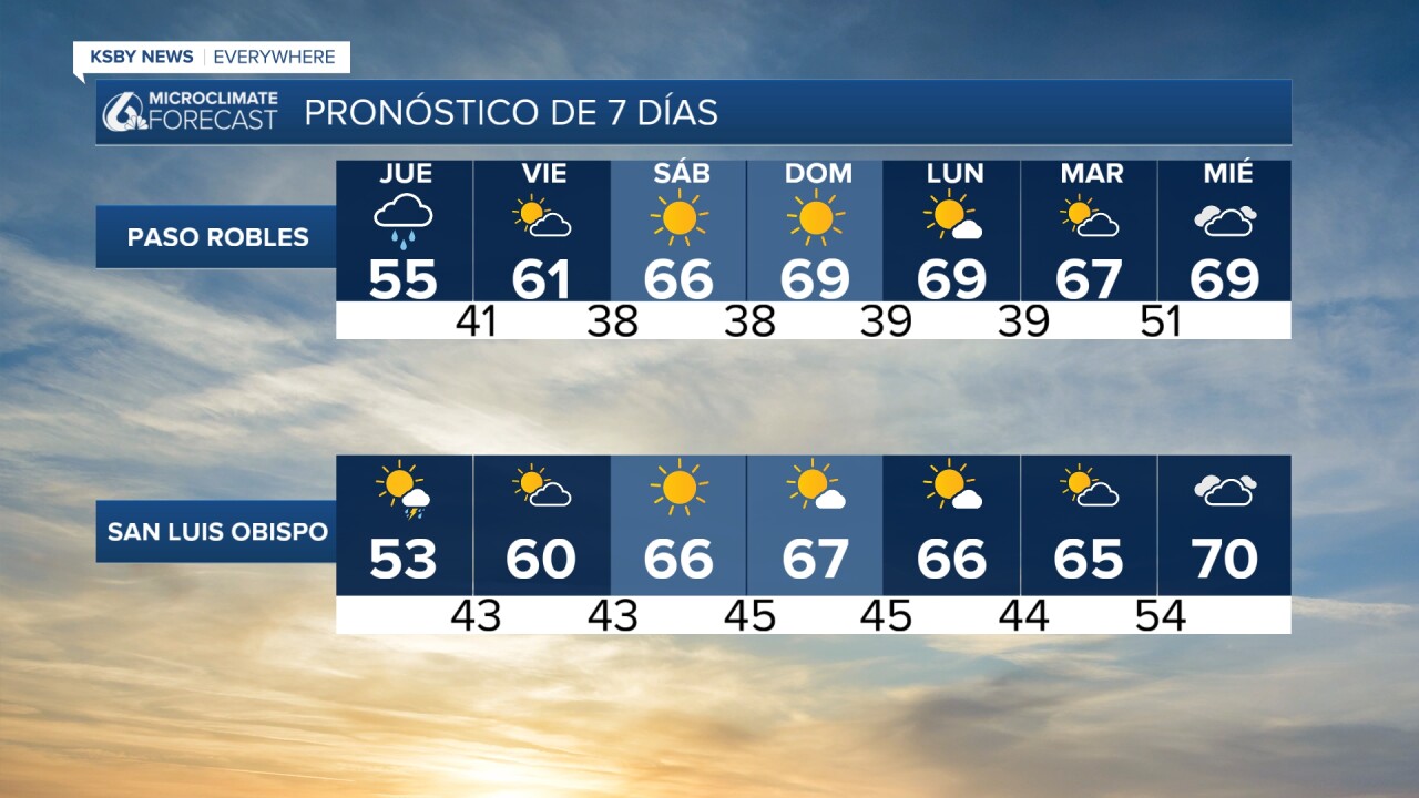
Lo mismo para el Día de Acción de Gracias, con un incremento menor en nuestras temperaturas.

¡Disfruten el resto de su día, Costa Central!
— Leslie Molina
