



Here is your weather forecast for San Luis Obispo & Santa Barbara Counties from Meteorologist Jim Castillo.
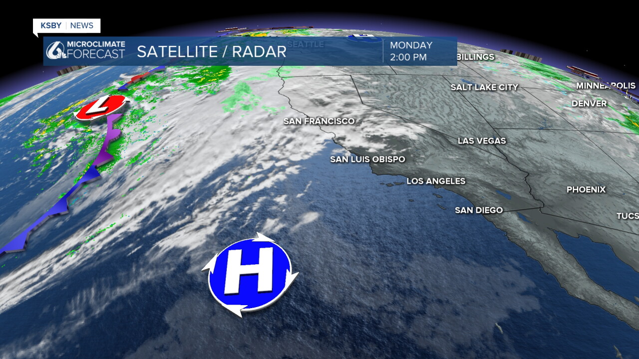
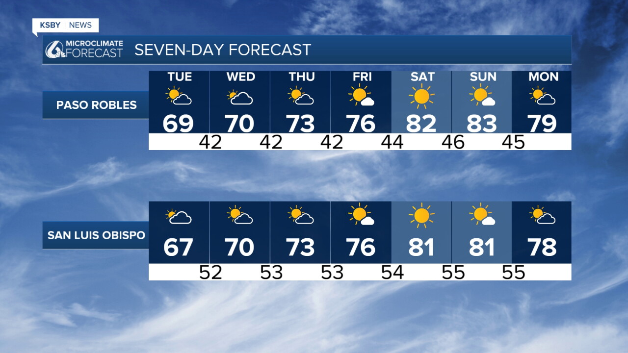
Upper-level high pressure is set to rebuild over California this week, initiating a warming trend across San Luis Obispo and Santa Barbara counties. As the high pressure ridge anchors overhead the Central Coast, standard autumn conditions will transition into a pronounced mid-to-late-week warming.
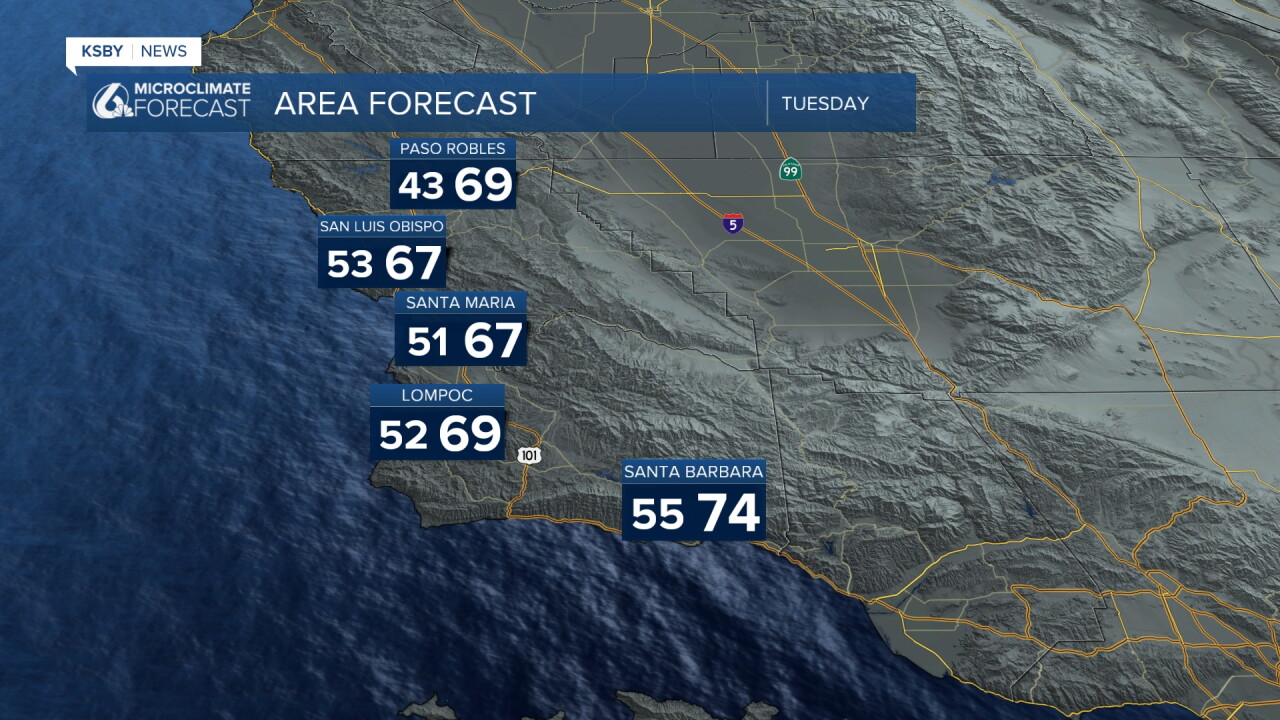
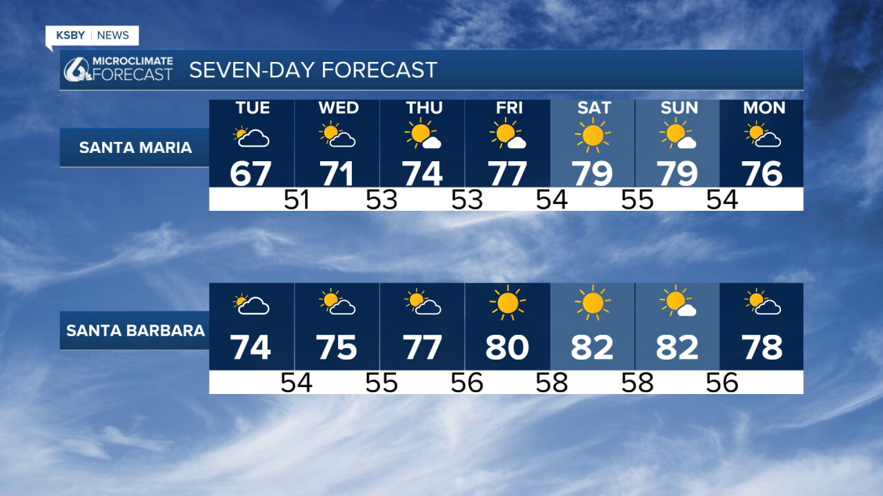
Monday & Tuesday: A weak trough passing well north on Tuesday will bring some clouds over extreme northern San Luis Obispo County, with a slight chance of isolated sprinkles mainly near Cambria and San Simeon Tuesday morning, then clearing. Expect cloudy conditions to start Election Day with possible drizzle or showers for some, then partly cloudy with daytime highs in the 60s to near 70 across coastal valleys and overnight lows dropping into the mid-to-upper 40s and closer to 60 at the coast.
The elevation of the Santa Lucia Mountains in San Luis Obispo County and the Santa Ynez Mountains in Santa Barbara County will keep inland areas cool overnight due to sharp radiational cooling. Low-level marine stratus will remain minimal as offshore flow begins to suppress the coastal boundary layer.
Offshore wind pattern (Friday - Sunday): Confidence is increasing for a late-week synoptic shift as upper-level dynamics support building offshore northeast gradients. Northeasterly winds will downslope off the Santa Lucia Range into San Luis Obispo County coastal valleys, as well as over the Santa Ynez Mountains into the South Coast of Santa Barbara County, driving rapid compressional heating.
Inland valleys across both counties will push into the low 80s as early as Wednesday. By Friday through the weekend, daytime highs will approach the upper 70s to low 80s even along the immediate coast, accompanied by drops in relative humidity.
Wind support & uncertainties: While mid-level wind support aloft currently appears light on model guidance, local pressure gradients between the Great Basin and the Central Coast will dictate the exact magnitude of wind gusts along exposed ridges within the Los Padres National Forest.
Have a great night, Central Coast!
-Jim
