


Good evening, Central Coast!
Here's the forecast for San Luis Obispo and Santa Barbara Counties:
Current Pattern Overview: June is settling into its typical pattern with weak upper-level disturbances and persistent onshore flow. A broad, sagging trough at upper levels will maintain marine influence throughout the week, bringing the classic coastal low clouds, as well as some fog and wind patterns to our region.
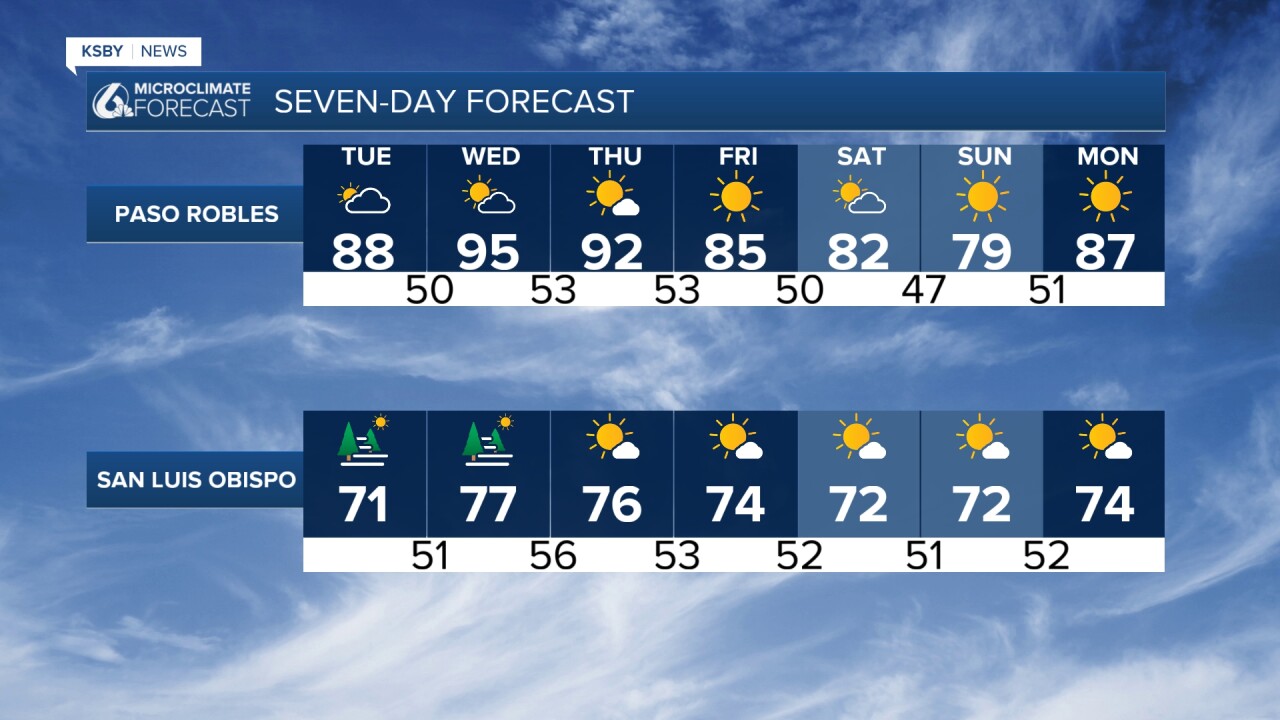
Tonight through Tuesday, Election Day: Marine layer development will accelerate tonight as onshore flow strengthens and an eddy circulation develops along the Southern California coast. Low clouds and fog will push earlier and deeper into inland valleys, particularly affecting areas near the Santa Lucia and Santa Ynez Mountains. Tuesday night and Wednesday will see similar cloud patterns, with the marine layer potentially thick enough to keep some beaches socked in through the afternoon hours.

Wind Forecast - Key Focus on Wednesday: The pressure gradient between inland high pressure and coastal low pressure will drive stronger-than-normal sea breezes throughout the week. Wednesday brings the most significant wind event, with a Gale Watch in effect for the Central Coast from Wednesday afternoon through Thursday morning. Southwest Santa Barbara County has a chance of advisory-level winds during this timeframe. The strongest winds will occur during the typical afternoon onshore push, affecting coastal areas and mountain passes in both counties.
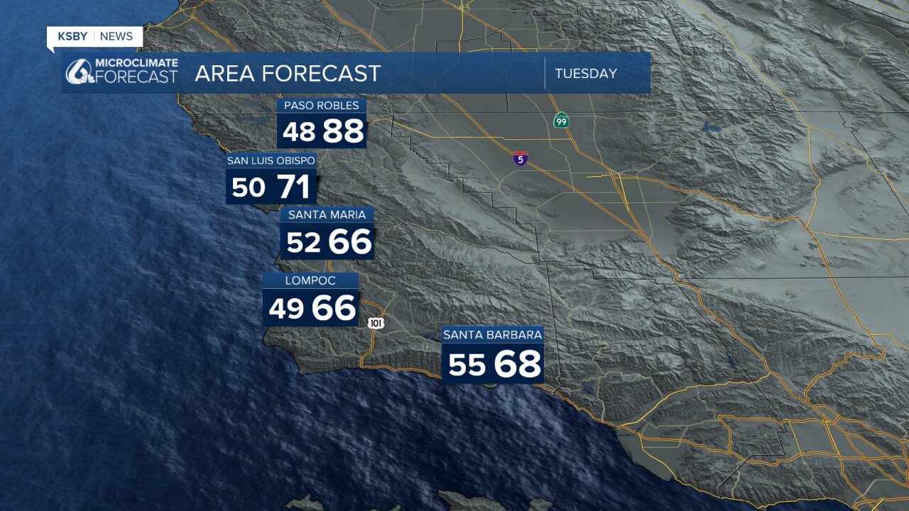
Temperature Trends: Coastal and valley temperatures will drop today and Tuesday as the marine influence increases. While today's highs remain above seasonal averages, Tuesday's cooling will bring most coastal and valley locations to slightly below normal temperatures. Wednesday may see some warming in northern areas due to a brief north flow, though thick marine layer presence could limit this warming. Interior sections of both counties, including higher elevations in Los Padres National Forest, should see a few degrees of warming on Thursday as a weak ridge builds in from the west.
Weekend Outlook: Heights aloft will decrease over the weekend as an upper-level low moves into the Pacific Northwest. This will maintain moderate to strong onshore flow daily, peaking on Friday. Expect continued night and morning low clouds and fog across the region. Friday appears to be a classic June Gloom day with strong onshore flow keeping much of the nearshore areas cloudy and cool throughout the day. Some beaches may not clear until late afternoon on Thursday, Saturday, and Sunday.
This pattern represents typical early June conditions for the Central Coast, with marine layer dominance and gusty afternoon winds being the primary weather features through the extended forecast period. No major heat through the week or weekend.

Have a great night, Central Coast!
-Jim
