


Good evening, Central Coast!
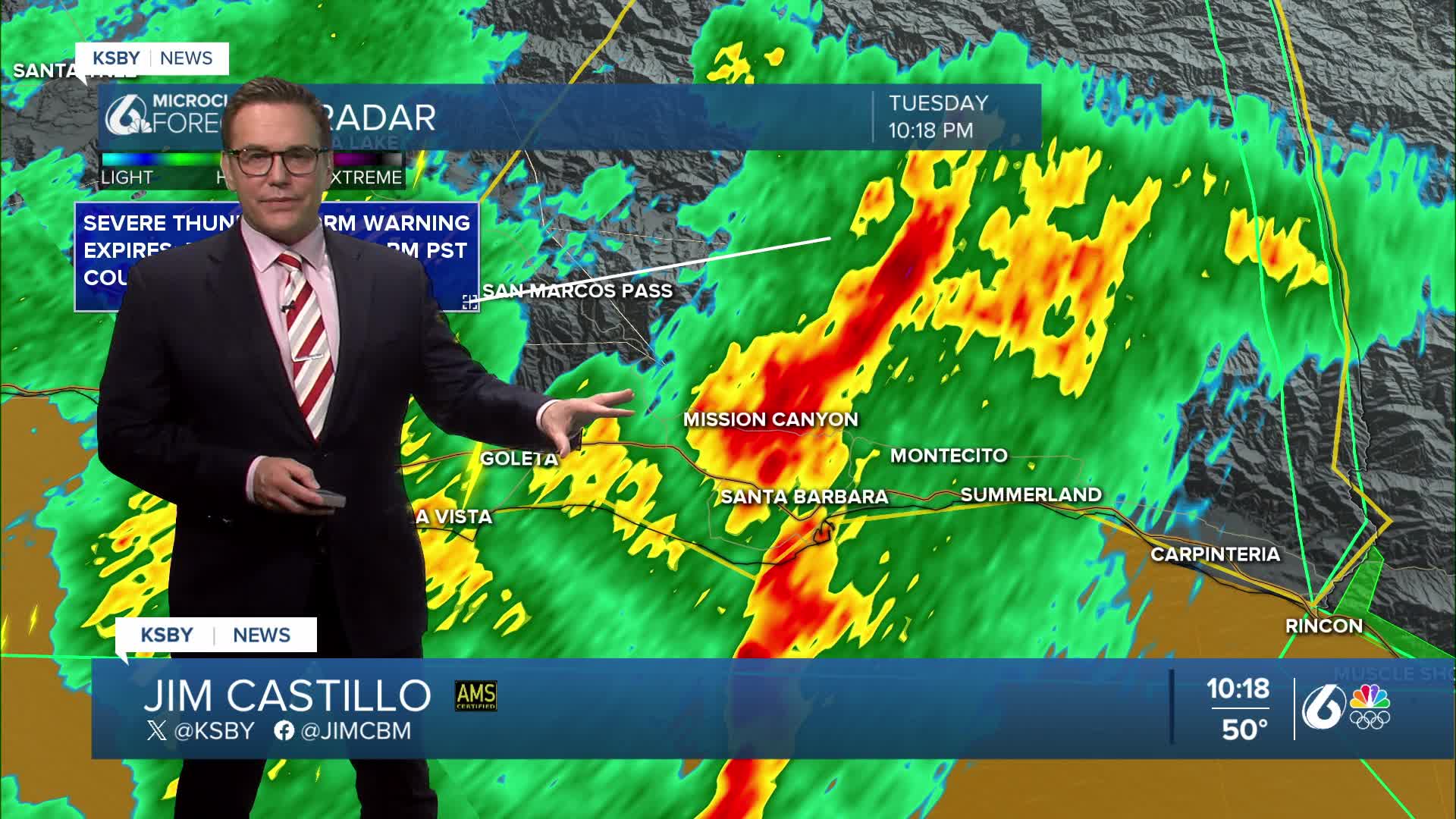
UPDATE: A Severe Thunderstorm Warning has been issued for west central Santa Barbara County until 11 pm, including the city of Santa Barbara.

ALERT from the National Weather Service in Oxnard, CA. Rain gauges near the area of the Gifford & Madre burn scars have met rainfall thresholds for potential debris flows and mudslides. The KSBY weather team is watching this closely. As of 4:30 pm, there are no reports of debris flows or mudslides, but remain cautious if you are in those areas.
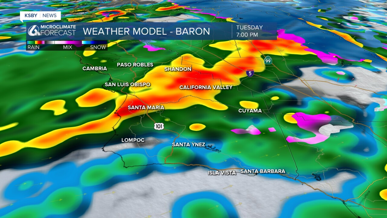
A colder, energetic storm system will move across the Central Coast this evening & tonight as a strong upper low shifts east and another vigorous cold front pushes through.
Rain continues spreading into San Luis Obispo County and Santa Barbara County through tonight.
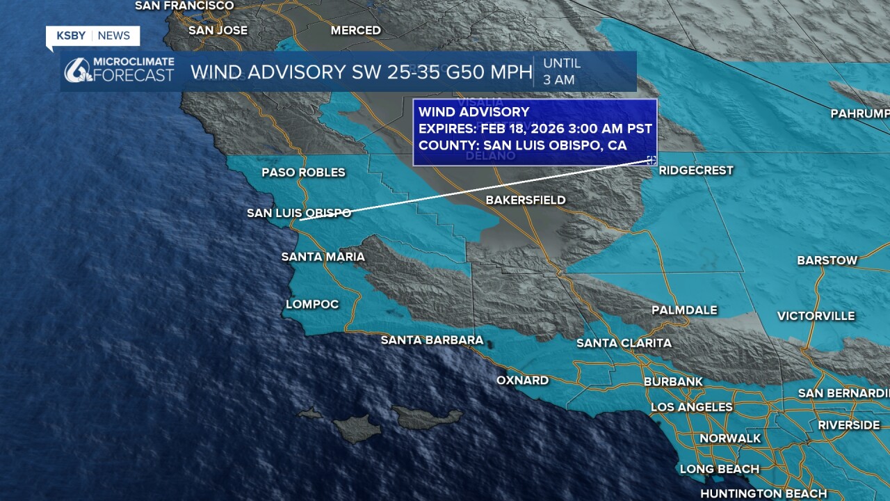
Strong southerly winds continue ahead of the trough, driven by a tight pressure gradient. Gusts of 35 to 45 mph are expected across San Luis Obispo and Santa Barbara counties this evening into tonight.
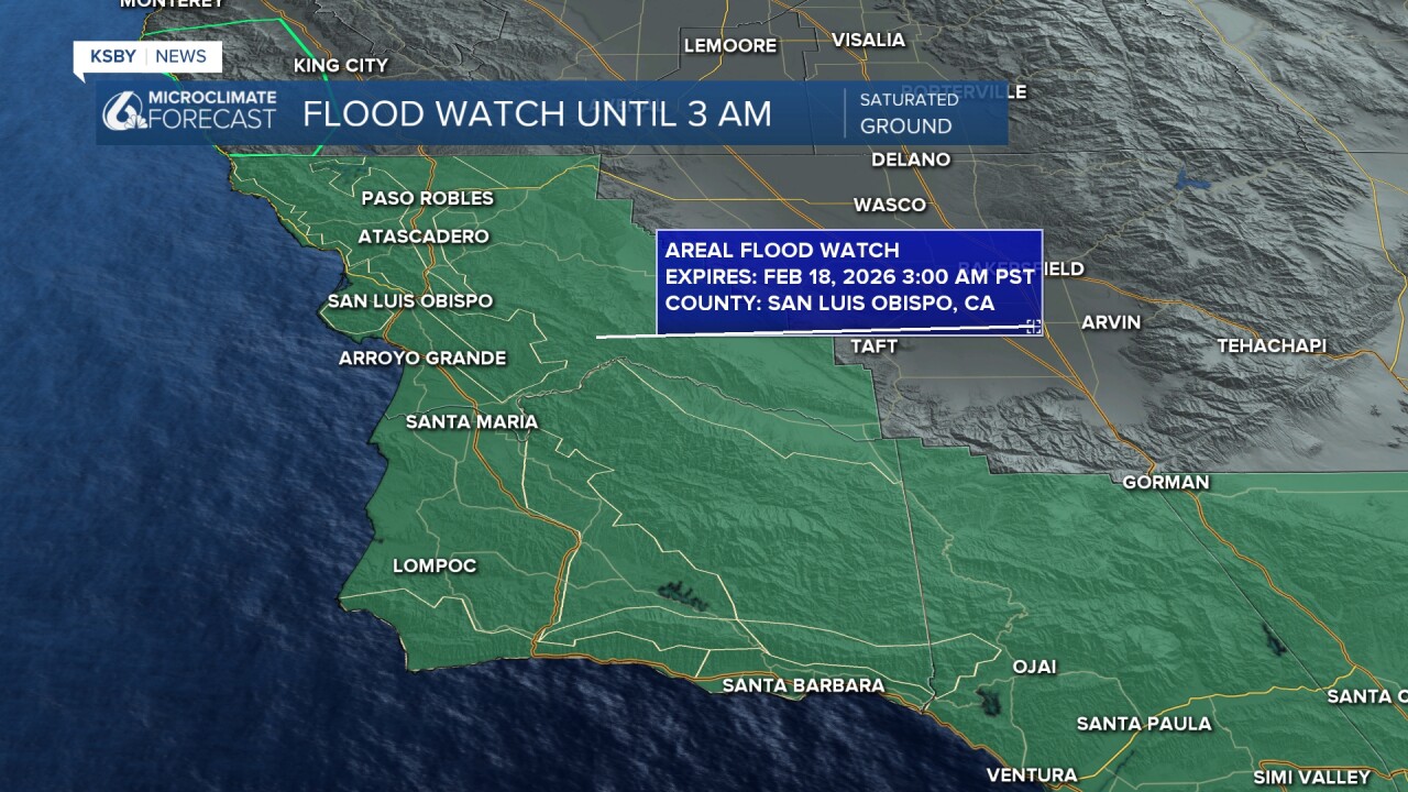
A Flood Watch and a Wind Advisory are in effect:
until 3 am for San Louis Obispo and Santa Barbara Counties.
Additional rainfall from Tuesday evening through early Wednesday will total:
of .50" to 1" for the coasts and valleys, and locally higher in the mountains.
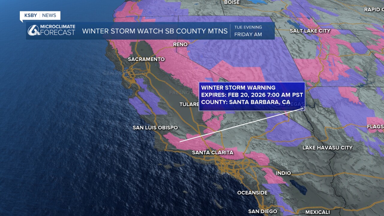
The interior mountains of Santa Barbara County could see a few higher gusts, and the Winter Storm Warning starts tonight in the interior mountains, where 1 to 4 inches of snow is expected to fall between 3,500 to 4,500 feet.
Steady light to moderate rain will increase tonight ahead of a sharp cold front. A brief 15- to 30-minute burst of heavy rain and strong winds is likely along the front. Rainfall rates will commonly reach one-third to one-half inch per hour, with isolated downpours nearing 1 inch per hour, especially in upslope areas. Combined with recent rainfall, this raises the risk of flooding and debris flows, including burn scar areas.
Snow levels will lower to around 3,000 feet by early Wednesday. Most precipitation will taper by daybreak Wednesday.
If you are traveling on I-5, one to three inches of snow are possible on the Grapevine, with higher totals in the surrounding mountains. Travel over mountain roads could be delayed or restricted.
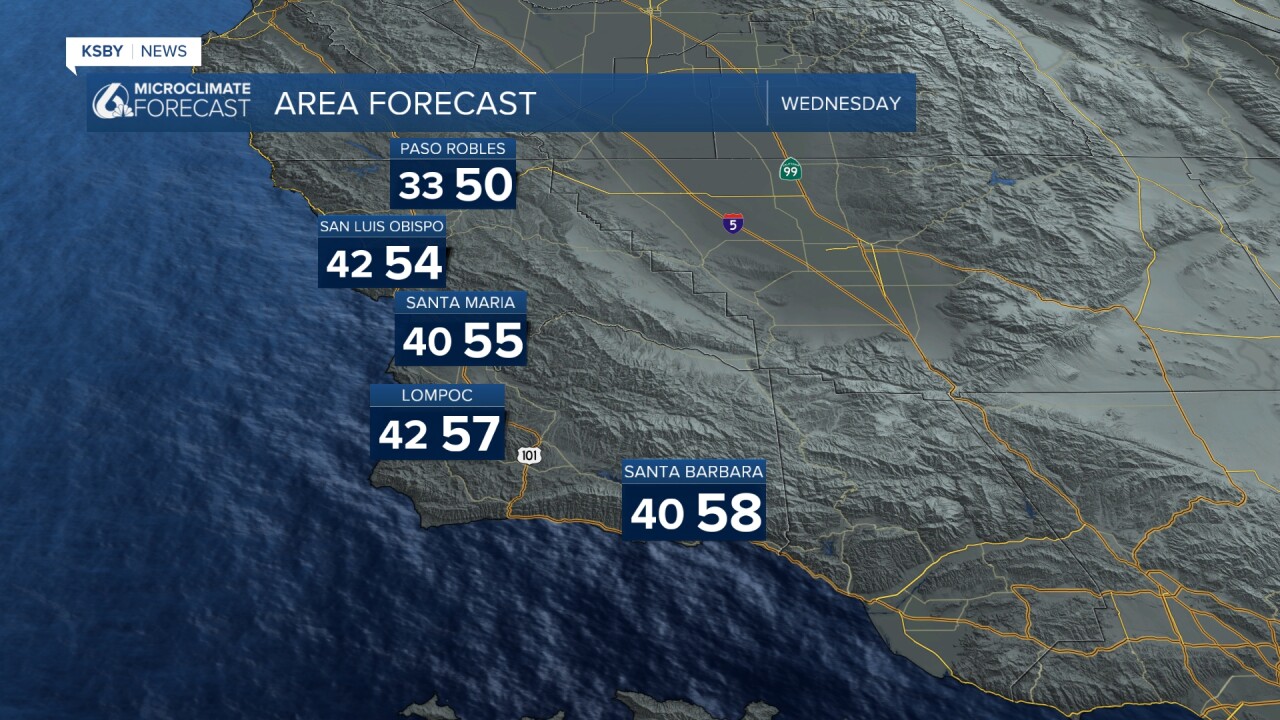
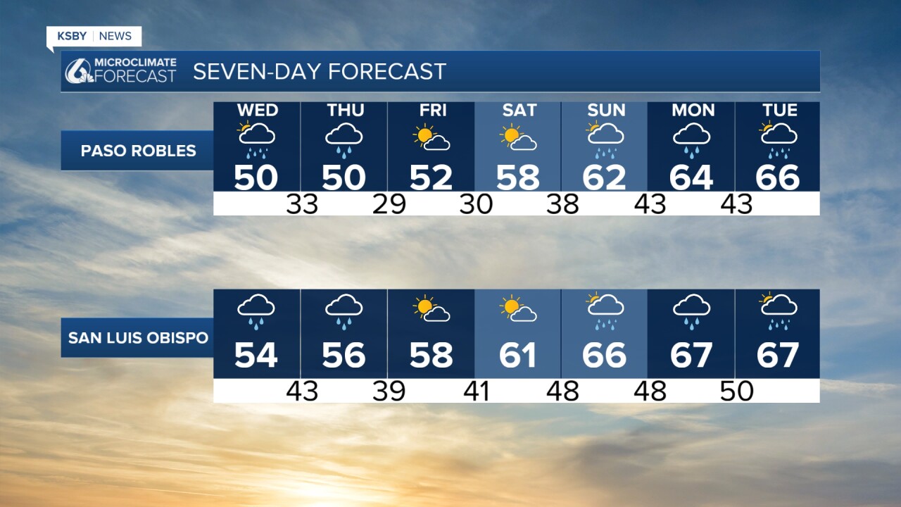
Skies will gradually clear on Wednesday, though a few lingering showers are possible, especially across San Luis Obispo County. Highs will remain 10 to 15 degrees below normal, mainly mid to upper 50s.
Another weaker system arrives late Wednesday night into Thursday, first bringing rain to San Luis Obispo County and then spreading south during the day. Snow levels will range from 3,500 to 4,000 feet. This system is less dynamic, with rainfall totals generally one-third to one-half inch. Highs will again top out in the 50s.
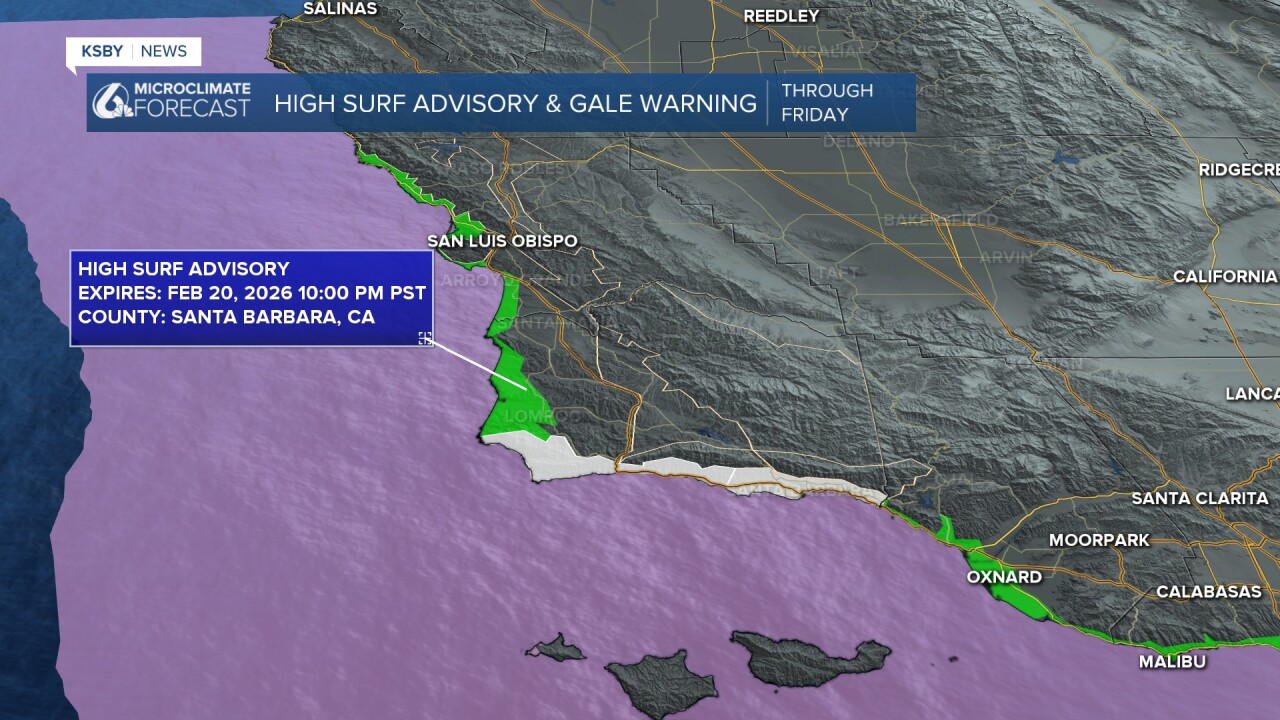
A High Surf Advisory continues along the Central Coast until Friday at 10 pm. Large breaking waves 10 to 15 feet with local sets to 20 feet on Wednesday. Rip currents will be dangerous. A Gale Warning continues until early Wednesday.
Looking ahead, drier northwest flow sets up late Thursday into Friday with gradual clearing and highs in the lower 60s — still below normal. Saturday looks like the nicest day, with mostly sunny skies and temperatures in the 60s.
By Sunday through Tuesday, another Gulf of Alaska system may bring a chance of rain across the Central Coast.

The KSBY Weather Team will keep you updated!
Have a good night, Central Coast!
-Jim
