

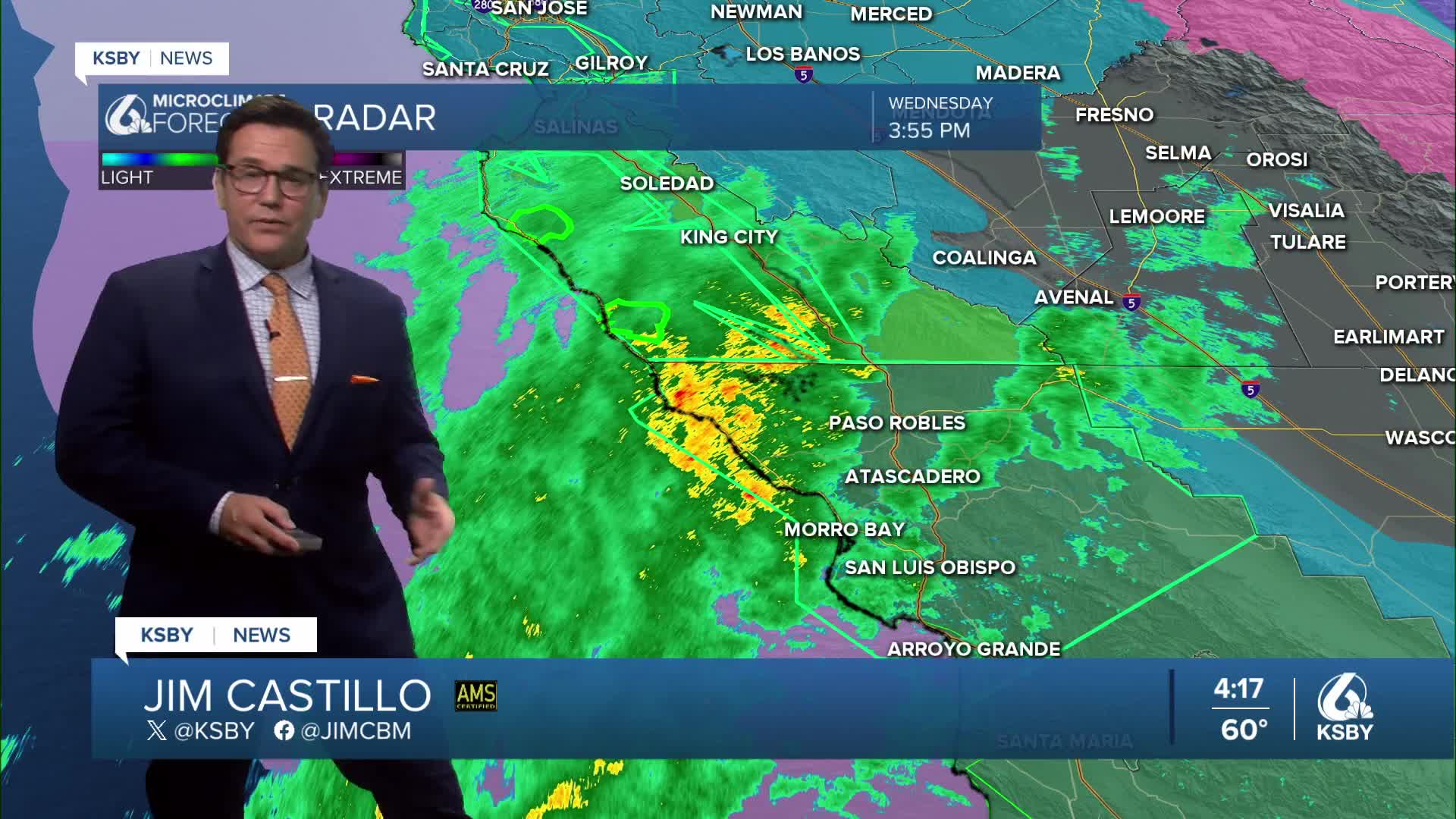


CENTRAL COAST STORM ALERT from Meteorologist Jim Castillo
A Flood Advisory has been issued for much of San Luis Obispo County until midnight, with minor flooding in some areas. Flash Flood Warnings for the burn scars in Monterey County.
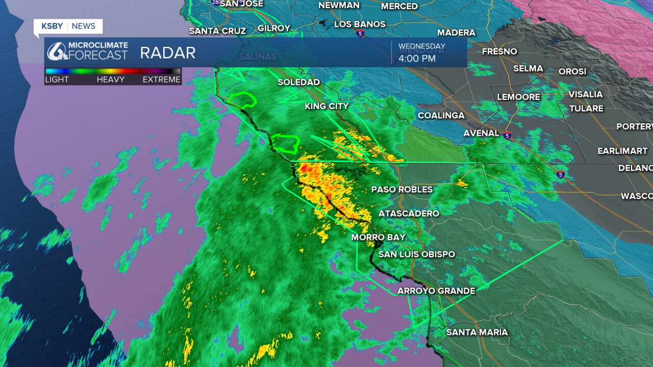
A moderate storm moving into San Luis Obispo and Santa Barbara Counties will continue through Thursday afternoon. Here is what you need to know:
Active Alerts:
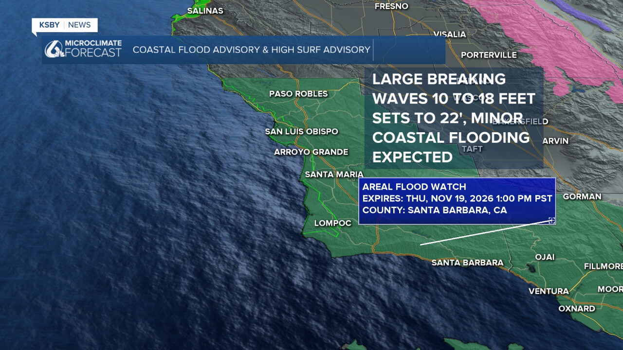
• Flood Watch: San Luis Obispo County (through tonight) and Santa Barbara County (through Thursday afternoon)
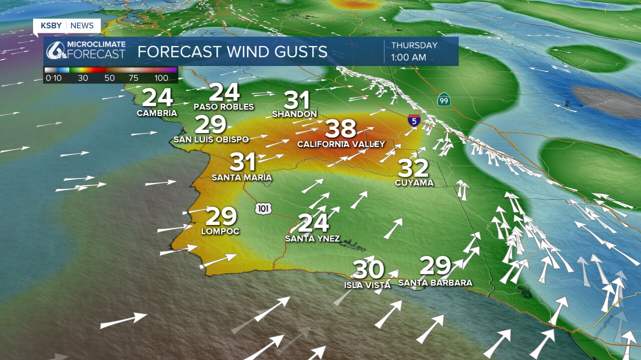
• Wind Advisories: Active across both counties through early Thursday with a south wind 20 to 30 mph and gusts up to 45 mph. Higher in the mountains and hills.
• High Surf and Coastal Flood Advisories: Dangerous surf, rip currents, and peak high-tide flooding expected Thursday morning
Timing:
• (Evening): Rain and some heavy is moving through San Luis Obispo County and spreads south into Santa Barbara County by tonight.
• Overnight (2:00 AM – 5:00 AM Thursday): Heaviest rain rates sweep through Santa Barbara and south-facing slopes.
• Through Thursday Afternoon: Embedded thunderstorms possible with localized downpours, lightning, and gusty winds
Rain Totals:
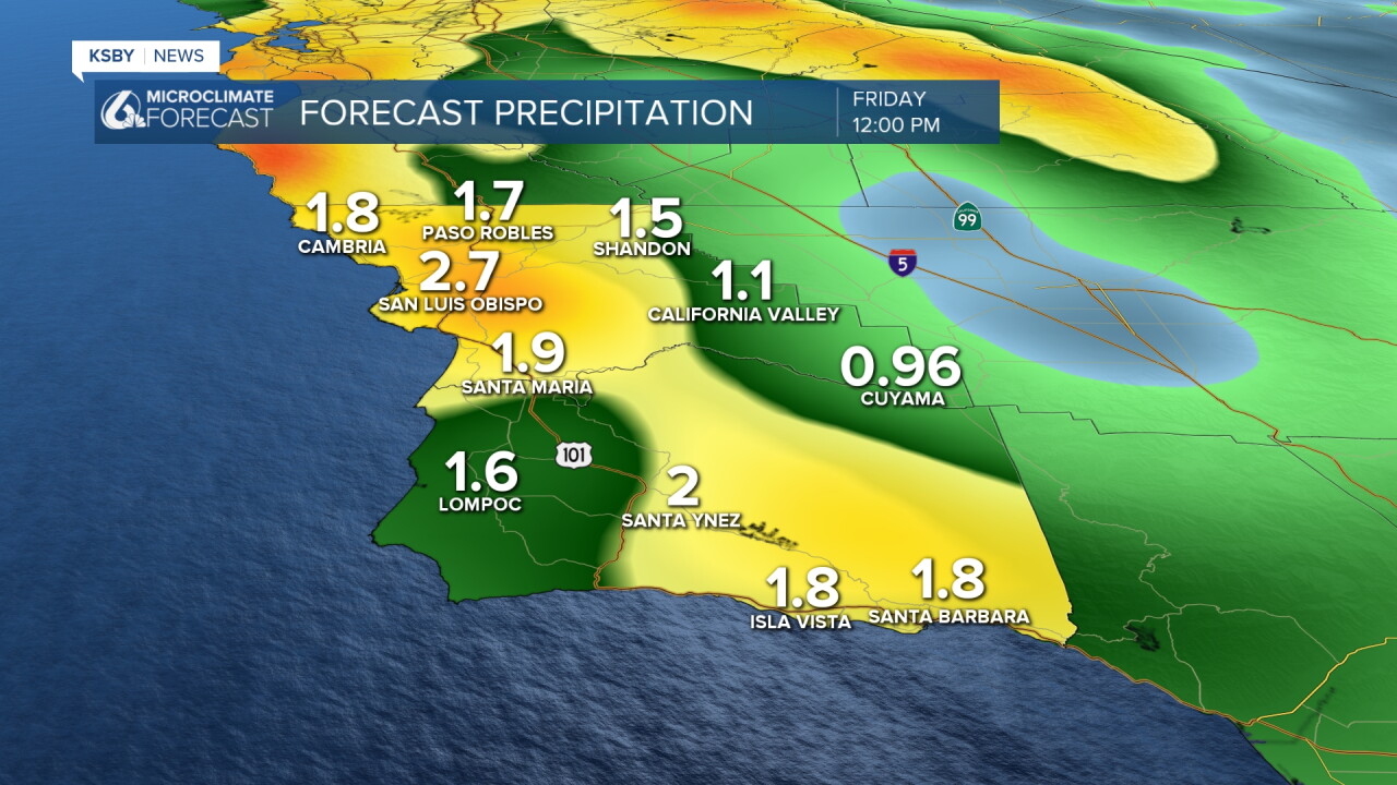
• Coasts and Valleys: 1 to 3 inches
• Foothills and Mountains: 2 to 5 inches (Santa Lucia Mountains, Santa Ynez Mountains, and Los Padres National Forest), plus light snow at the highest peaks
Coastal Hazards:
Expect large breaking waves near the Pismo Beach and Cayucos piers, hazardous conditions inside Morro Bay Harbor, and minor to moderate coastal flooding and beach erosion Thursday morning. Waves 10 to 18 feet and sets up to 22 feet.
What’s Next:
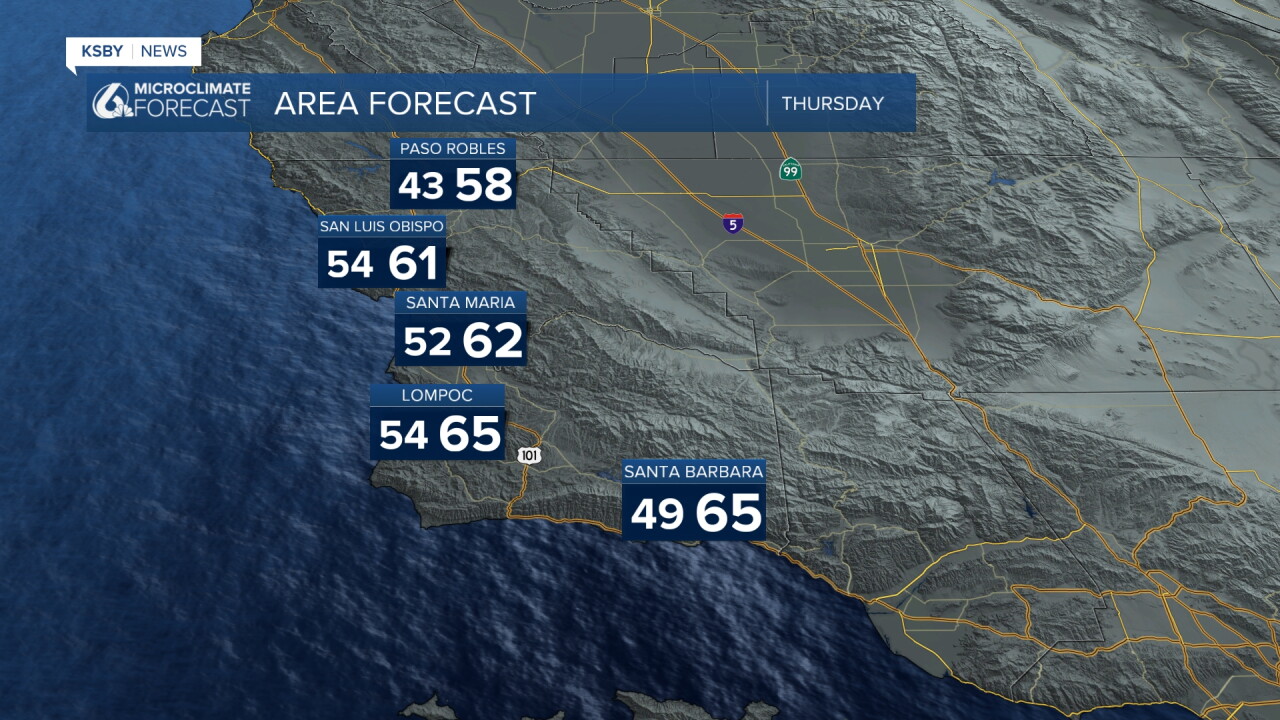
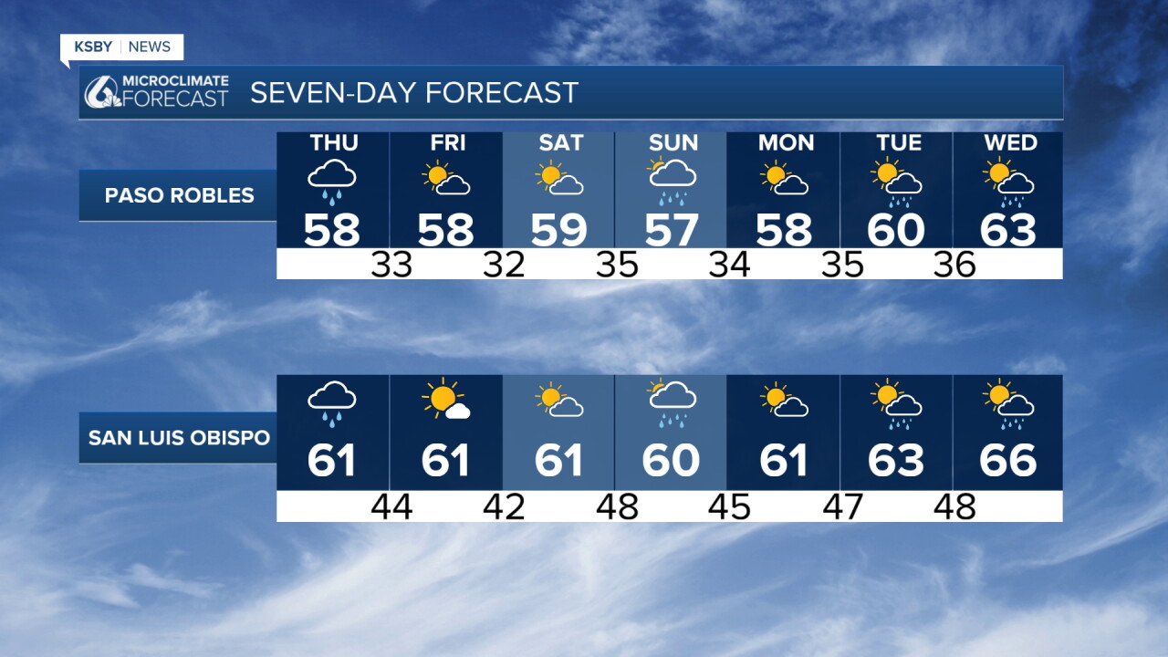
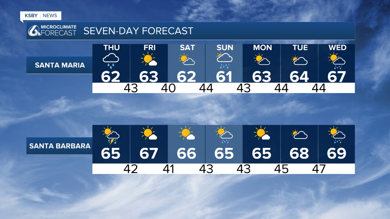
Sunny, brisk, and cool (mid-60s) for Friday and Saturday, though watch for interior valley frost Thursday night. A quick, lighter round of rain passes through San Luis Obispo County on Sunday before another potential system arrives mid-next week.
Stay safe, watch for slick roads, and keep clear of the jetties and piers.
Stay weather-aware, Central Coast!
-Jim
