

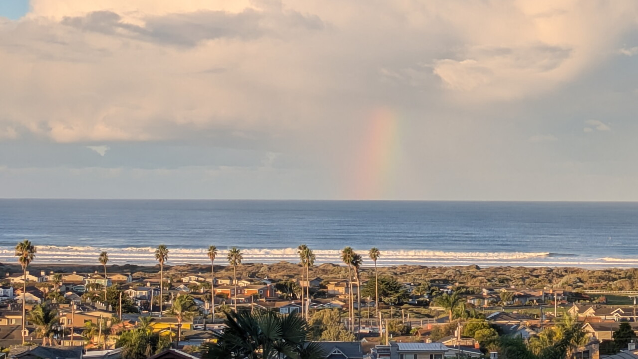


Here is your Central Coast weather forecast from Meteorologist Jim Castillo for San Luis Obispo and Santa Barbara Counties
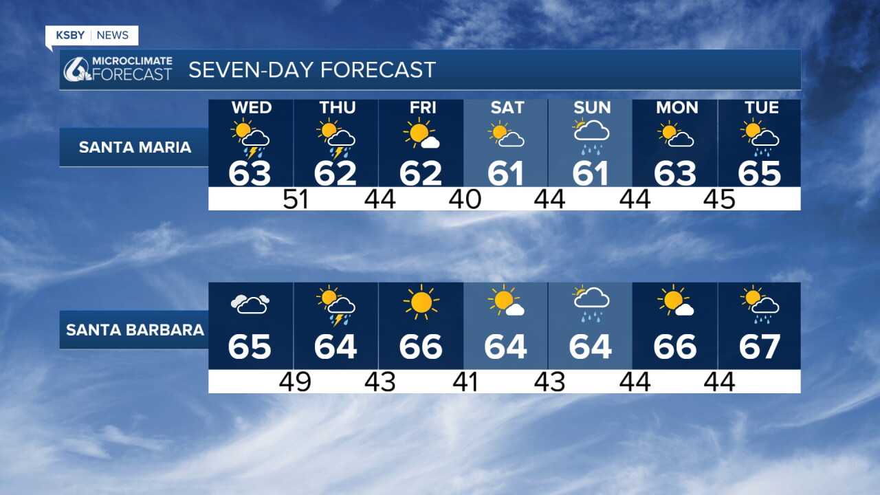
A cold, unsettled pattern holds through Thursday, bringing below-normal temperatures, hazardous surf, and a significant mid-week storm.
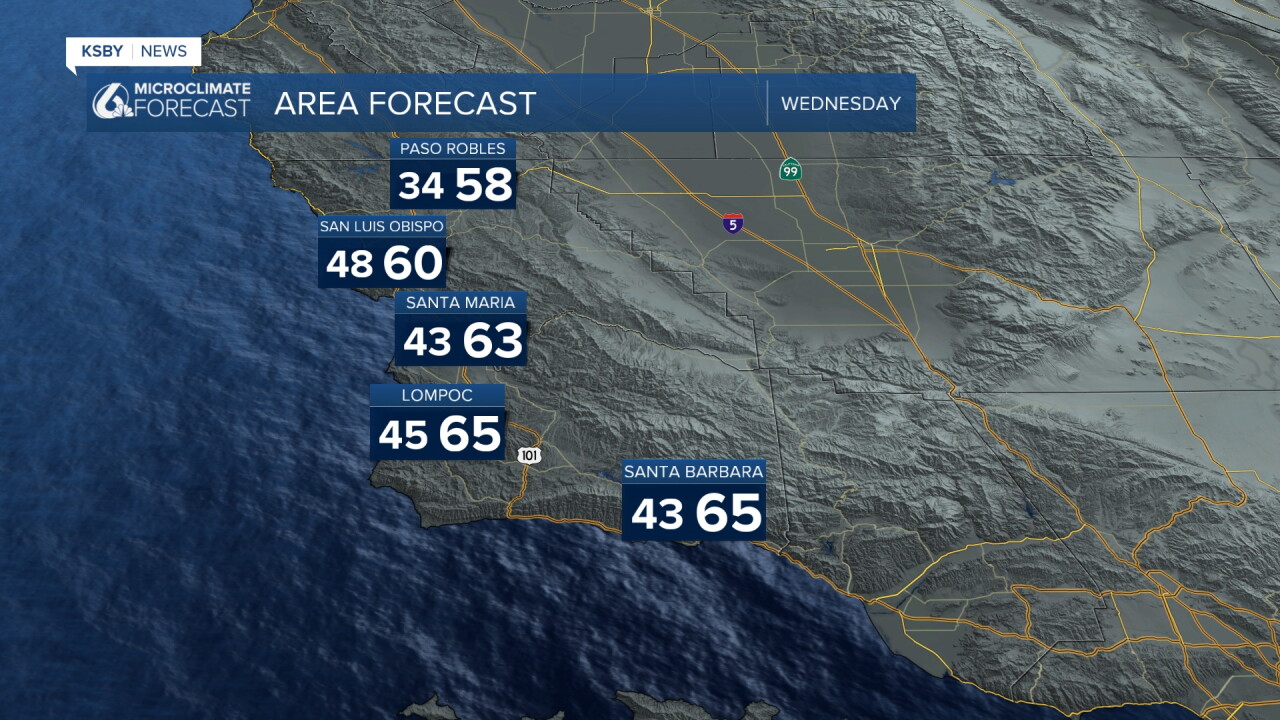
Tonight, most areas are partly cloudy and chilly, 30s in North County and 40s in the coastal valleys.
The Mid-Week Storm (Wednesday through Thursday)
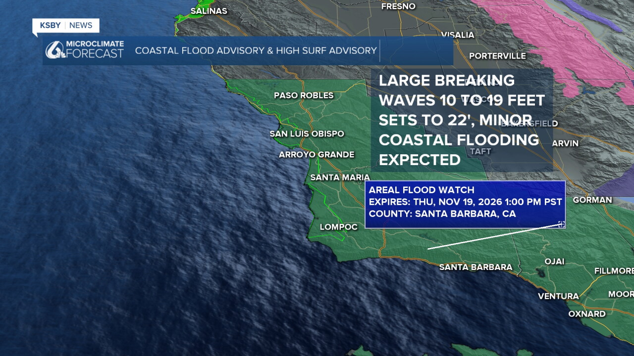
FLOOD WATCH IN EFFECT from Wednesday afternoon through late Wednesday night in San Luis Obispo County and late Wednesday night to Thursday for Santa Barbara County: Flooding caused by excessive rainfall is possible. Excessive runoff may result in flooding of rivers, creeks, streams, and other low-lying and flood-prone locations. Rain rates up to 1 inch per hour are expected in the mountains, and up to 0.75 inches per hour elsewhere.
HIGH SURF ADVISORY NOW IN EFFECT UNTIL 9 PM PST FRIDAY... COASTAL FLOOD ADVISORY IN EFFECT FROM 3 AM TO 10 AM PST THURSDAY... large breaking waves of 10-19 feet, with local sets of 20-22 feet. Peak surf is expected from late Wednesday through Thursday night. Dangerous rip currents expected. For the Coastal Flood Advisory, minor coastal flooding is expected. San Luis Obispo County Beaches and Santa Barbara County Central Coast Beaches.
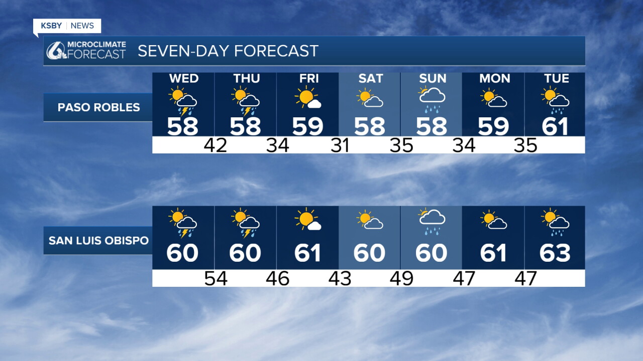
Rain Timing: Rain moves into northwestern San Luis Obispo County Wednesday, spreading southeast into Thursday. The heaviest rain hits San Luis Obispo County Wednesday evening through early Thursday morning, shifting to Santa Barbara County Thursday morning through afternoon.
Expect 1 to 3 inches for coasts and valleys, and up to 5 inches on south-facing slopes of the Santa Lucia and Santa Ynez Mountains and Los Padres National Forest. Rain rates may hit 1 inch per hour, with a 20 percent chance of thunderstorms.
Strong Winds: Widespread gusts of 30 to 45 mph are expected, reaching 40 to 60 mph in the mountains, foothills, and exposed coasts. Saturated soil plus high winds could lead to downed trees and power outages.
Marine: Small Craft Advisories are active across all waters, escalating to Gale-force winds Wednesday afternoon through Thursday night.
Extended Outlook (Friday through Monday)
Dry and slightly warmer conditions return Friday and Saturday before another cold front brings a chance of showers on Sunday.
Stay weather-aware, Central Coast!
-Jim
