

Happy Sunday, Central Coast!
We have a large storm headed to the Central Coast that will have impacts beginning Monday afternoon, lasting into Tuesday evening. Here is the latest on what we can expect.
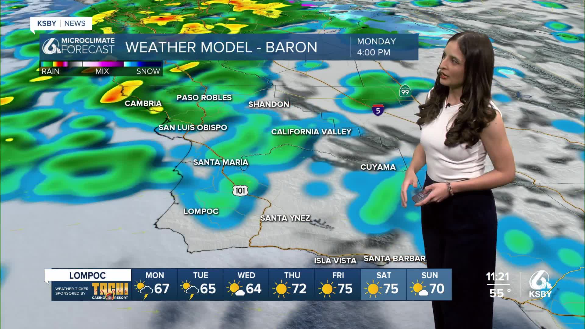
Starting Monday afternoon, a cold front will reach the Central Coast and begin the storm. This will start with clouds but turn quickly to rain. This will start in northern San Luis Obispo County in the early afternoon. At first, the rain will be patchy, but by the evening, the core cold front will arrive and will bring a band of heavy rain. That front will pass through from 7 p.m. Monday through 2 a.m. Tuesday.
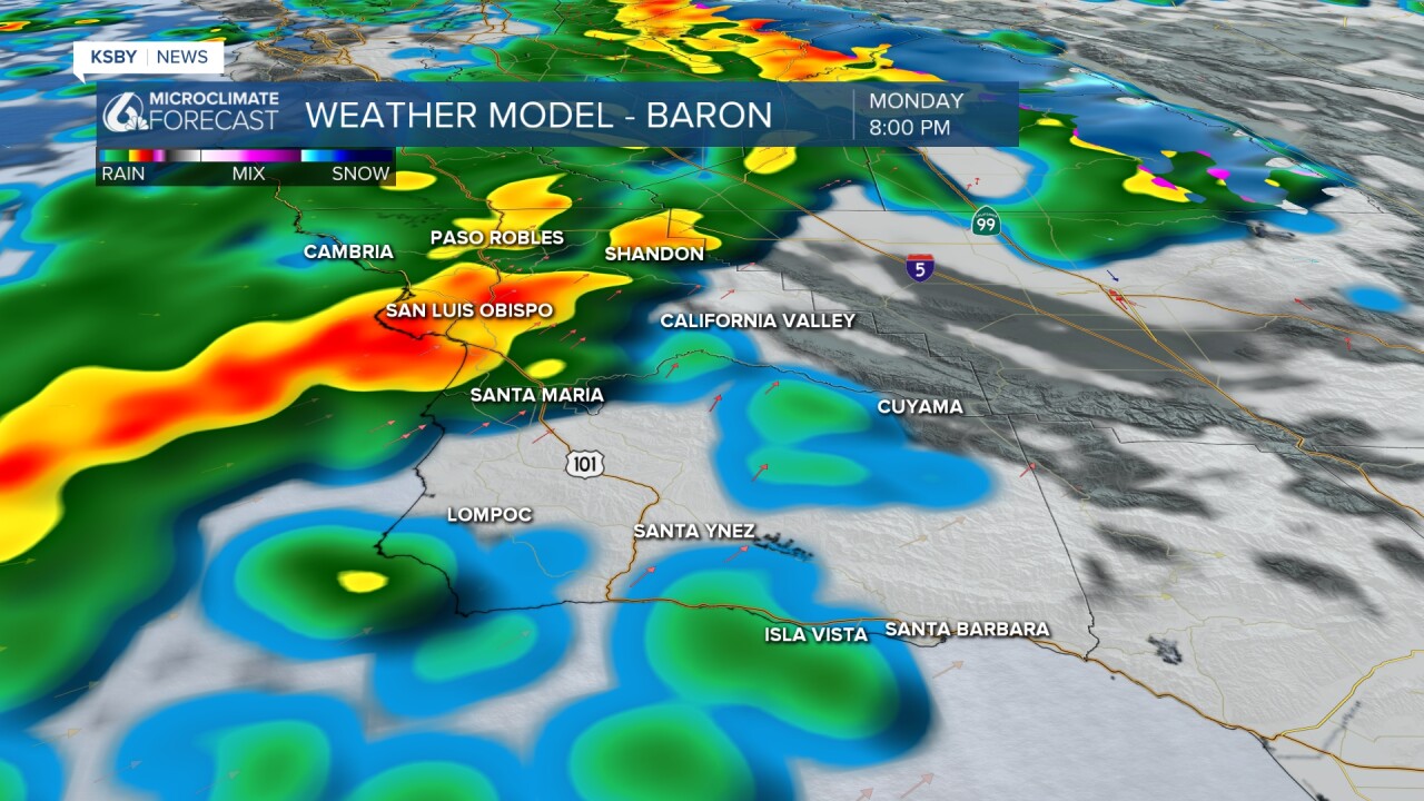
Once the core front passes through, the storm will shift a little bit and bring patchy showers through Tuesday afternoon. These, while patchy, have the chance for some convection (thunder and severe threats possible but not likely).

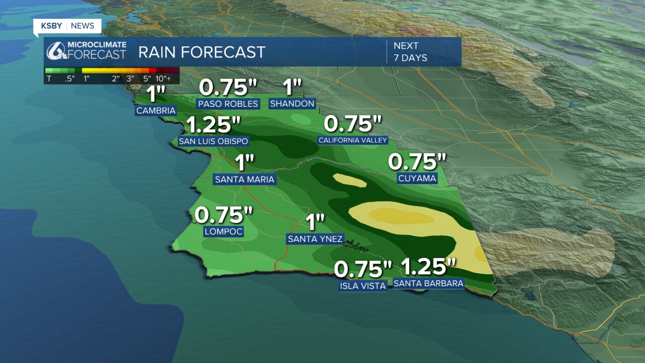
The rain will be heavy at times and add up quickly. High elevation peaks and ridges in the Santa Lucia mountains and the Los Padres National Forrest are looking at the highest rain totals but the whole region is picking up decent totals.
Along with the rain, we can expect winds up to 45 mph and some cooler temps.
Because of the heavy rain, there is concern for local flooding across the region. For the most part, this is not a problem, but it was an active fire season there is much more concern along burn scars.
A flood watch has been issued for the areas around recent burn scars in San Luis Obispo and Santa Barbara counties. This will go into effect Monday evening through Tuesday afternoon. Peak rates of 0.80" per hour are possible. That brings the risk of flash flooding and debris flows around recent scars. Properties impacted by the Gifford and Madre Fires are at the greatest risk.

Thankfully, the vast majority of impacts will be low-level, just watching the burn scars. Urban poor drainage flooding is possible, but it will clear quickly.
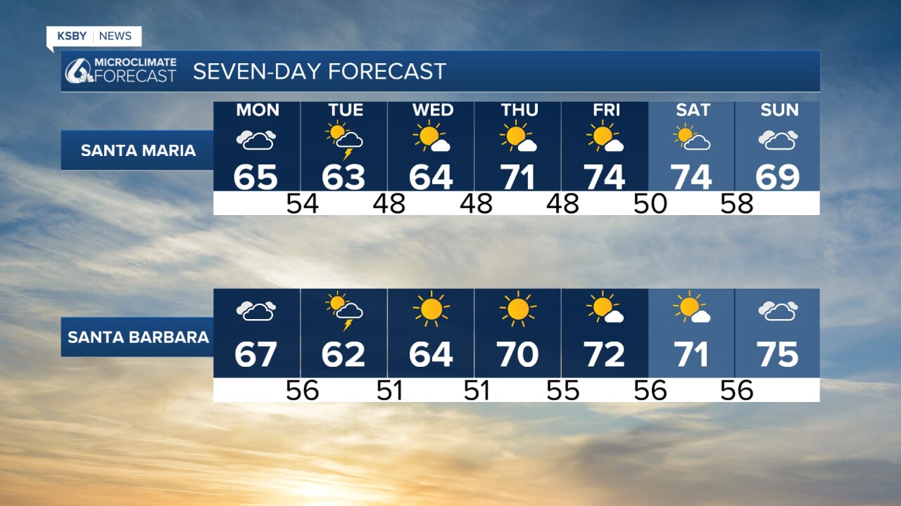
Following the storm, temperatures will be on the cooler side and will take a while to recover fully. Sunshine will return quickly. Here is a look at the 7 day forecast!

We will keep a close eye on the storm as it moves in and bring you the latest on air, online, and on social media through the storm.
-Vivian
______________________________________________________________
¡Feliz Domingo, Costa Central!
Hemos observado temperaturas moderadas este fin de semana. ¡Espero que lo hayan disfrutado!
En la primera parte de la semana laboral, nuestra región observará un cambio climático. Un frente frío está pronosticado para llegar a la Costa Central y traer tormentas.
Comenzamos el lunes con nubes, pero esto cambia a lo largo del día. Las comunidades localizadas en la región norte del condado de San Luis Obispo, serán las primeras en recibir lluvia en la tarde. Al principio, estas lluvias serán dispersas, pero se intensificarán al atardecer.

Las lluvias serán más intensas de lunes a las 7 PM hasta martes a las 2 AM. Durante estas horas, el frente frío pasará por nuestra región.
Para el martes por la tarde, ya habrá pasado lo peor de la tormenta. Sin embargo, seguiremos viendo lluvias dispersas y hay una menor posibilidad de que observemos tormentas eléctricas.

Estas lluvias serán un poco pesadas y varias ciudades en nuestra región podrán registrar más de una pulgada de lluvia. Esta imagen demuestra los totales que podríamos registrar en este período.
Además, estaremos observando ráfagas de hasta 45 mph.

Al igual, estaremos observando zonas en los condados de San Luis Obispo y Santa Bárbara, en donde previamente hubo incendios forestales. El Servicio Nacional de Meteorología emitió una vigilancia de inundaciones que empieza el lunes y concluye el martes por la tarde (áreas pintadas de color verde). Las zonas de alto riesgo incluyen la cicatriz de quemadura del incendio Gifford y la cicatriz de quemadura del incendio Madre. Cuando hay lluvias repentinas, la tierra en las cicatrices no absorbe el agua y esto puede causar inundaciones repentinas.

El pronóstico de los próximos siete días indica que estas lluvias terminarán el miércoles.

Después, regresaremos a temperaturas más cálidas en los 70s.

¡Buenas noches, Costa Central!
— Leslie Molina
