

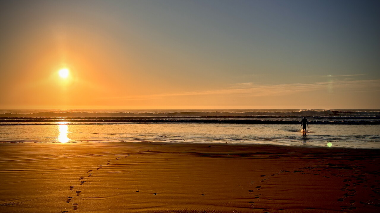


Here's the Central Coast Weather forecast from Meteorologist Jim Castillo for San Luis Obispo & Santa Barbara Counties
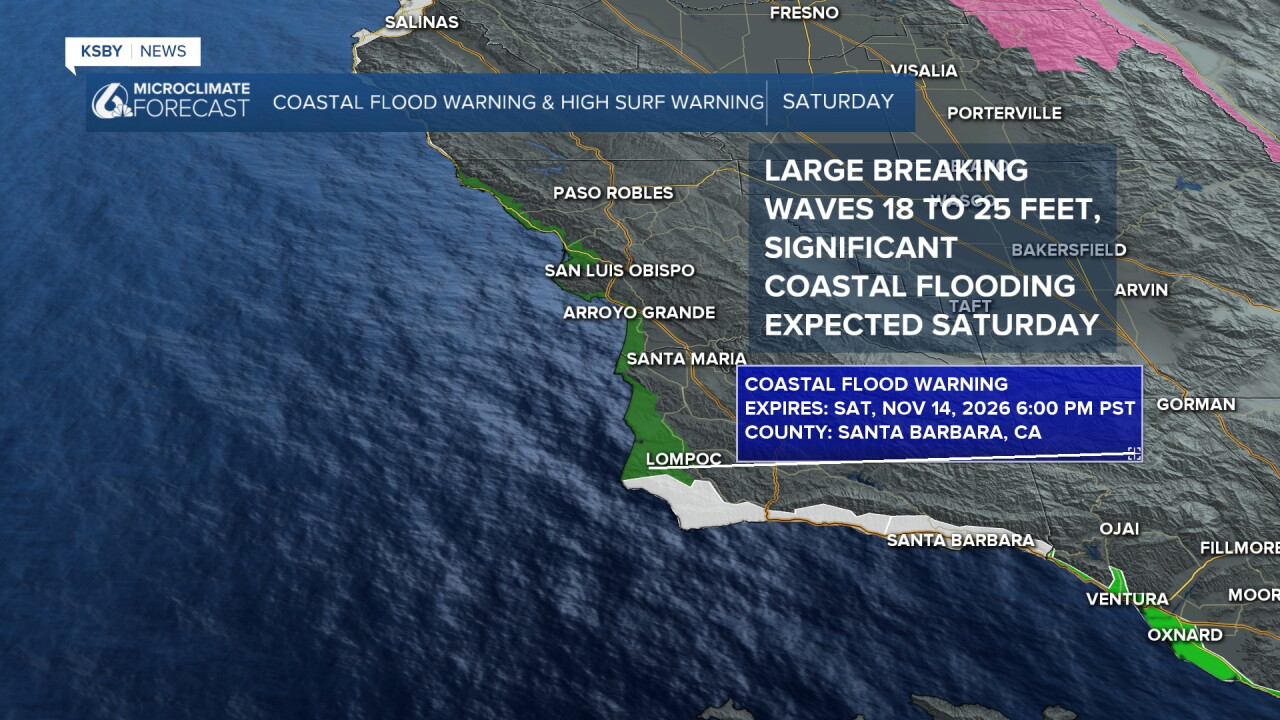
The Setup: Saturday, we have a Coastal Flood Warning with significant coastal flooding expected and a High Surf Warning for large breaking waves 18 to 25 feet!
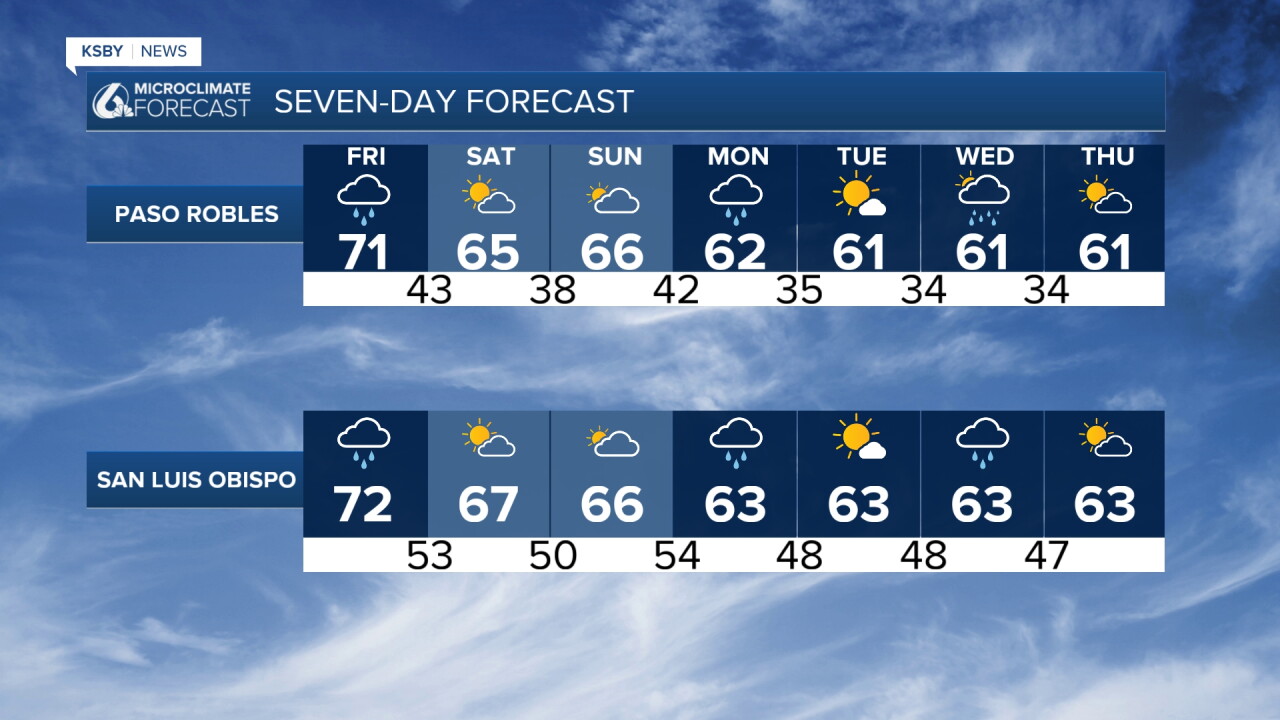
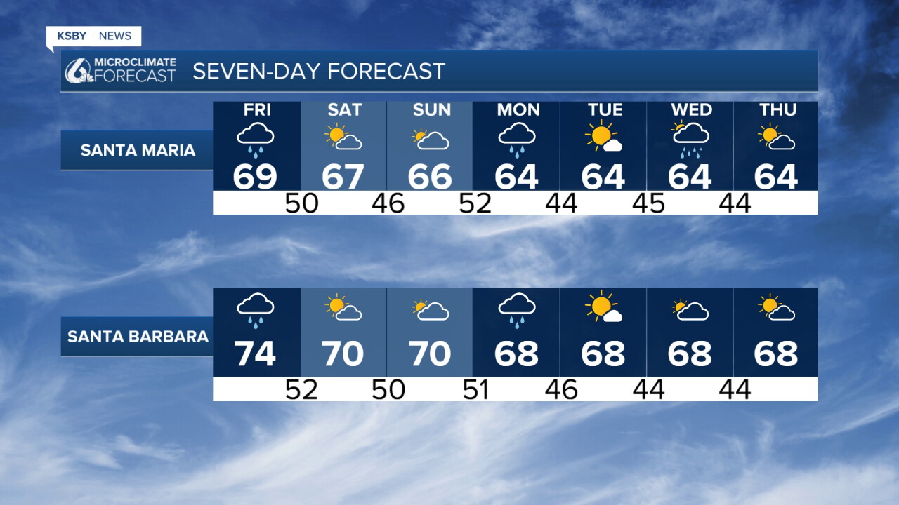
A significant cooling trend started Thursday; temperatures are dropping toward seasonal norms across San Luis Obispo and Santa Barbara counties. Rain for Friday and Monday!
First Wave of Rain: A low-pressure area & cold front pushing in from the Pacific Ocean will bring light, scattered showers early Friday, dropping generally 0.20 inches or less across most areas as the main storm energy stays south and east.
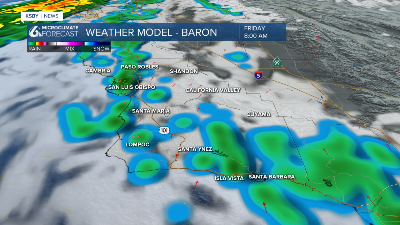
Second Wave of Rain: A cold front sweeps through later Friday into Friday night, delivering widespread rainfall totals of 0.25 to 0.75 inches, with higher amounts likely along favored mountain slopes in the Santa Lucia, Santa Ynez ranges & the Los Padres National Forest.
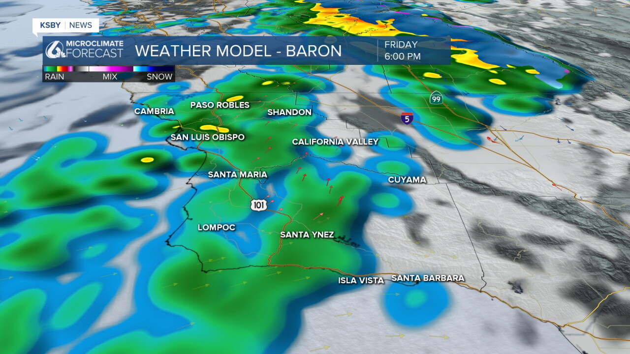
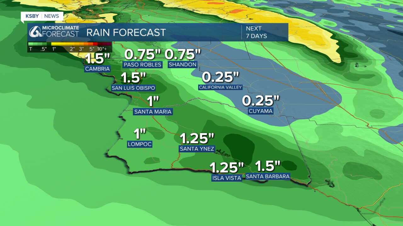
Combined rainfall between tonight and Saturday morning will range from 0.25 to 1.25 inches across the region. Rainfall rates will mostly hold under 0.25 inches per hour, with isolated brief rates up to 0.50 inches per hour Friday night.
Winds & Temperatures: Friday highs will top out in the 60s across coastal and valley zones, while mountain areas in the Los Padres National Forest cool into the 40s and 50s. Southwest-to-northwest winds turn gusty Friday and Friday night, creating low-end advisory conditions in interior valleys and passes.
Weekend Outlook: Drier conditions prevail Saturday and Sunday with afternoon highs in the 60s, though parts of the Santa Barbara South Coast could reach 70 degrees.
Next Week's Active Pattern: A parade of storms arrives Sunday night through early Tuesday (0.10 to 0.50 inches), followed by another system on Wednesday (0.25 to 1.25 inches), based on current forecasts. These amounts may change as we continue to track both systems.
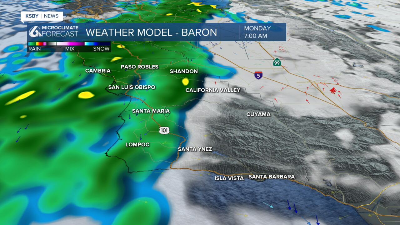
Saturday, we have a Coastal Flood Warning with significant coastal flooding expected and a High Surf Warning for large breaking waves 18 to 25 feet! Areas that may see the most significant impacts will be west- and northwest-facing beaches, with widespread flooding likely at Oceano Dunes. Breaking waves may impact the Cayucos and Pismo Beach piers as well as the Morro Bay Harbor entrance.
Below: Rain likely Friday, Monday, and later Wednesday into Thursday next week. Below are the potential 7 Day totals.
Always stay weather-aware, Central Coast!
-Jim
