


Good Wednesday evening, Central Coast!
Here's the forecast for San Luis Obispo & Santa Barbara Counties:
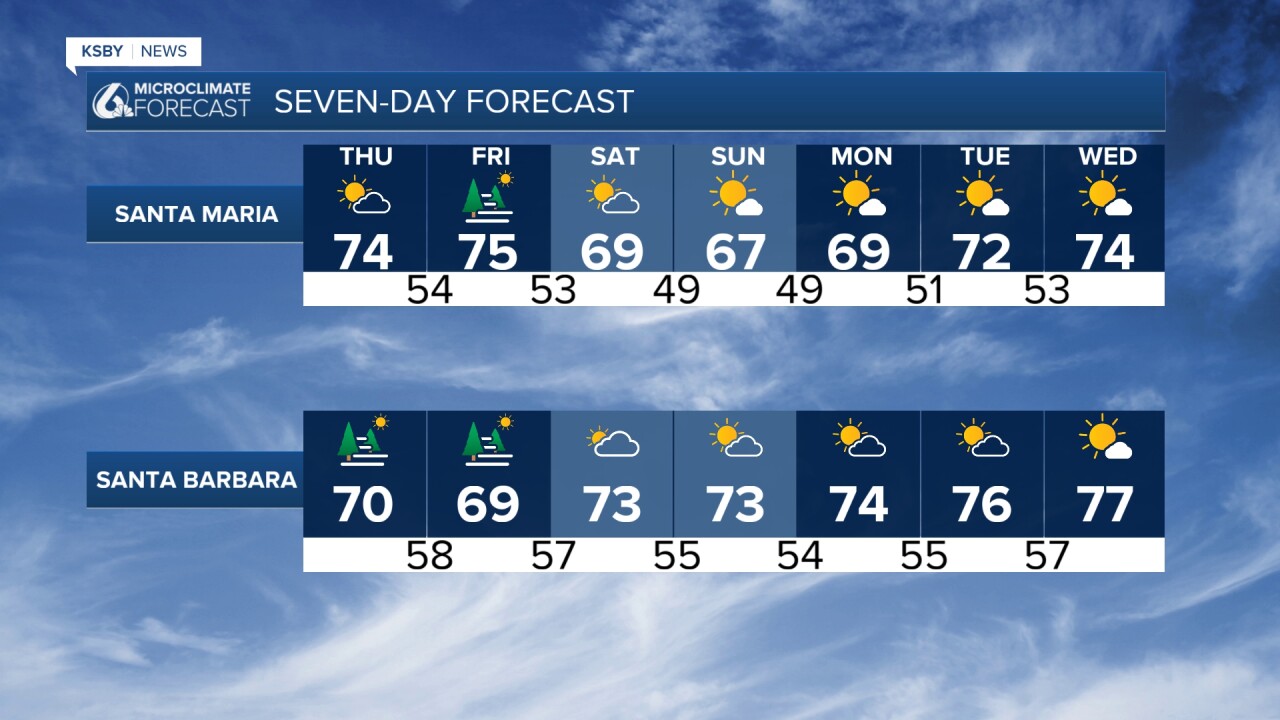
Current Conditions Through Thursday: A strong dry northerly flow has successfully cleared most stratus clouds from the Central Coast Wednesday afternoon, with this pattern expected to continue for at least the next 48 hours. This northerly wind pattern is generating gusty conditions along coastal areas and through the Gaviota Pass, where wind gradients are intensifying from the north. While high-resolution models suggest winds will remain below advisory thresholds, conditions are being closely monitored.
The wind direction shift has produced significant warming across inland valleys and foothills of the Santa Lucia Mountains, Santa Ynez Mountains, and Los Padres National Forest areas, with temperatures climbing 5 to 10 degrees above yesterday's readings. Expect similar warming on Thursday before the pattern shifts.
This Weekend: A significant pattern change as a large upper-level low-pressure system approaches the West Coast. This will initiate a cooling trend of 2 to 4 degrees per day through Sunday. The marine layer will deepen considerably, resulting in much later clearing times, with some coastal areas potentially remaining overcast through the afternoon hours.
Extended Outlook Sunday through Wednesday: Forecast confidence decreases for the extended period. Ensemble models suggest the upper-level low may persist longer into next week than initially projected. This scenario, typical for early June, could extend "June gloom" conditions across the region. Current model consensus favors this cooler pattern.
Below: The jet stream dips across the entire West Coast this weekend, deepening the Marine Layer.


Have a great night, Central Coast!
-Jim
