


Good Tuesday evening, Central Coast!
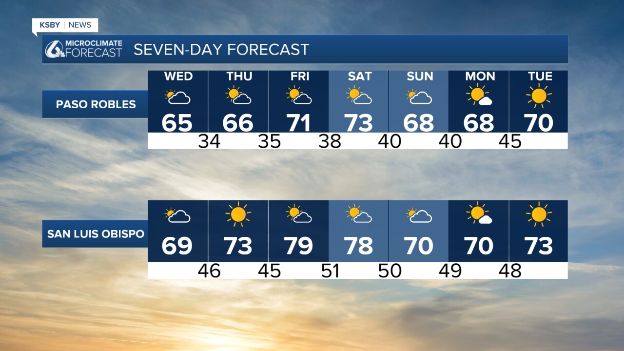
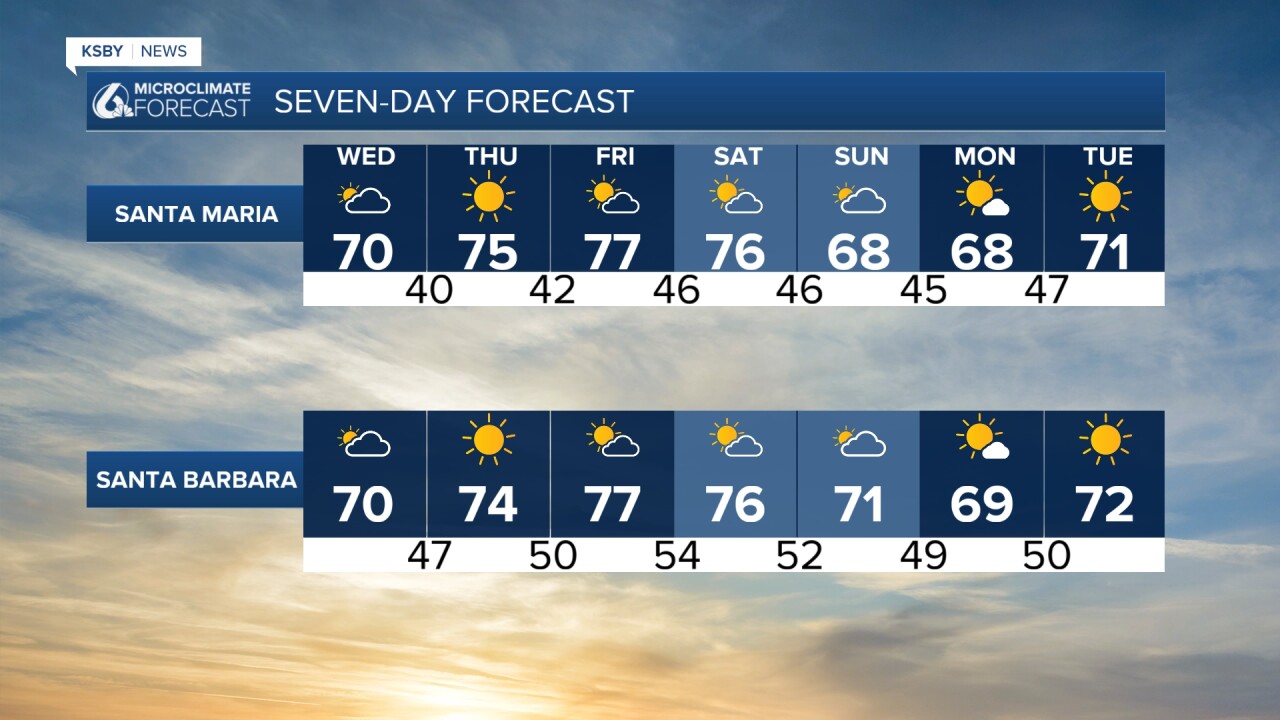
A cold front kicks up the winds tonight into Wednesday. After midnight, a north wind up to 15 mph is likely. Some of our communities in the hills may only see lows in the 50s with the wind mixing up the air. On Wednesday, a north to northeast wind of 15 to 25 miles per hour should be common. Any rain looks to pass us by to our north, then a warm-up starts Thursday and lasts through the weekend as high pressure builds back into the area.
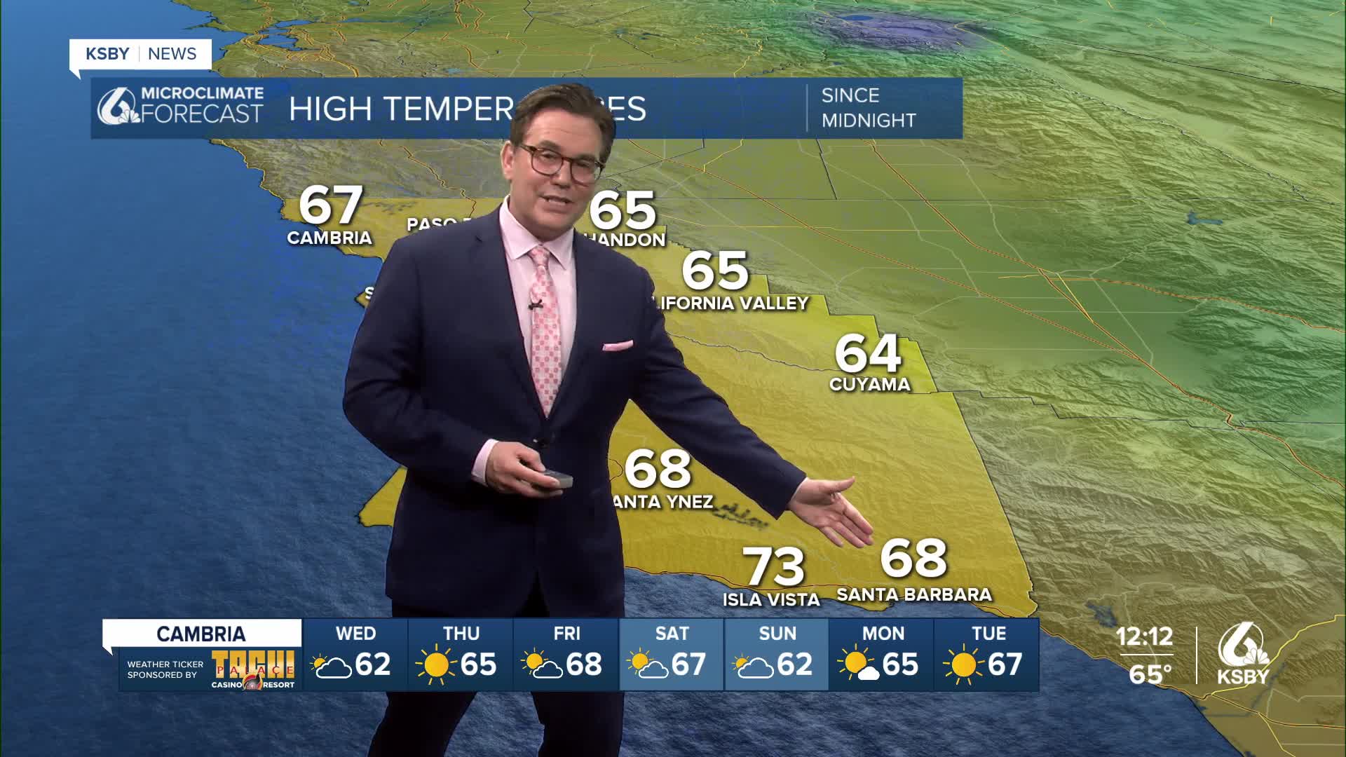
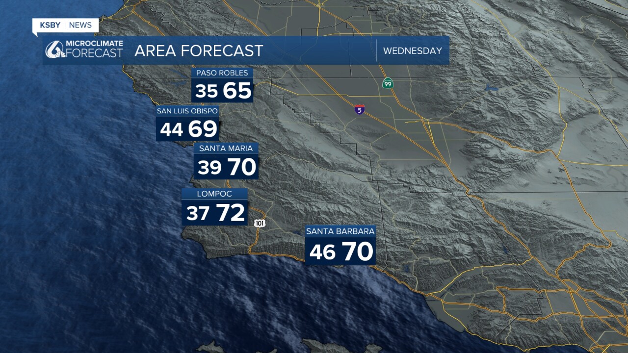
Tonight, clouds increase, and some areas start mostly cloudy on Wednesday, then by the afternoon, we begin to see the sun mixing in with the high clouds. High temperatures on Wednesday will be near normal or just above normal in the 60s and low 70s.
With the onshore breeze tonight into Wednesday morning, there may be some low clouds and fog along the Central Coast to start Wednesday. The wind turns offshore later in the day on Wednesday with some nice clearing.


Rest well, Central Coast!
-Jim
