


Good windy evening, Central Coast!
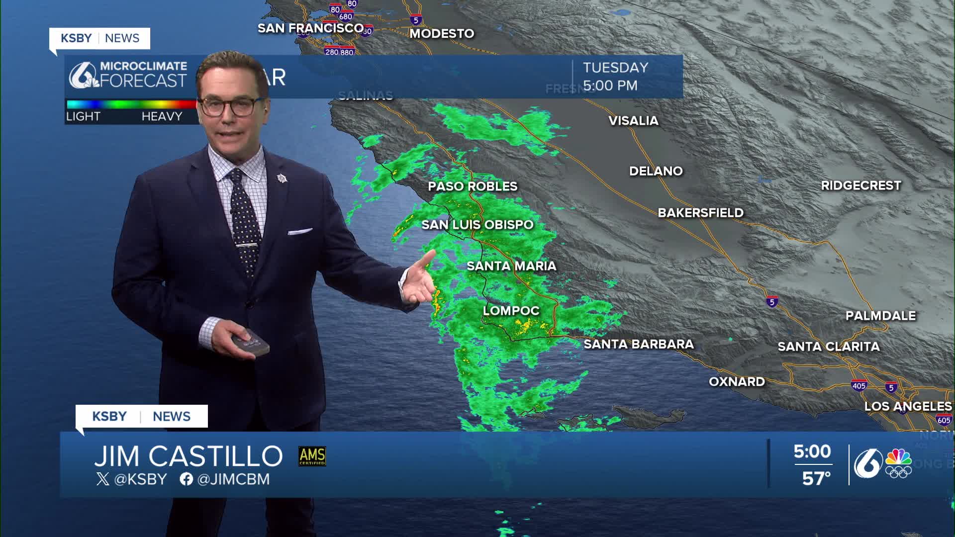
Rain continues to move onto the Central Coast!
Light to moderate rain continues to overspread the entire area tonight into early Wednesday. Strong southerly winds 20-30 mph with gusts 45+ will be common. The highest wind gust, so far, has been at 600 feet in Santa Ynez at 51 mph. Santa Maria had a gust to 45 mph at the airport.
There’s a Gale Warning in effect for the Central Coast waters, along with a High Surf Advisory and a Wind Advisory, so expect rough conditions if you’re heading out tonight into early Wednesday. Some areas could see .50" to over 1.00" of rainfall with this system tonight into early Wednesday. The heaviest rain will fall along the south-facing slopes, with a strong southerly wind.
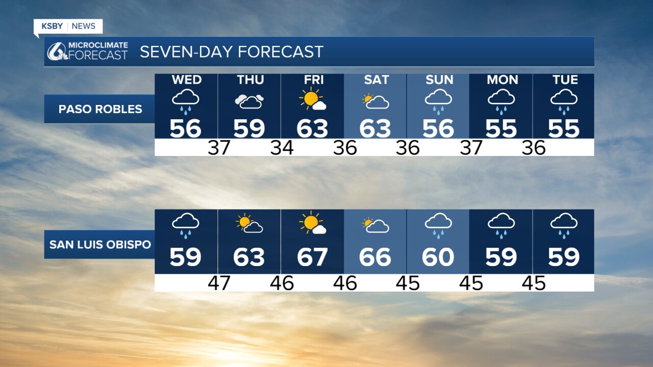
Light to moderate rain moves in tonight and sticks around through Wednesday morning. It will continue breezy, with gusty southerly winds making things feel a little raw. Rain eases up later Wednesday, but a few lingering showers could linger along the Central Coast into early Thursday.
After that, we finally get a break. Thursday through Saturday look dry and warmer, so it’ll be a nice stretch before the next system rolls in. Rain and wind return Sunday through next Wednesday. The KSBY weather team will continue to have updates on the active weather in our forecast.
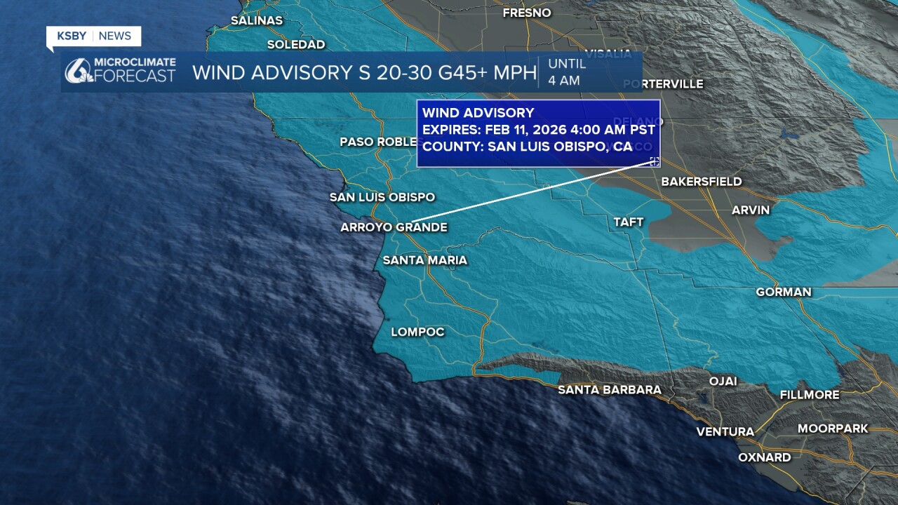
Below is a more serious High Wind Warning for the interior valleys and the mountains until 4 am with a southerly wind 20 to 30 mph, some gusts to 60 mph are possible. PG & E is reporting a power outage in part of the Cuyama Valley south of highway 166.

Below is a snapshot of the 6 am future clouds and rain. Scattered showers are still likely through the morning. Rain should tapper-off after the morning commute.

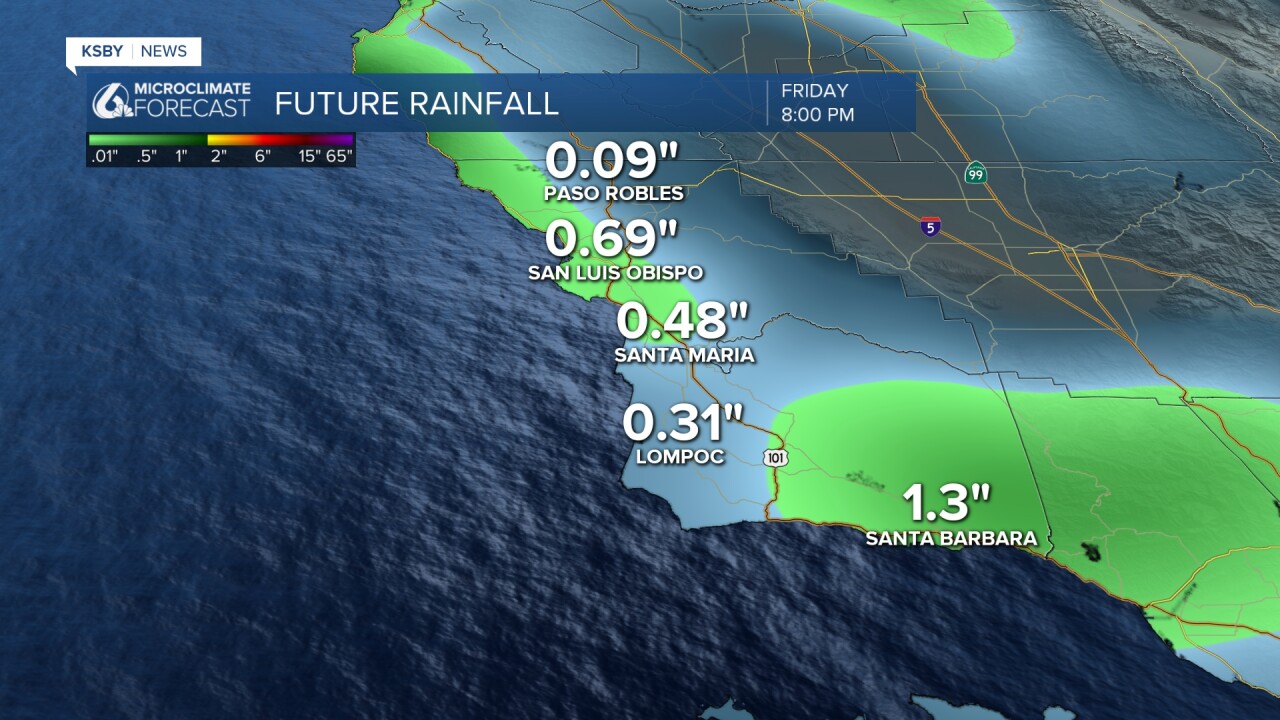
Below are the potential rainfall amounts, anywhere from .25" to over 1.00" of rain tonight into early Wednesday.
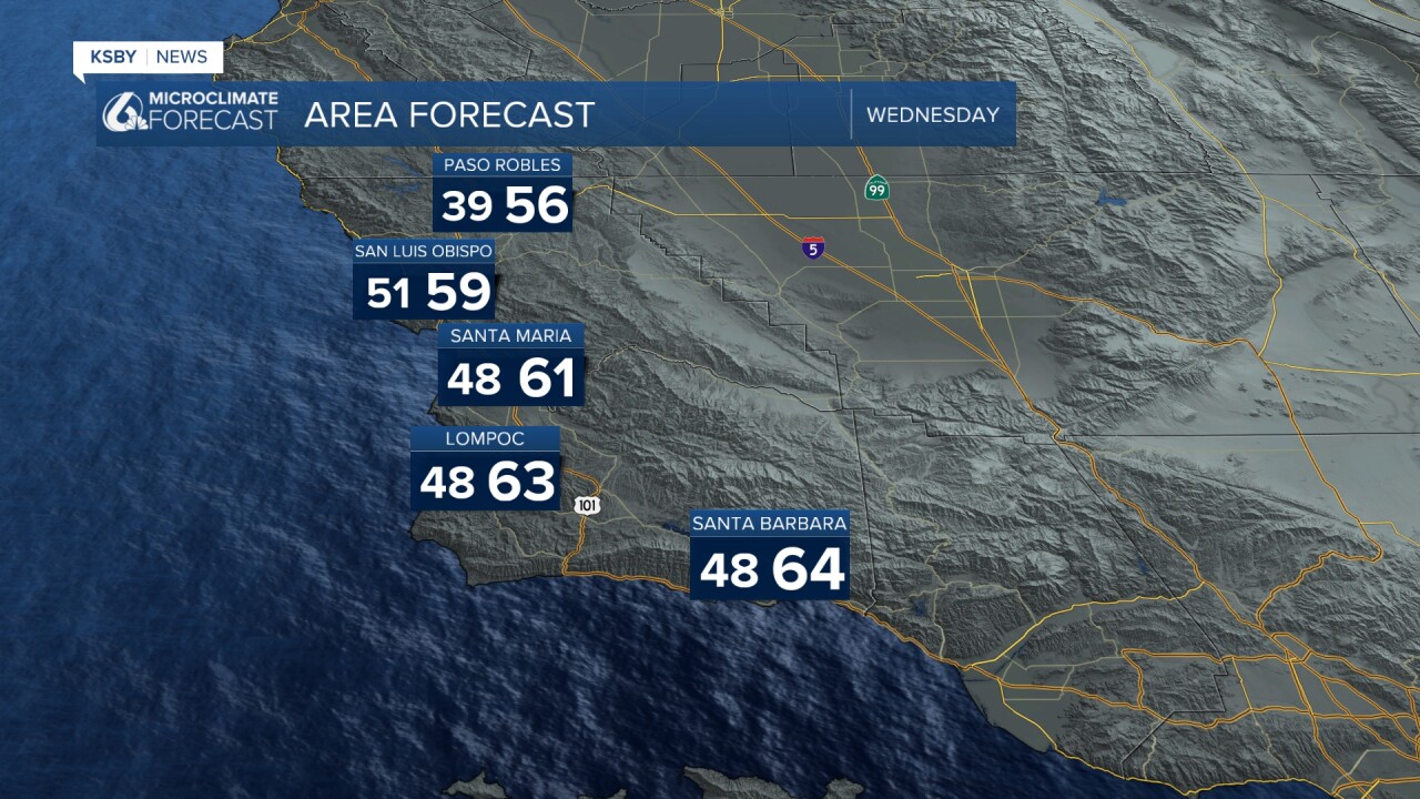
Below are the below-average high temperatures that are expected on Wednesday. Jacket weather!
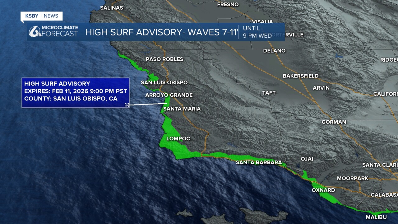
Below is the High Surf Advisory for the Central Coast with large breaking waves of 7 to 11 feet expected through Wednesday.
Below is the Gale Warning until 3 am.

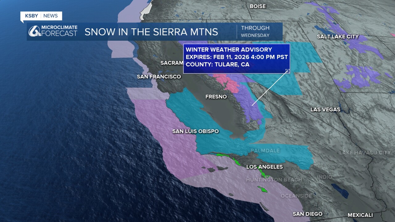
The Sierra Mountains are seeing some much-needed snow!

Another Pacific system moves in on Sunday and could last into midweek nextweek. The KSBY weather team will continue to keep you posted!
-Jim
