



Happy Friday, Central Coast!
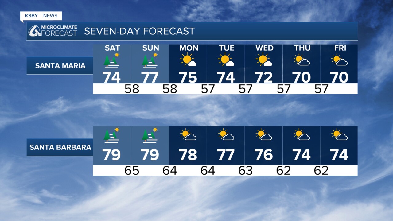
Here is your weekend weather outlook for San Luis Obispo and Santa Barbara Counties from Meteorologist Jim Castillo
A persistent high-pressure ridge centered over the Four Corners region continues to dominate our weather pattern, bringing another hot weekend to much of the Central Coast. This ridge will strengthen through Sunday before finally weakening Monday.
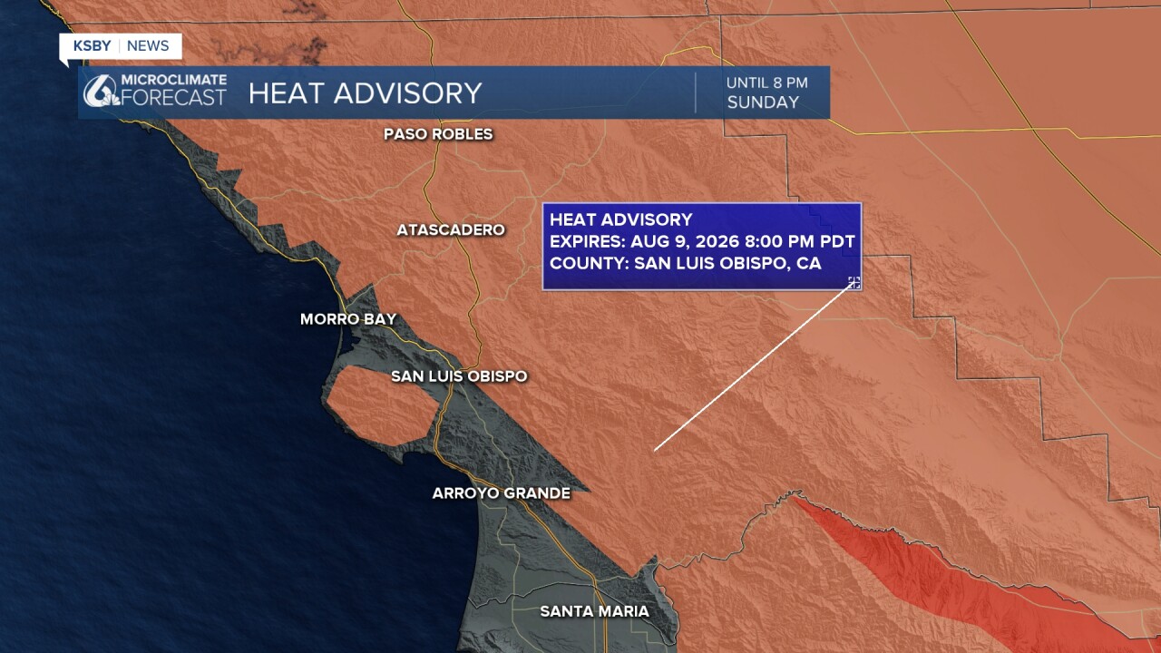
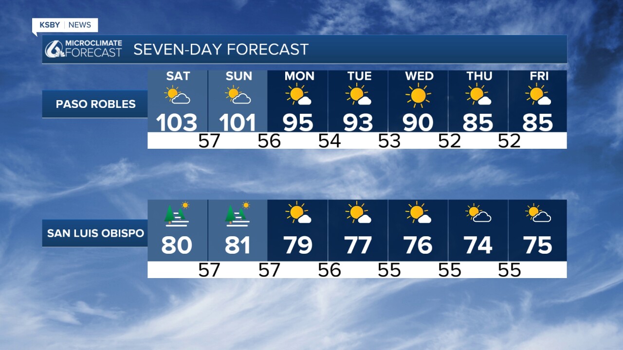
Interior Areas (Including Santa Lucia Mountains foothills and Los Padres National Forest): 95 to 108 degrees - Heat Advisories and Extreme Heat Warnings remain in effect
Coastal Valleys: 80s - Heat Advisories have been expanded to include some of these areas as onshore flow weakens
Beaches: 60s and 70s - Near to above-normal temperatures expected, and NO heat advisory.
Peak heat is forecast for Saturday.


Marine Layer and Fog
Night through morning low clouds and patchy dense fog will be common over coastal areas and coastal valleys through the weekend. The marine layer may become increasingly shallow, potentially creating locally dense fog conditions. Monsoonal moisture aloft could disrupt typical marine layer formation patterns.
Fire Weather Concerns
Dry conditions will prevail across both counties. The combination of hot temperatures, gusty interior winds, and dry conditions will create elevated to brief critical fire weather conditions.
Thunderstorm Risk: 10 to 15 percent chance of afternoon and evening convective activity, mainly across the Santa Barbara County Mountains and Santa Ynez Mountains. Any thunderstorms that develop could produce dry lightning, increasing fire start potential.
Monsoonal Influence
Subtropical moisture will continue moving across the region at upper levels through the weekend. This increased moisture will raise humidity levels near the surface, particularly along the coast, and may keep overnight temperatures warmer than normal. Warmer sea surface temperatures off Santa Barbara County will enhance heat impacts during daytime hours.
Wind Pattern
The strongest onshore winds are expected Sunday based on projected surface pressure gradients.
Looking Ahead
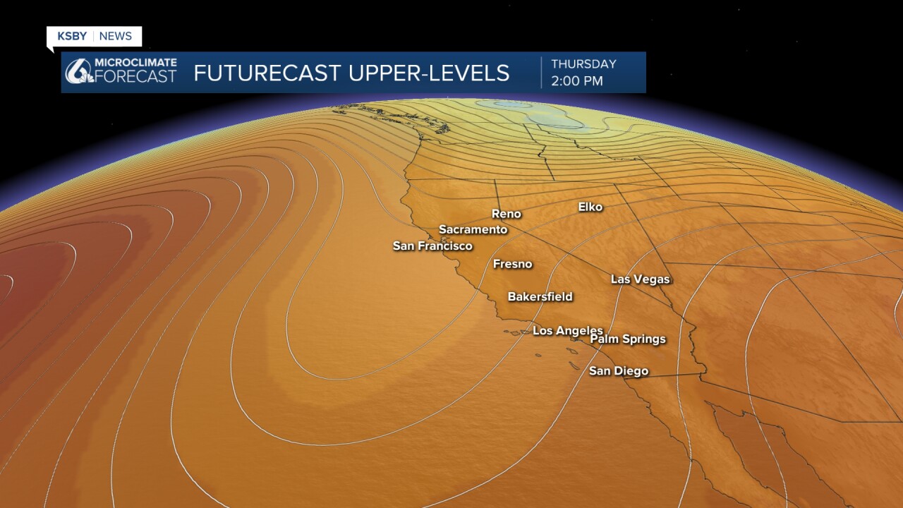
The high-pressure ridge will finally begin weakening Monday as upper-level troughs move into the Pacific Northwest and Northern California, bringing a cooling trend all next week.
Below: A trough of low pressure finally develops along the West Coast cooling all of us off.


Have a great weekend, Central Coast!
-Jim
