



Here is your Central Coast Weather Forecast from Meteorologist Jim Castillo: Heat Wave continues through Thursday
The high temperature on Saturday in San Luis Obispo was 99 the highest of 2026 so far and it was 97 in Santa Barbara on Sunday!
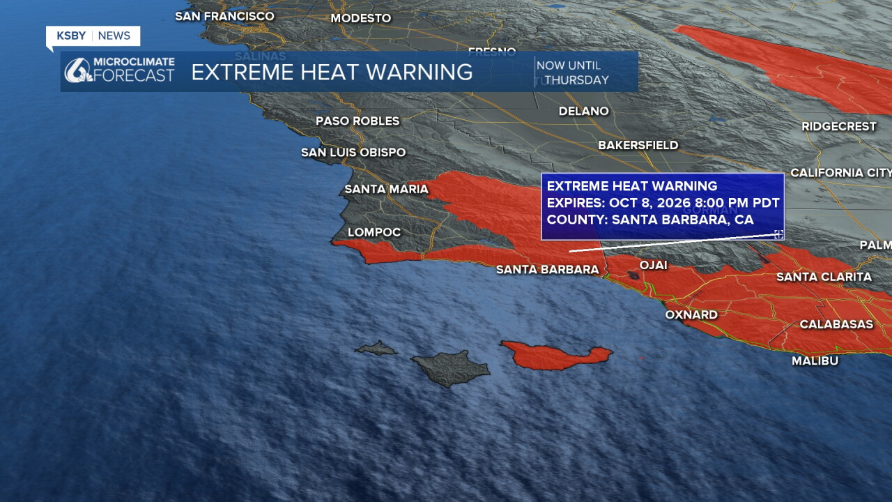
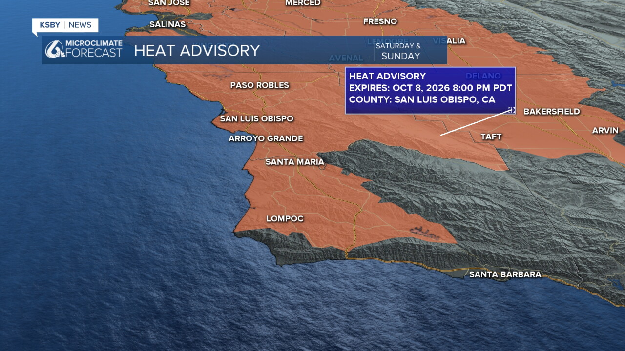
A dangerous, long-lasting heat wave persists across San Luis Obispo County and Santa Barbara County, including the Santa Lucia Mountains, Santa Ynez Mountains, and the Los Padres National Forest. Find Air conditioning and stay hydrated!
Offshore flow, remaining active in the mornings and pushing into afternoons, will maintain record or near-record high temperatures through Thursday.
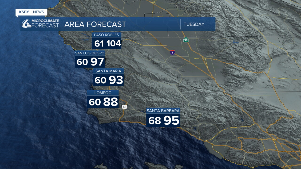
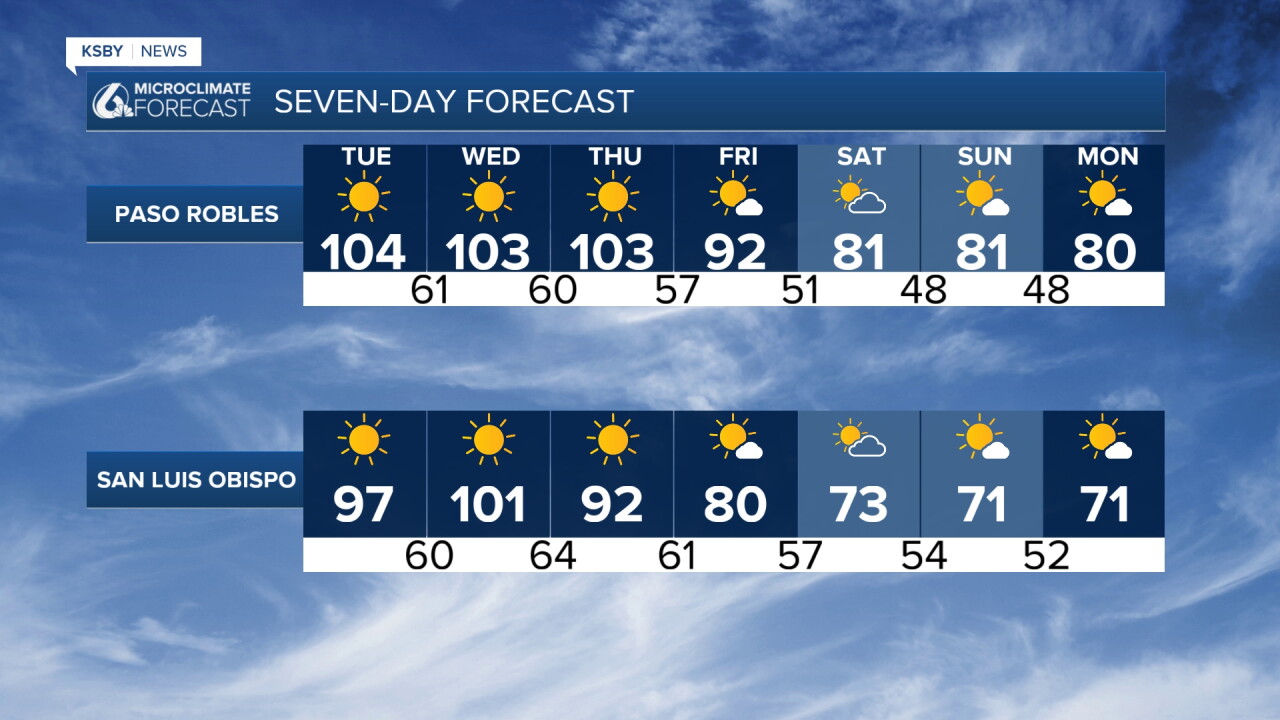
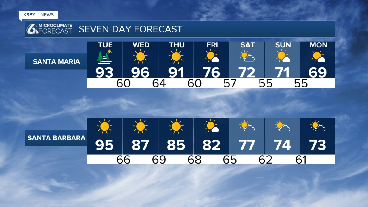
Coastal and interior valleys across the region will experience extreme highs ranging from 90 to 103 degrees, running well above normal.
Even coastal beaches will offer little relief, with afternoon highs climbing into the 80s.
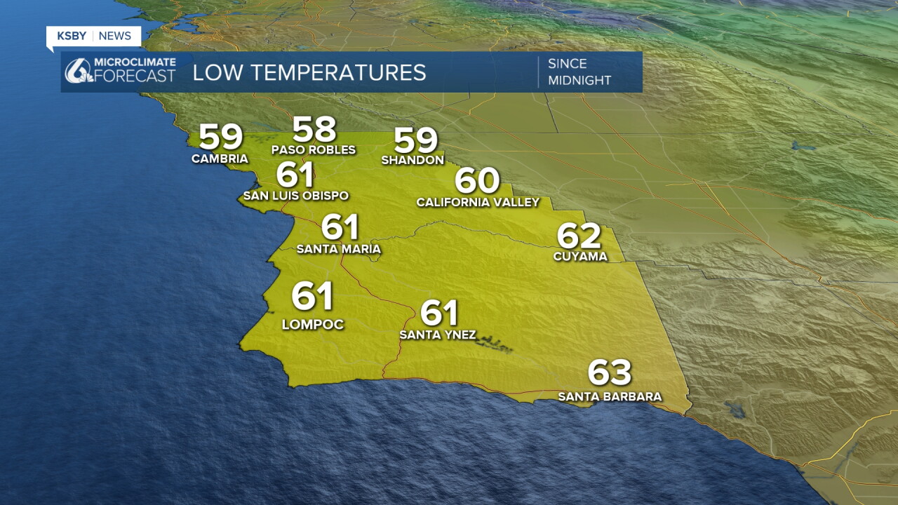
Overnight lows will stay exceptionally warm, dropping only into the 60s and 70s, while mountain ridges and foothill locations right at the top of the inversion layer will stay elevated in the 80s.
Heat advisories and extreme heat warnings remain in effect through Thursday evening for all coastal zones, valleys, mountains, and inland sectors of San Luis Obispo and Santa Barbara counties.
Transition and Cooling Trend (Friday and Saturday)
The upper-level high pressure system breaks down on Friday, replaced by weak cyclonic flow, lowering upper heights, establishing onshore flow to the east, and leaving only weak offshore flow from the north.
High temperatures on Friday will trend downward into the 80s and 90s across interior valleys; while still above normal, it will mark a transition out of dangerously hot levels.
A robust upper trough moves into California on Saturday, significantly increasing onshore flow and sparking the return of marine layer stratus clouds along the coast.
Maximum temperatures will drop across the board on Saturday, though readings will still finish several degrees above normal.
Weekend Tropical Moisture and Late-Week Swell
Moisture from distant Hurricane Rachel approaches Southern California by Sunday, staying mostly southeast of the Central Coast.
Sunday brings a very small, slight chance of showers primarily targeting areas to the south into LA County, alongside continued troughing that introduces a robust marine layer cloud pattern.
Additional cooling all weekend will push maximum temperatures back down to normal or slightly below normal levels across San Luis Obispo and Santa Barbara counties.
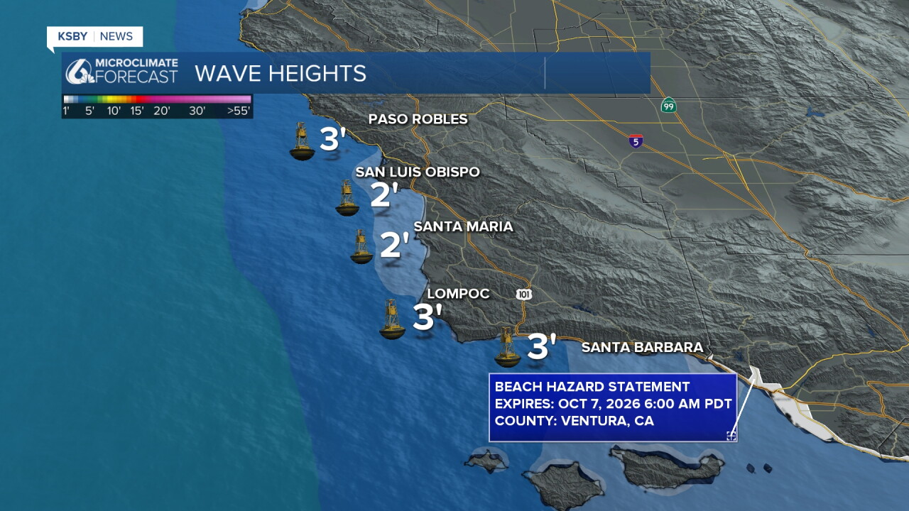
Ocean impacts from the system will arrive soon after, with swells generated by Hurricane Rachel could reach local waters by next week.
Keep cool and stay hydrated, Central Coast!
-Jim
