



Good Tuesday evening, Central Coast!
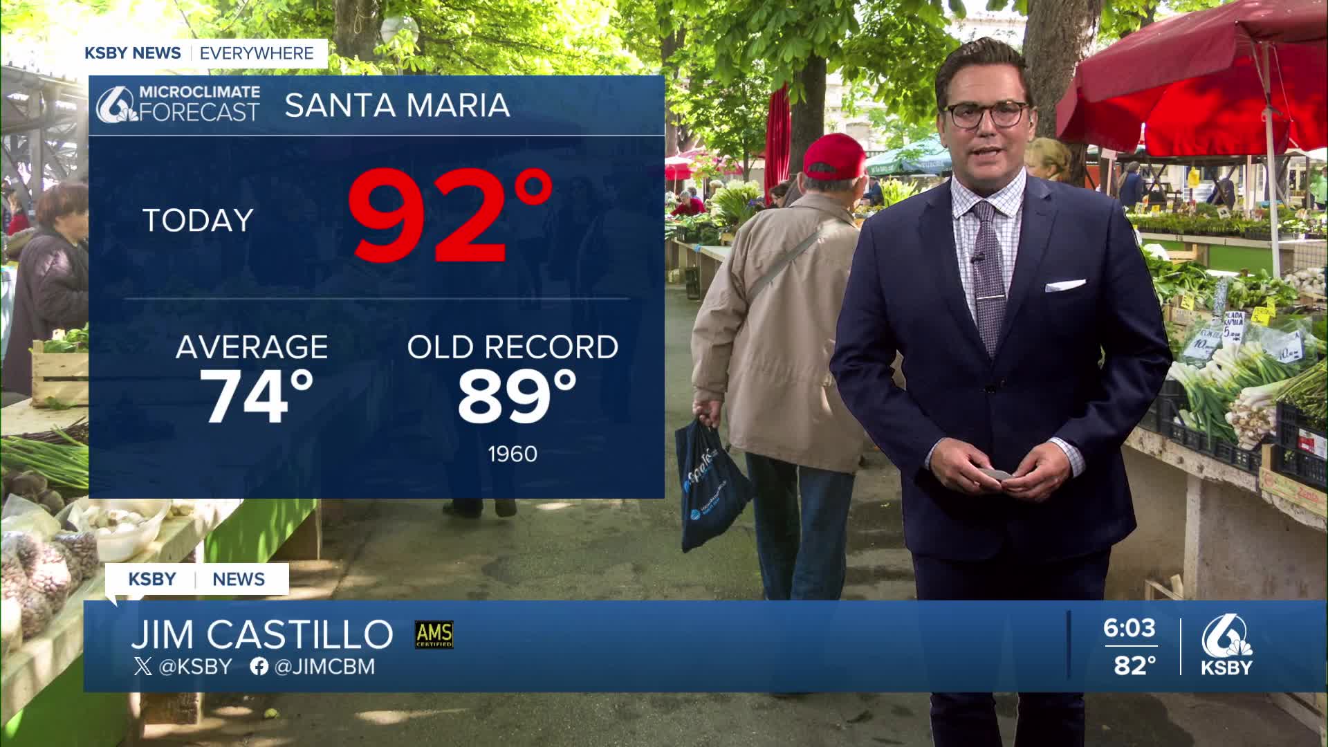
Current Situation: • Very warm conditions developed today across the Central Coast due to a decaying tropical system west of the region • The tropical system crushed the marine layer and disrupted the normal cooling onshore flow • Marine layer and onshore flow expected to return to normal patterns tomorrow
A massive high-pressure area is currently centered over Nebraska, affecting most of the western and southern United States • High-pressure core will move south tomorrow, then shift west Thursday through Saturday • System will eventually settle over New Mexico and Arizona • Mid-level flow changing from southerly today to northerly by Thursday
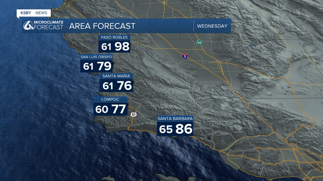
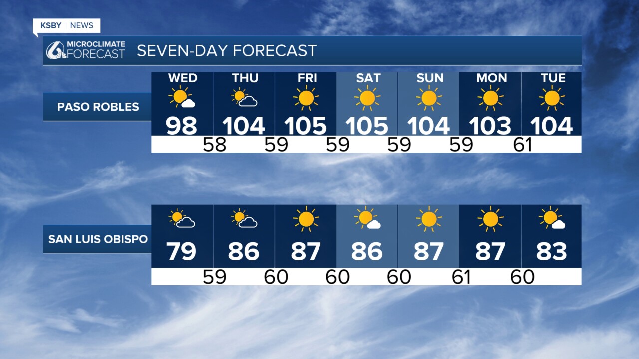
Temperature Forecast: • Significant warming begins weakly tomorrow but intensifies Thursday • Inland valleys and lower mountains: 97 to 107 degrees by Friday • Inland coastal areas: 85 to 95 degrees • Beach areas will vary depending on marine layer response • Warmer than normal ocean temperatures will create muggy, unpleasant conditions
Heat Advisories have expanded to include most of the area, and all are in effect Wednesday through Monday • High temperatures 10 degrees above normal • Overnight lows 5 to 10 degrees above normal in valleys • Mountain and foothill overnight lows 10 to 15 degrees above normal • Reduced overnight cooling will limit relief for homes and bodies

Wind Conditions: • Gusty north winds expected Wednesday through Friday • Southern Santa Barbara County most affected Wednesday through Thursday or Friday night • Northwesterly to north gusts of 30 to 50 mph expected • Wind Advisory issued for southwest Santa Barbara County where strongest winds anticipated
Heat Risk Factors: • Thursday through Sunday will be the hottest period of the next seven days • Extended duration of above-normal temperatures increases heat illness risk • Highest risk groups: young children, elderly, those without air conditioning, outdoor workers • Five-day heat event with limited overnight relief

Have a great night, Central Coast!
-Jim
