



Good Wednesday evening from Meteorologist Jim Castillo
Here's your weather forecast for the Central Coast of California, covering San Luis Obispo and Santa Barbara Counties
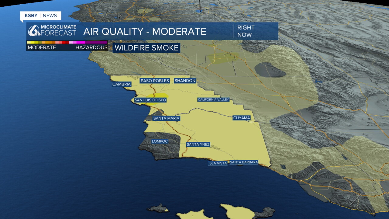
Below: Our air quality has been moderate, with smoke from the Timber Fire around Big Sur riding the northwest winds down the Central Coast. Many have smelled the campfire-like smell in the air. The Timber fire is only 27% contained, so the haze in the sky and at times the campfire-like smell in the air will continue with our moderate air quality.
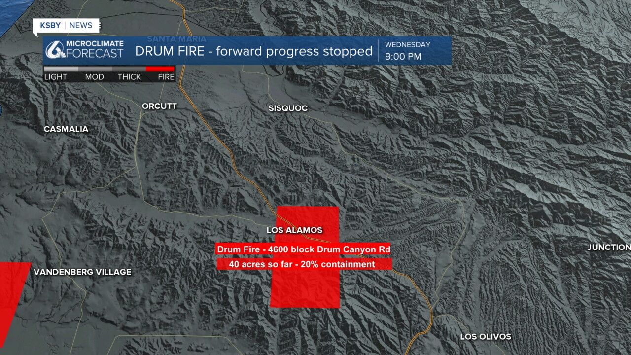
In our area, the Drum Fire south of Los Alamos has burned 40 acres and is now 20% contained. Forward progress has been stopped. The city of Los Alamos has not been affected.
Night through morning marine layer clouds will remain confined to coastal areas, primarily north of Point Conception, throughout much of this week. The marine layer will continue to impact the Central Coast each night and morning, providing natural cooling for immediate coastal zones. This pattern will limit the areal coverage of marine layer stratus and fog through the forecast period, with the best coverage remaining across the Central Coast.
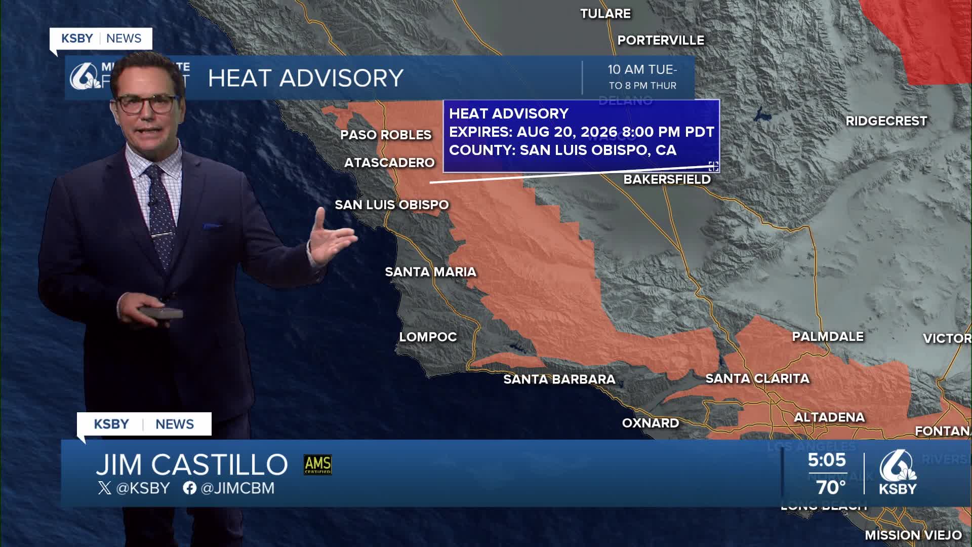
HEAT ADVISORY CONDITIONS ONLY FOR THE INTERIOR VALLEYS AND LOWER MOUNTAINS
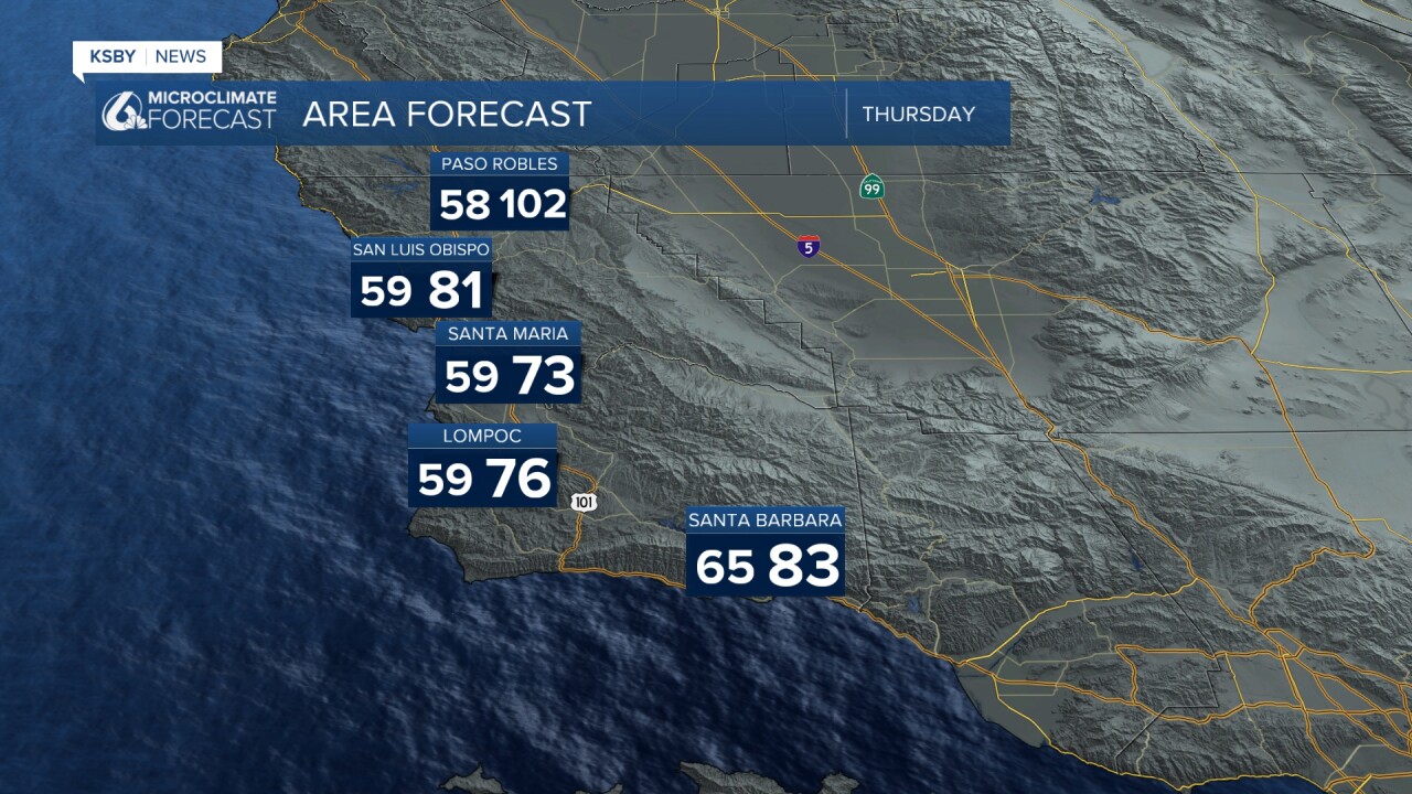
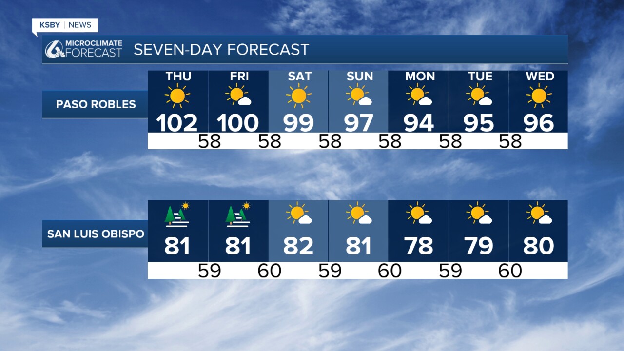
Moderate heat risk is expected in the warmest inland locations through Thursday. Heat Advisories remain in effect for the lower mountains and interior valleys of San Luis Obispo and Santa Barbara Counties. Away from the immediate coast, afternoon high temperatures will reach the mid-90s to low 100s through Thursday. Most areas have been cooling down into the upper 50s to low 60s at night.
Friday will bring slightly cooler temperatures, but a slight increase in relative humidity. Saturday temperatures may warm slightly in some areas while humidity decreases. Heat advisories may need extension into Friday or Saturday for the interior valleys. Residents should exercise extreme caution with outdoor activities in hot inland areas.
ATMOSPHERIC PATTERN
Upper-level high pressure continues centered over the Four Corners region through Friday, then shifts southeastward Saturday. At the surface, moderate onshore flow will persist with weak northerly offshore flow. High atmospheric heights and thicknesses, combined with limited marine influence, will maintain warm conditions away from the coast.
SANTA LUCIA AND SANTA YNEZ MOUNTAINS
The Santa Lucia Mountains and Santa Ynez Mountains will experience temperatures noticeably above seasonal normals. Locally gusty northerly winds are expected across the western Santa Ynez range over the next couple of evenings. A gradual increase in northerly winds will occur through the forecast period in usual locations within the Santa Ynez Range as northerly offshore gradients strengthen.
EXTENDED OUTLOOK
The upper-level high over the desert Southwest will meander around the Four Corners area through the extended period. Surface pressure gradients bear watching - if weak offshore gradients develop by Tuesday/Wednesday, conditions could become warmer than currently forecast. The pattern will continue limiting marine layer coverage while maintaining potential for periodic monsoonal moisture incursions.
Wind conditions will remain generally light, with northeasterly winds possible but not reaching advisory levels. The overall pattern favors continued warm and dry conditions inland with persistent marine influence along the immediate coast.

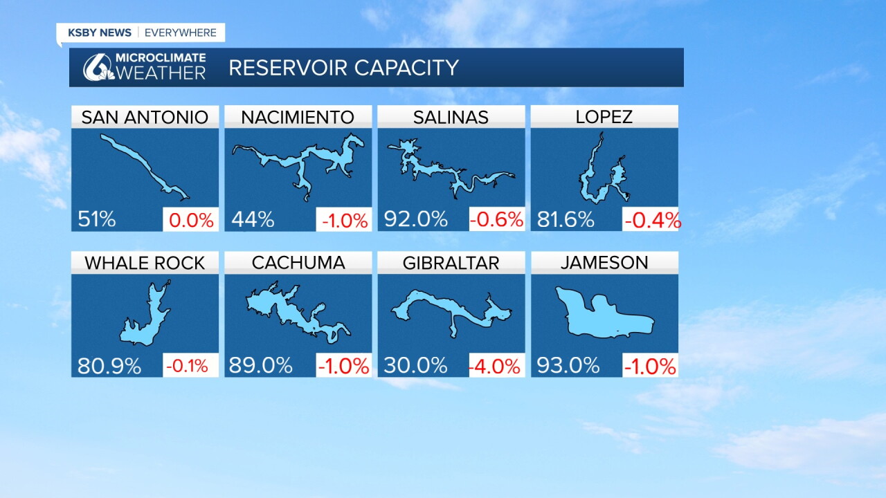
Below: Current reservoir levels and the change from a week ago.

Have a great night, Central Coast!
-Jim
