




Good Wednesday evening, Central Coast!
Here is your forecast for San Luis Obispo and Santa Barbara Counties:
TONIGHT: Clear skies continue across the Central Coast with overnight lows dropping to the upper 50s to mid-60s along the coast and low to mid-60s in the inland valleys. Marine layer development will be limited tonight, staying compressed to around 800 feet. Expect another round of Sundowner winds developing across southwestern Santa Barbara County this evening with gusts potentially reaching 45 mph with a few higher gusts possible, prompting a Wind Advisory for the southwestern sections of Santa Barbara County through San Marcos Pass.
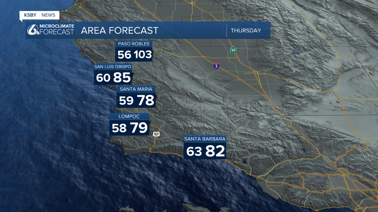
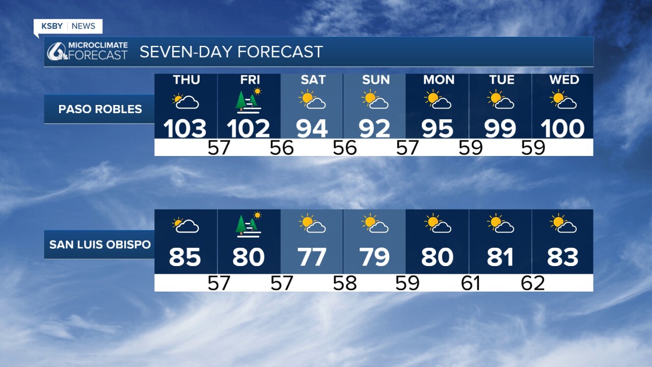
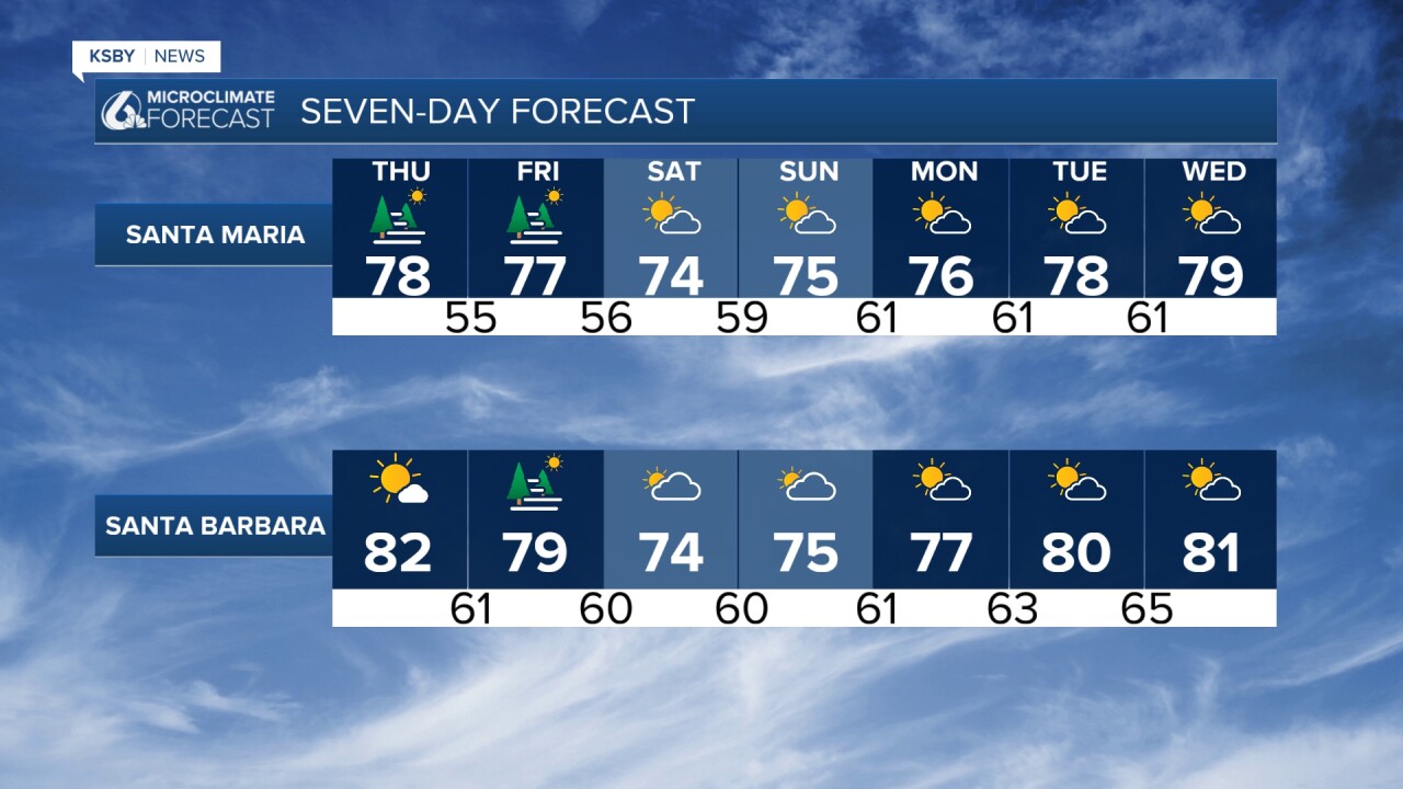
TOMORROW THROUGH FRIDAY: The heat continues to build across our inland areas as a strong upper-level high-pressure system maintains its grip over Southern California and it expands into the Central Coast. While coastal areas will see temperatures near normal thanks to the sea breeze - ranging from the mid-70s to low 80s - our interior valleys and mountain areas will experience significant warming.
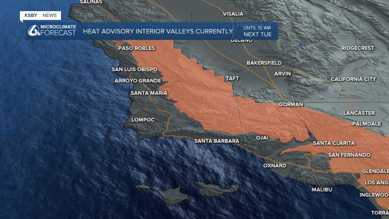
Below: The Heat Advisory for our interior valleys continues through next Tuesday morning, then an Extreme Heat Watch starts.
Saturday will bring 3 to 6 degrees of cooling, with coastal temperatures dropping to the mid-70s to low 80s and valley temperatures settling into the mid-80s to mid-90s - much closer to seasonal normals.
Expect valley temperatures to climb into the 92 to 103 degree range, running well above normal. The Santa Lucia Mountains, Santa Ynez Mountains, and portions of Los Padres National Forest within our counties will see similar elevated temperatures. Heat Advisories remain in effect for these inland areas.
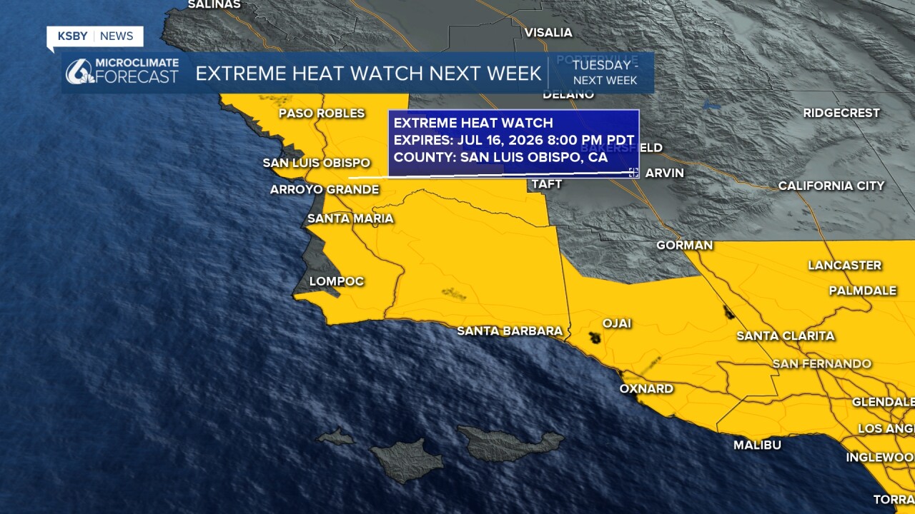
EXTREME HEAT WATCH - TUESDAY THROUGH THURSDAY for most of the area: Looking ahead to next week, an Extreme Heat Watch has been issued for Tuesday through Thursday as temperatures could reach dangerous levels in our interior valleys and mountain regions. Moderate heat impacts will persist next Tuesday through Thursday even closer to the beaches.
Expect a pattern change that will open the door for possible monsoon moisture over the weekend into next week, bringing partly to mostly cloudy skies and even a chance for isolated showers or thunderstorms, particularly over our eastern mountain areas including the Los Padres National Forest. It will likely stay dry in most areas and feel more humid. The combination of the heat and the humidity will make it feel uncomfortable.
When it gets hot, stay hydrated, limit outdoor activities during peak heating hours, and check on elderly neighbors and pets during this extended heat event.
Below: Next week! The National Weather Service in Oxnard has issued an Extreme Heat Watch for most of our area starting next Tuesday and continuing through Thursday.
Have a great night, Central Coast!
-Jim
