



Good Tuesday evening, Central Coast!
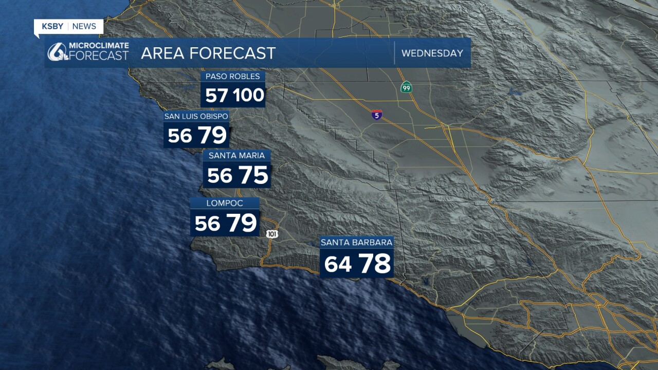
Here is your San Luis Obispo County and Santa Barbara County forecast.
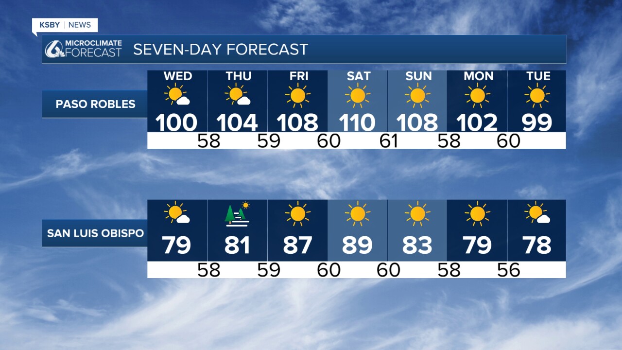
Now through Thursday: Temperatures running slightly above normal with no heat advisories or heat warnings.
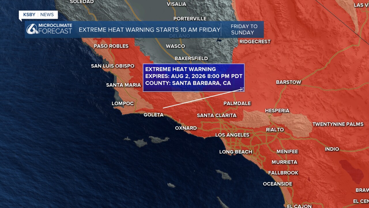
Heat builds into our area by Friday across the Central Coast and continues through the weekend. The coastal valleys will have a Heat Advisory Friday through Sunday.
HEAT OUTLOOK
Friday through Sunday: Widespread temperatures in the 80s and 90s away from the coast, with interior valleys reaching 108-114 degrees. Overnight lows will remain warm.
REGIONAL IMPACTS
Santa Ynez Mountains: The heat brings an elevated fire risk, unstable conditions, and potential gusty winds.
Los Padres National Forest: Extreme heat warnings Friday through Sunday. High fire danger expected.
WEATHER PATTERN
An extremely strong ridge is building rapidly Wednesday night through Friday, possibly peaking Saturday. This will cause rapid warming of 2-5 degrees each day while eliminating the typical night-to-morning marine layer that normally provides cooling.
Wind Conditions: Sub-advisory Sundowner winds expected this evening across southwest Santa Barbara County. Generally light onshore winds each afternoon through Thursday, then diminishing as the ridge strengthens.
Marine Conditions: Large south swell from Major Hurricane Genevieve will create dangerous surf and rip currents at area beaches.
SAFETY RECOMMENDATIONS
Now is the time to prepare and make plans to stay cool. Consider rescheduling outdoor activities planned for mid-morning through mid-evening hours Friday through Sunday. Ensure access to air conditioning or cooling centers, especially for vulnerable populations.
Fire Safety: Take extreme care with any fire ignition sources. Hot, unstable conditions combined with gusty winds create dangerous fire weather conditions, particularly in the mountains and southwest Santa Barbara County.
EXTENDED OUTLOOK
No significant relief expected next week. The ridge may weaken slightly or rebuild north of the region, meaning moderate to high heat risk will likely continue with additional heat warnings possible through mid-week.


Have a great night, Central Coast!
-Jim
