



Happy Saturday, Central Coast!
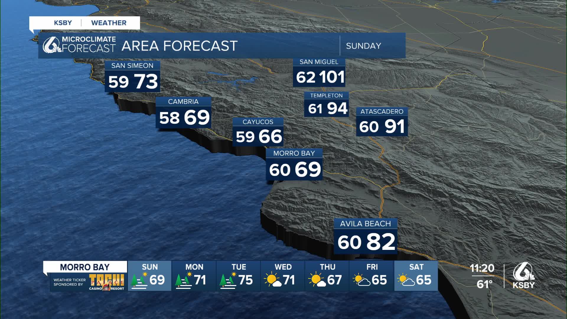
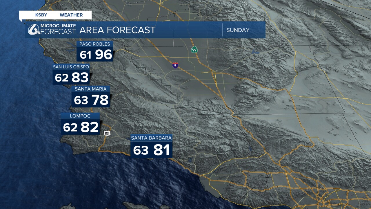
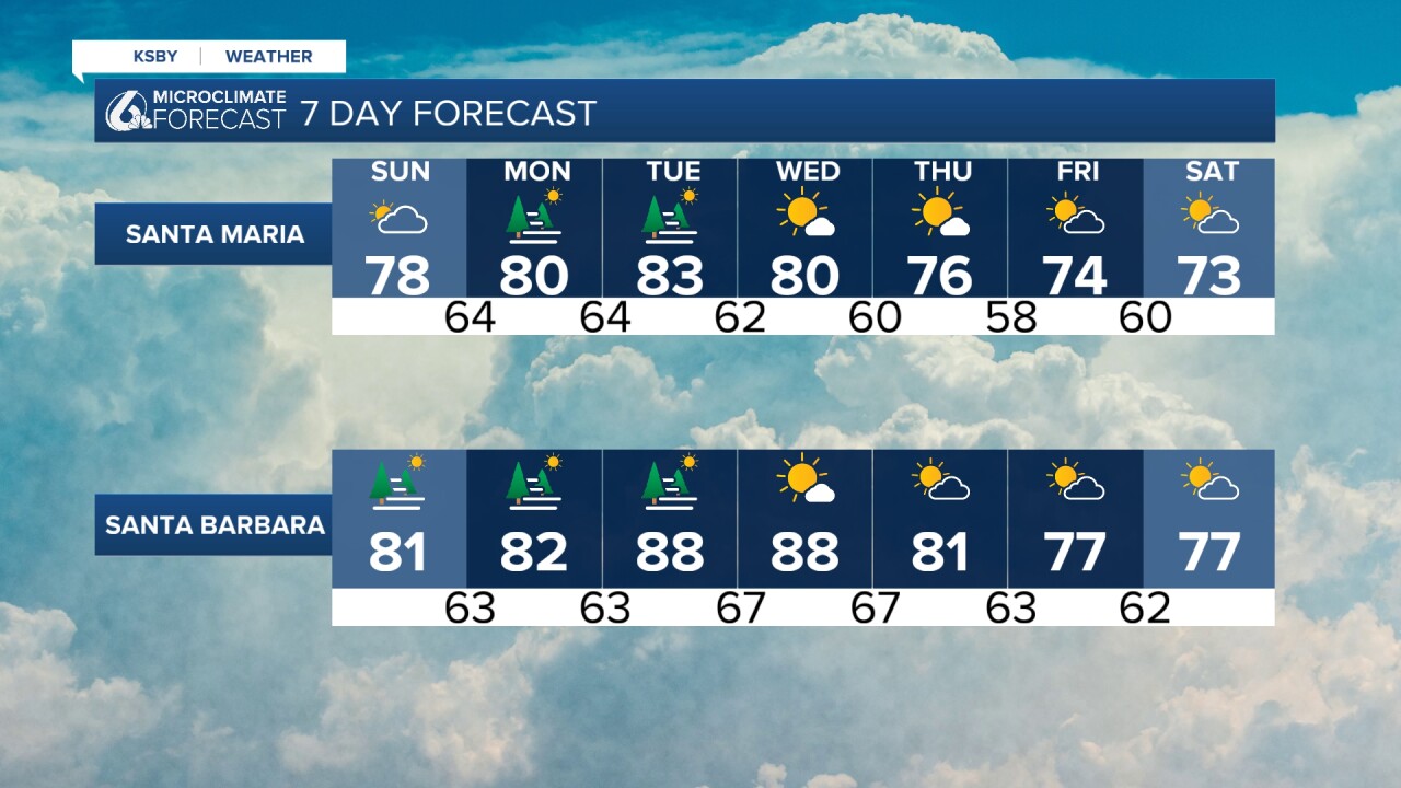
Today's high temperatures are similar to the ones we experienced on Friday. On Sunday, temperatures will resume increasing across most of the region. Take a look at what is expected for tomorrow!
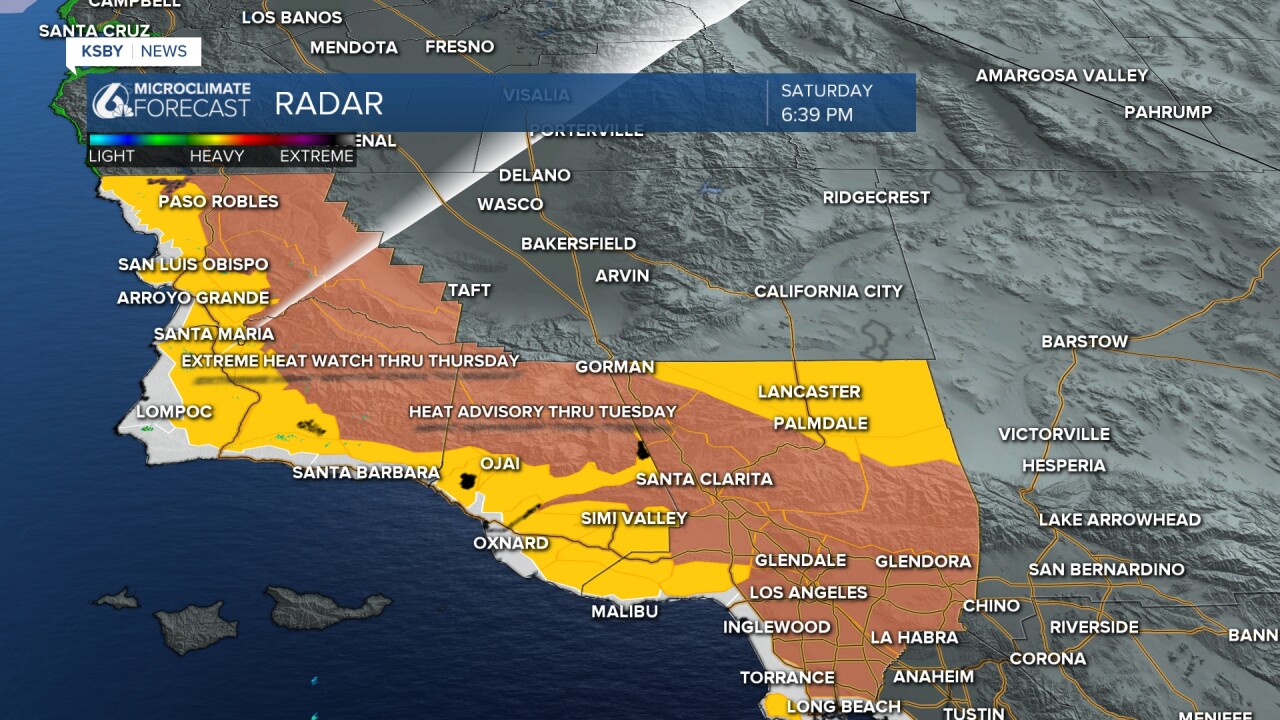
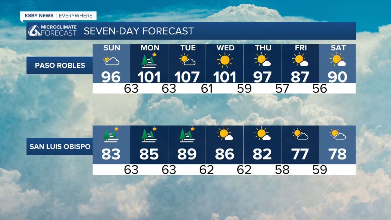
The Heat Advisory, which started last week, will continue through Tuesday of next week. An Extreme Heat Watch follows, beginning that same Tuesday and ending Thursday. Expect the weather to be rather uncomfortable into next week. This is due to monsoonal moisture south of us that will move in on Sunday, increasing humidity levels as well. The result? It will feel increasingly muggy.
This monsoonal moisture will not only lead to muggy conditions; there's the potential for thunderstorms and showers to happen in the next couple of days. The likelihood of this is small, but it still poses a concern. For instance, the potential for dry lightning, meaning in fire weather.
Starting Saturday night into early Sunday, there is a 15 to 20 percent chance of this taking place in the Central Coast.
It is important to stay hydrated and avoid spending too much time outdoors. People of all ages run the risk of developing a heat-related illness.
Stay hydrated,
— Leslie Molina
