

Happy Tuesday, Central Coast!
The storm that we have been chatting about for a full week is here!
Before we dive into the forecast, here are a few links that are helpful to have on hand during these storms.
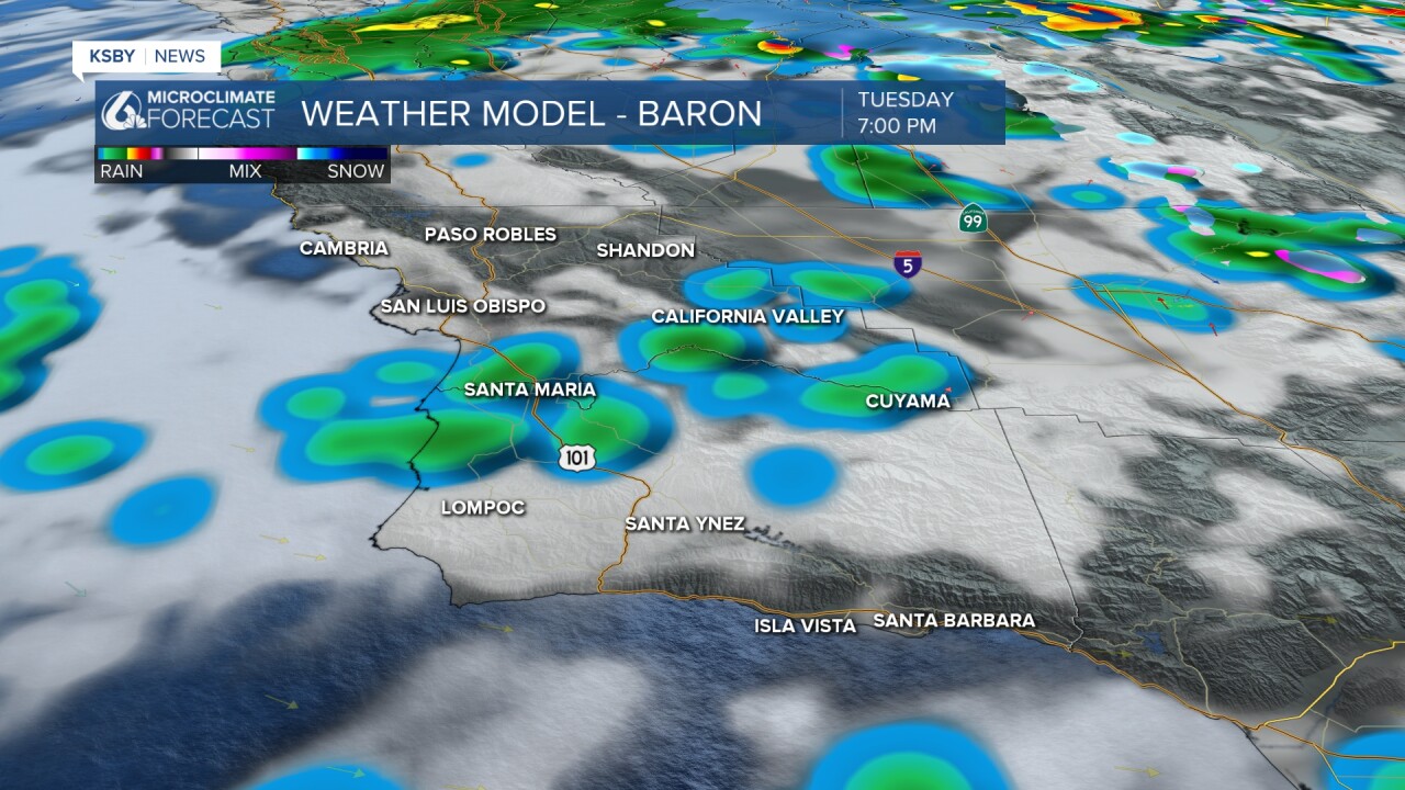
We've seen a lot of overnight rain. Here's a look at the rain that we saw as of 7:10 a.m. today.

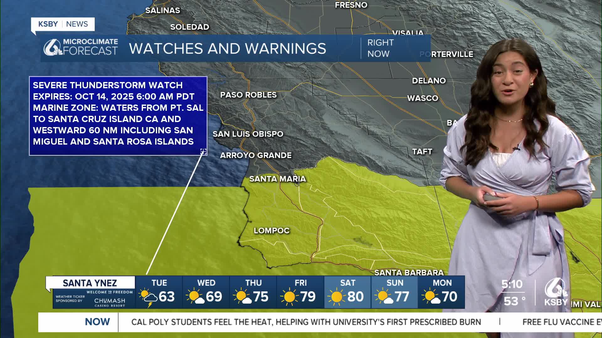
We've had plenty of watches and warnings to start the morning. We are still under an areal flood watch in areas with burn scar until 3:00 p.m.
There may be hazardous and damaging flooding and debris flows. Flooding may also occur in poor drainage and urban areas. Low-water crossings may be flooded.

We'll be dealing with strong winds until about 8:00 a.m. Please be cautious when driving this morning. With the rain and with leaves still on trees, be prepared for blown-over trees as well as power outages.

And we have a severe thunderstorm watch in the East Santa Barbara channel. Other thunderstorm warnings that we've seen this morning in Santa Barbara County have been lifted.

Heavy rain will be clearing out until the early afternoon, moving southeast.


We'll then be seeing cloud cover and scattered showers throughout the day. Make sure to keep that raincoat close by!
Thankfully, sunshine will return quickly with highs climbing into the weekend.
Here is a look at our 7-day forecast!


Stay safe and stay dry!
-Izzy
