

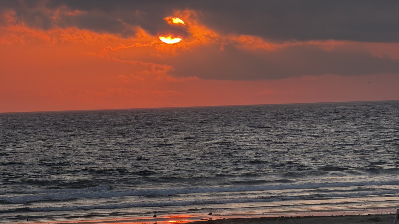


Here is your Central Coast forecast from Meteorologist Jim Castillo for Santa Barbara & San Luis Obispo Counties
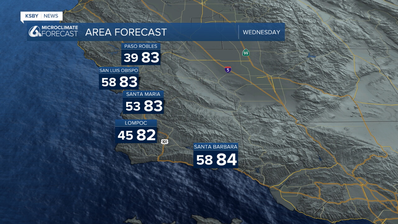
An upper-level ridge continues to bring north and northeast offshore winds until later this week, lots of afternoon sunshine, and mostly clear nights. Temperatures reach the upper 70s and 80s across coastal, valley, and foothill areas. Offshore canyon winds continue across the Santa Lucia Mountains, Santa Ynez Mountains, and Los Padres National Forest, peaking Friday and staying below advisory levels.
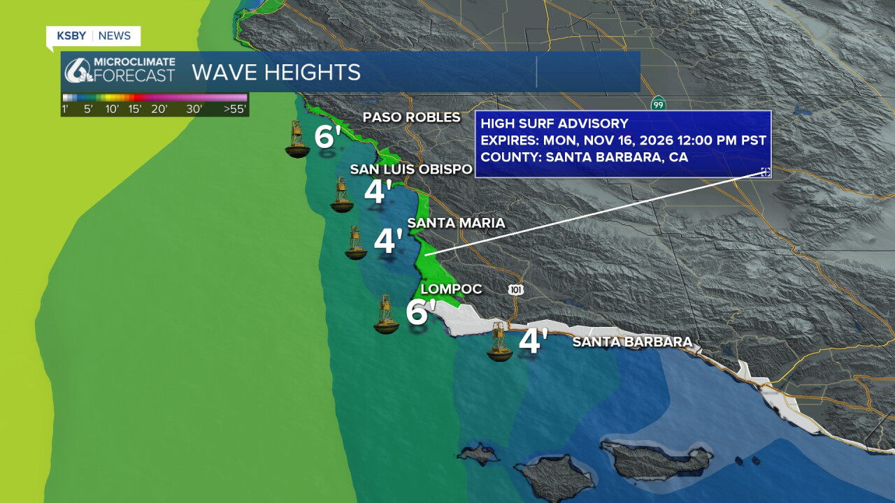
The Coastal Flood Advisory ended at noon on Tuesday, while the High Surf Advisory was extended until noon on Monday.
Large and breaking waves of 7 to 10 feet are likely, with minor tidal overflows possible during morning high tides. Rip current risk continues.
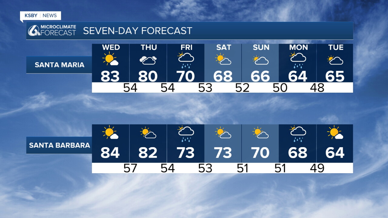
By the end of the week, onshore winds will increase, and a long-lasting cool-down is in the forecast. Rain chances start increasing. Rain develops Friday, and some models now indicate a few downpours are possible with the first of many systems. Rain looks likely Friday, lighter in the morning, with some downpours possible later at night. We get plenty of dry time after Saturday morning, and Sunday looks dry, then more rain is possible Sunday night into Monday.
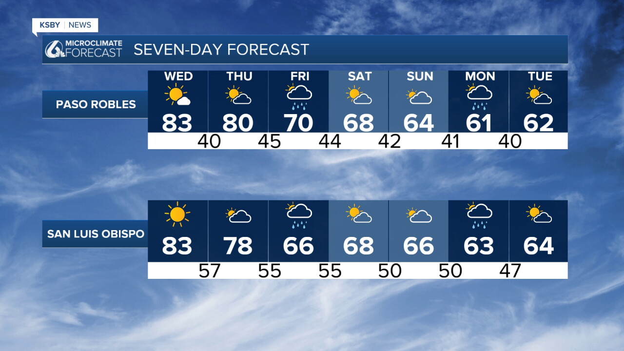
Have a great night, Central Coast!
-Jim
