



Good Tuesday evening from Meteorologist Jim Castillo
Here is your detailed Central Coast Weather forecast for San Luis Obispo & Santa Barbara Counties
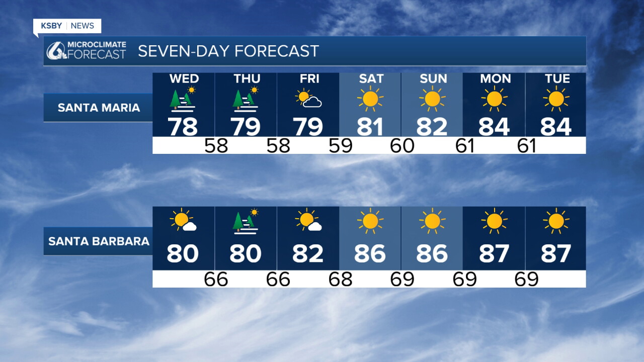
Heat Wave this weekend is the top weather story.
Coastal and Marine Impacts
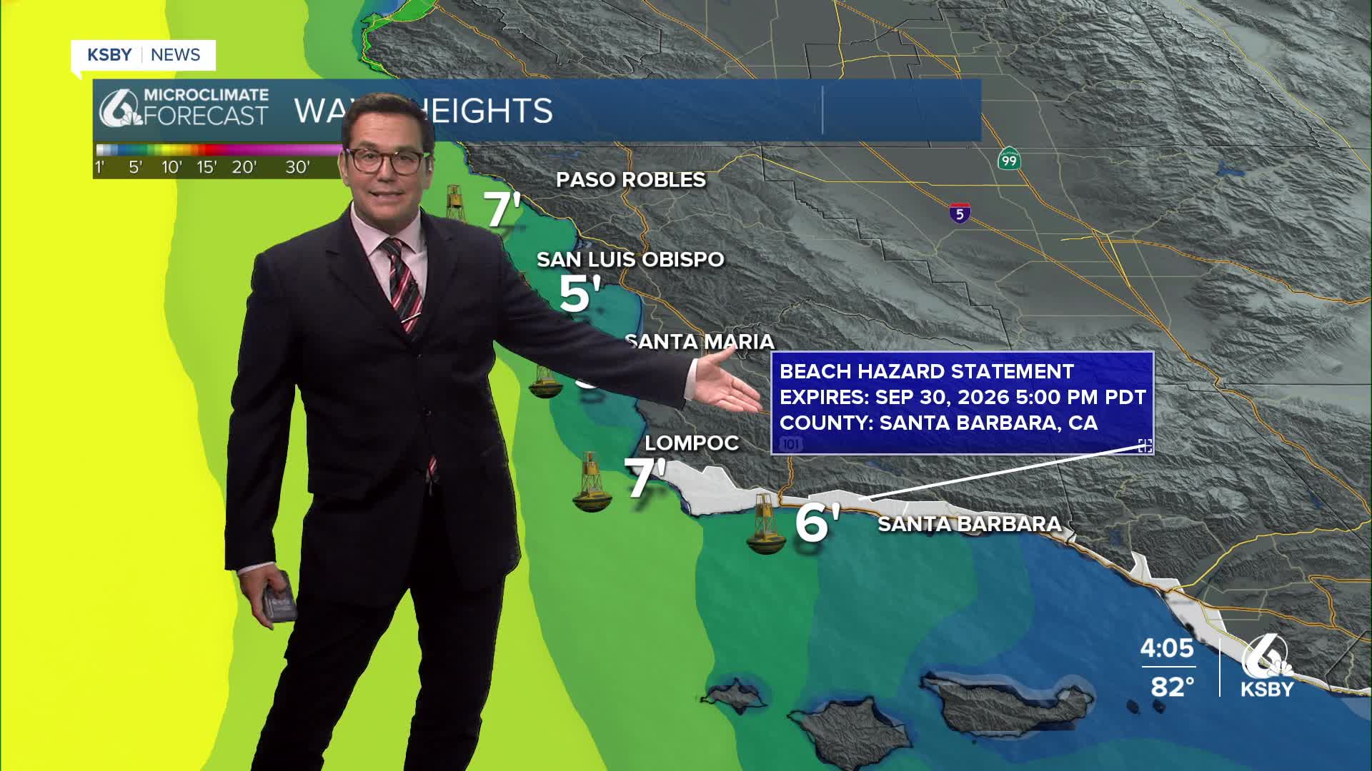
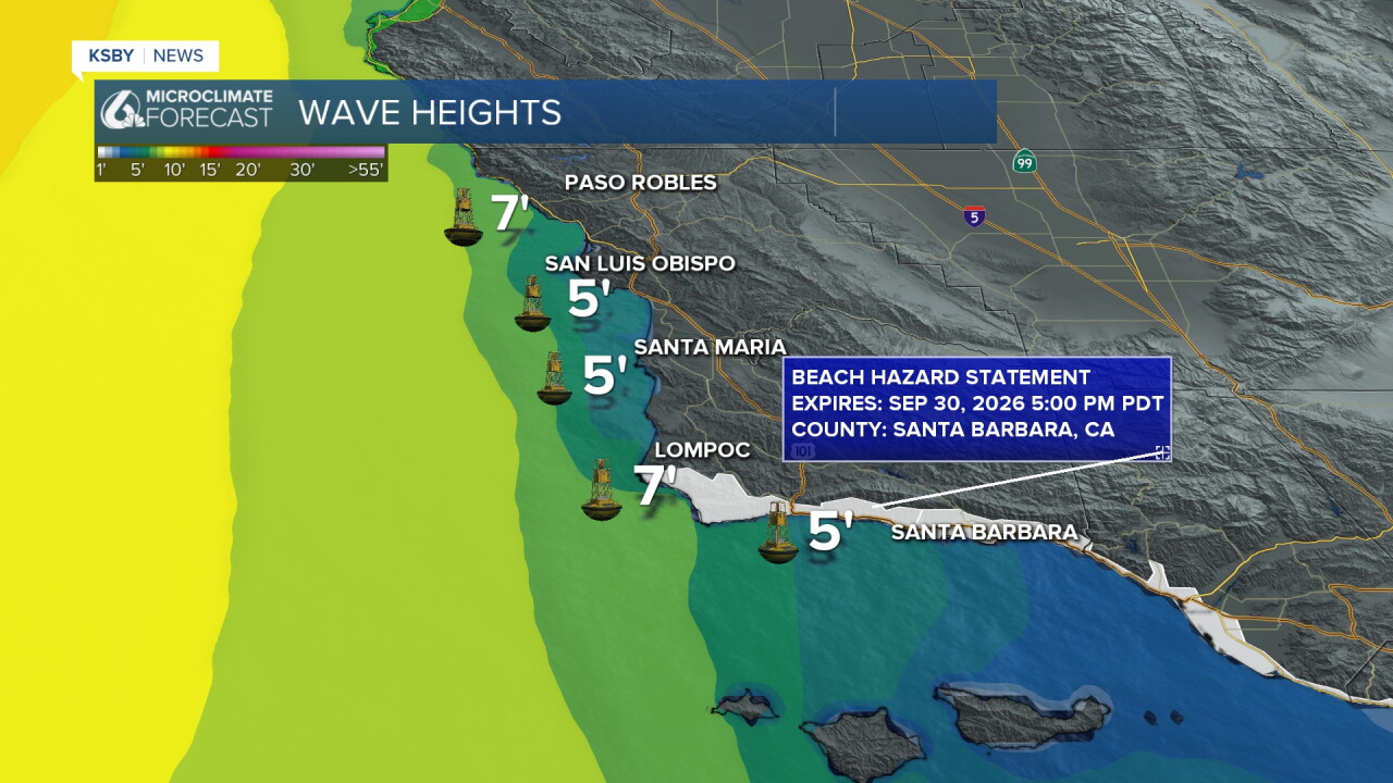
High Surf and rip current risk: Swells originating from distant tropical cyclones far to the south are impacting beaches across San Luis Obispo and Santa Barbara counties. Expect higher sets & rip currents.
Winds: A light offshore pressure gradient has delayed the normal sea breeze. Look for gusty north winds spanning the Santa Ynez Mountains and the Los Padres National Forest, with low-level advisory gusts reaching 35 to 45 mph.
Humidity: The dry offshore flow has caused relative humidity levels to plummet in some areas.
Short-Term forecast through Thursday
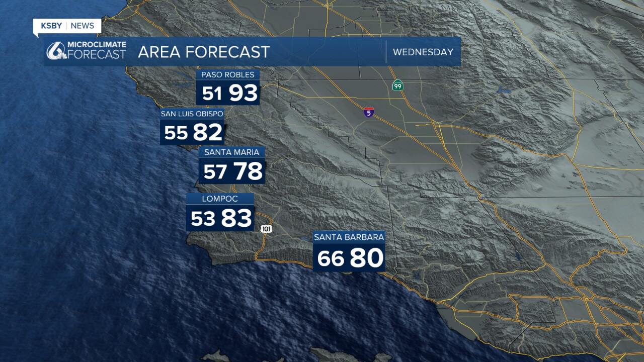
Wednesday: A weak offshore flow in the morning will shift to onshore by the afternoon. Increased upper-level heights will provide some warming for the mountains and far interior, while coastal and valley areas experience a slight cooling. Morning stratus may sneak into isolated Central Coast pockets.
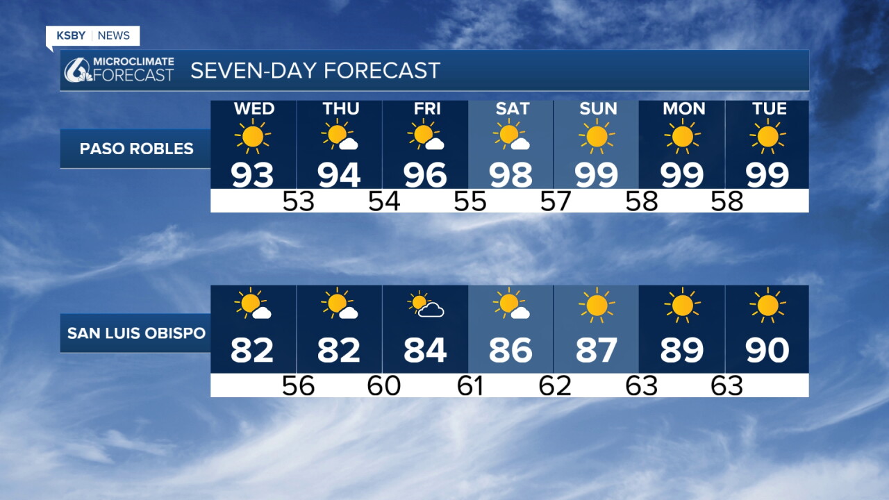
Thursday: An Eastern Pacific ridge solidifies its grip. Sinking air from the upper levels will push temperatures up another several degrees nearly everywhere. Expect coastal readings in the 70s & 80s, with interior valleys reaching the 90s.
Long-Term Outlook: Friday through Monday
The Peak of the Heat: A massive dome of high pressure will sit over California, initiating a prolonged, major heat wave over the weekend.
Temperature Ranges:
Coastal Areas: Highs will range in the 70s and 80s.
Interior Valleys: Dangerous heat will send readings soaring to mid 90s to near 100.
Heat headlines (advisories or warnings) are a near certainty.
Looking Ahead: Long-range modeling indicates that well-above-normal temperatures have strong potential to persist well into the first two weeks of October.
Have a great night, Central Coast!
-Jim
