



Good morning, Central Coast, and happy Thursday!
We are starting the day (again) with cloudy skies and limited visibility. That will clear out quickly, and temps will be similar to yesterday.
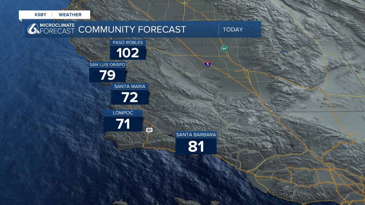
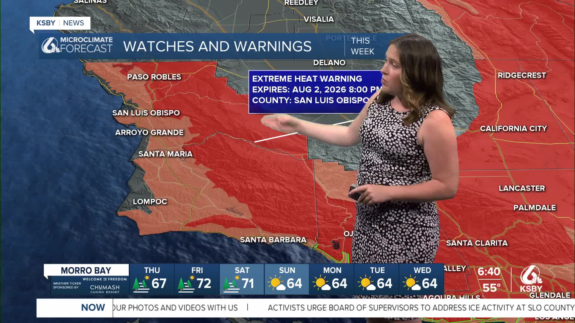
This has prompted an Extreme Heat Warning from 10 a.m. Friday to 8 p.m. Sunday. Plus, a Heat Advisory is in place for our coastal valleys for the same time frame.
If you are trying to escape the heat by heading down to the beaches, there is a beach hazard statement in effect through Saturday due to rip current risk and additional waves associated with Hurricane Genevieve.
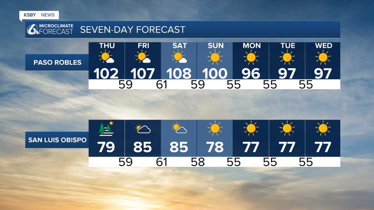
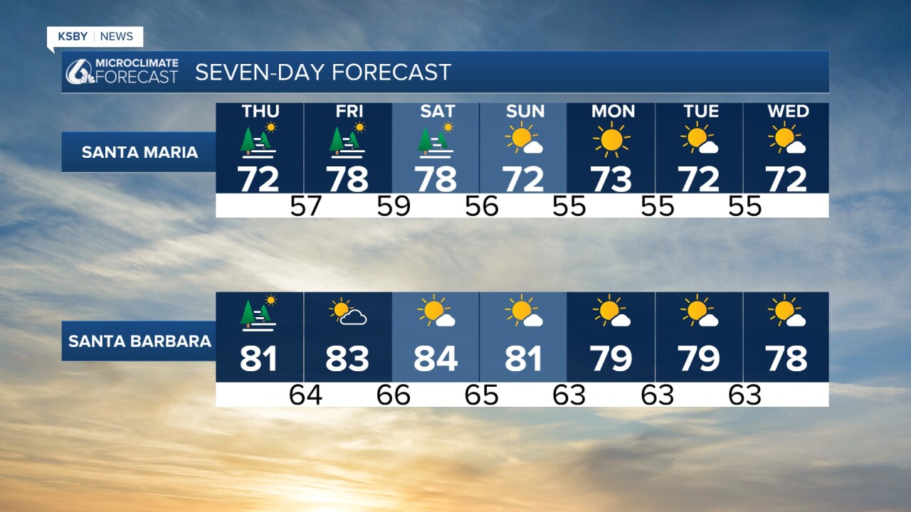
Here is what that all looks like put together for the weekend. Much hotter on Saturday, cooler Sunday.

Check out details on what to do this weekend in my "6 Things to Do" story here!
Starting Sunday and into next week, temps will be cooler although still above normal for this time of the year. The pattern of early morning clouds and afternoon sunshine will also return.
Be sure to stay hydrated, limit exertion for the hottest hours of the day, never leave pets or people in vehicles for any amount of time, walk pets early, and check in on your community members.
One final note this morning: here is a look at the reservoir capacities across the region with the week-to-week change in red.

Have a great day, Central Coast!
-Vivian
