



Good Thursday evening from Meteorologist Jim Castillo
Here is your forecast for the Central Coast for San Luis Obispo & Santa Barbara Counties
Current Pattern
Marine layer clouds have returned to the Central Coast Thursday morning as onshore flow strengthened. This brought welcome cooling with high temperatures dropping several degrees away from the immediate coastline, and some inland areas seeing drops of 10-15 degrees compared to Wednesday's readings.
Through the Weekend
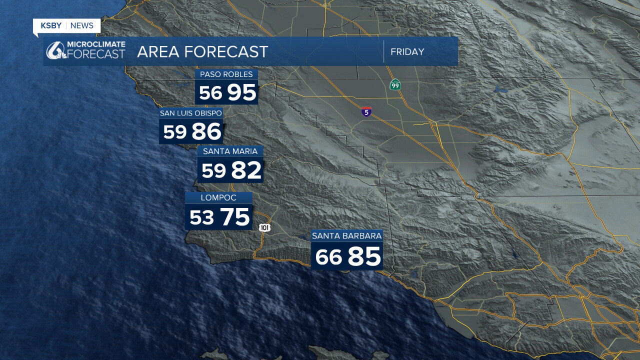
High temperatures will stay above normal through Saturday, with areas of low clouds and fog returning each morning.
Substantial cooling arrives Sunday. Inland areas of San Luis Obispo and Santa Barbara Counties will run 5-10 degrees below normal through the weekend. However, coastal zones will remain slightly above normal, generally reaching the 70s along the Santa Barbara County coast, thanks to much above normal sea surface temperatures.
Tropical Systems Impact
Significant uncertainty exists for next week as tropical storms Polo and Odalys continue swirling off Baja California. In an unusual pattern, these two systems are slowly moving toward each other, creating complex forecast challenges that may not resolve until late weekend for our surf and rip current risk along the Central Coast.
Most forecast models move Polo northwest then inland over central Baja, while Odalys shifts to a slow northward movement. High confidence exists for southerly swells impacting the Central Coast early next week, though rain chances remain low with current tracks favoring a Baja Sur landfall for Polo.
Looking Ahead
A significant warming trend is forecast for Tuesday and Wednesday. Some forecast models indicate increasing offshore flow during this period, potentially bringing 10-15 degrees of warming to the Santa Lucia Mountains, Santa Ynez Mountains, and Los Padres National Forest areas within our two counties.
Note: While beach impacts from Polo are possible Monday and Tuesday in the form of high surf and potential beach erosion, the most significant impacts are expected from Los Angeles County southward to San Diego County.
The marine layer pattern will continue to be the dominant weather feature for the Central Coast through the weekend, providing natural air conditioning for inland valleys while keeping coastal areas comfortably warm.



Have a great night, Central Coast!
-Jim
