

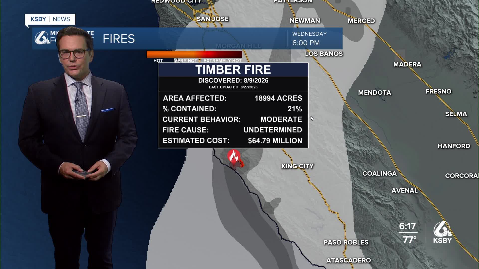


Good Wednesday evening from Meteorologist Jim Castillo
Here is your weather forecast for San Luis Obispo and Santa Barbara Counties
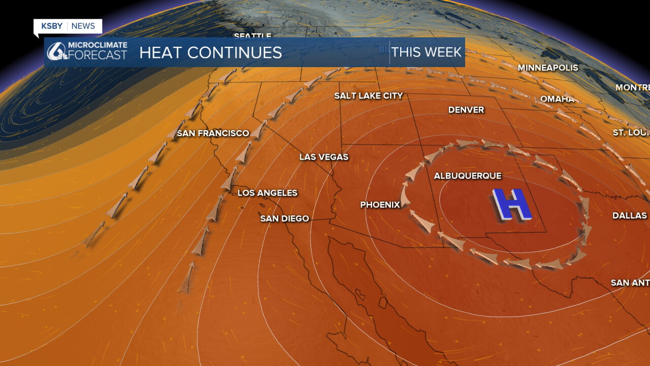
Dangerous Heat Continues Through Friday
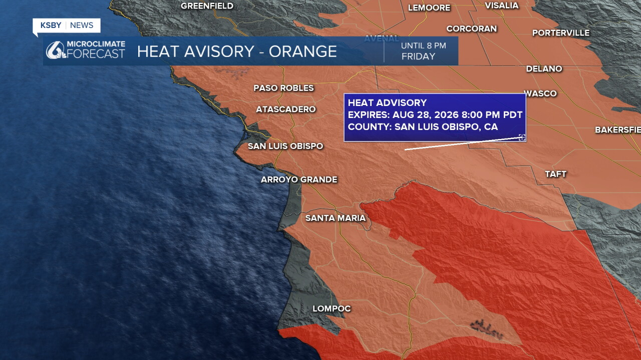
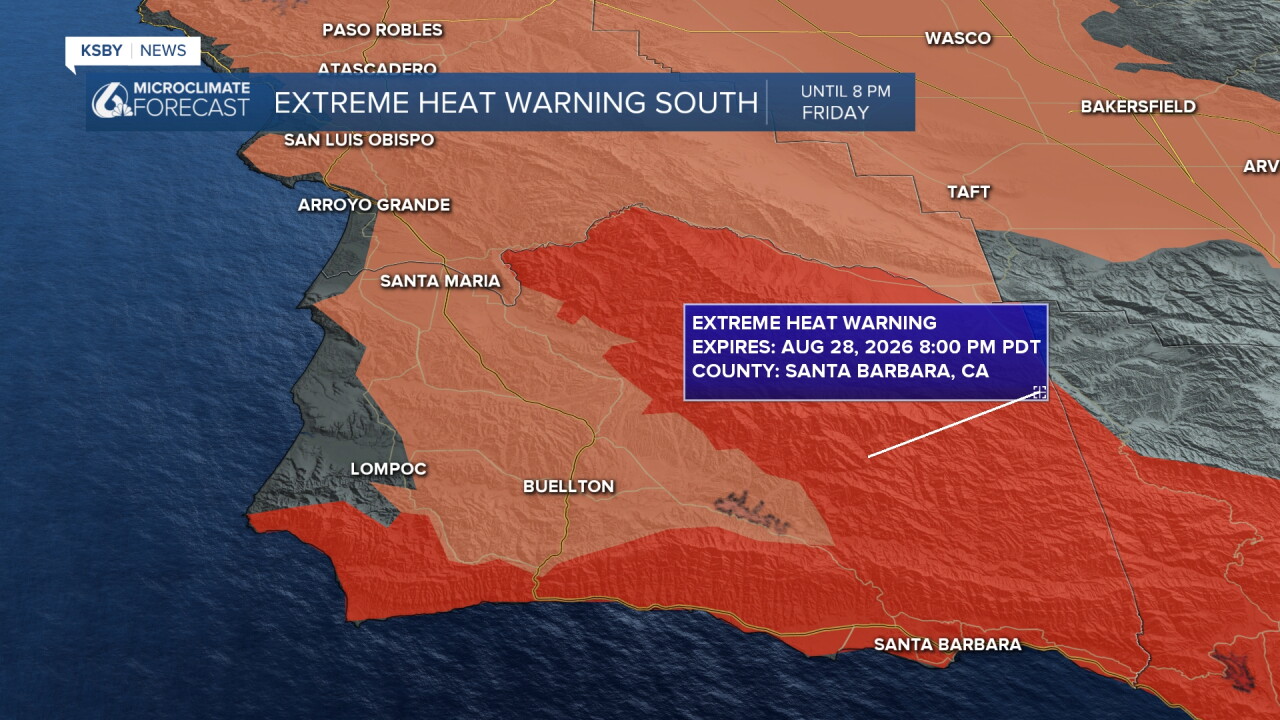
Hot conditions will dominate the week across San Luis Obispo and Santa Barbara Counties, with a high risk of heat-related illness. The Heat Advisory for the Central Coast has been extended 24 hours and now runs through 8 PM Friday.
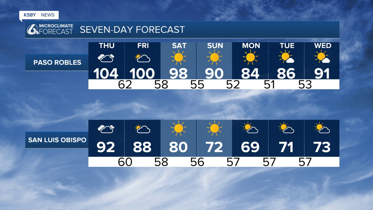
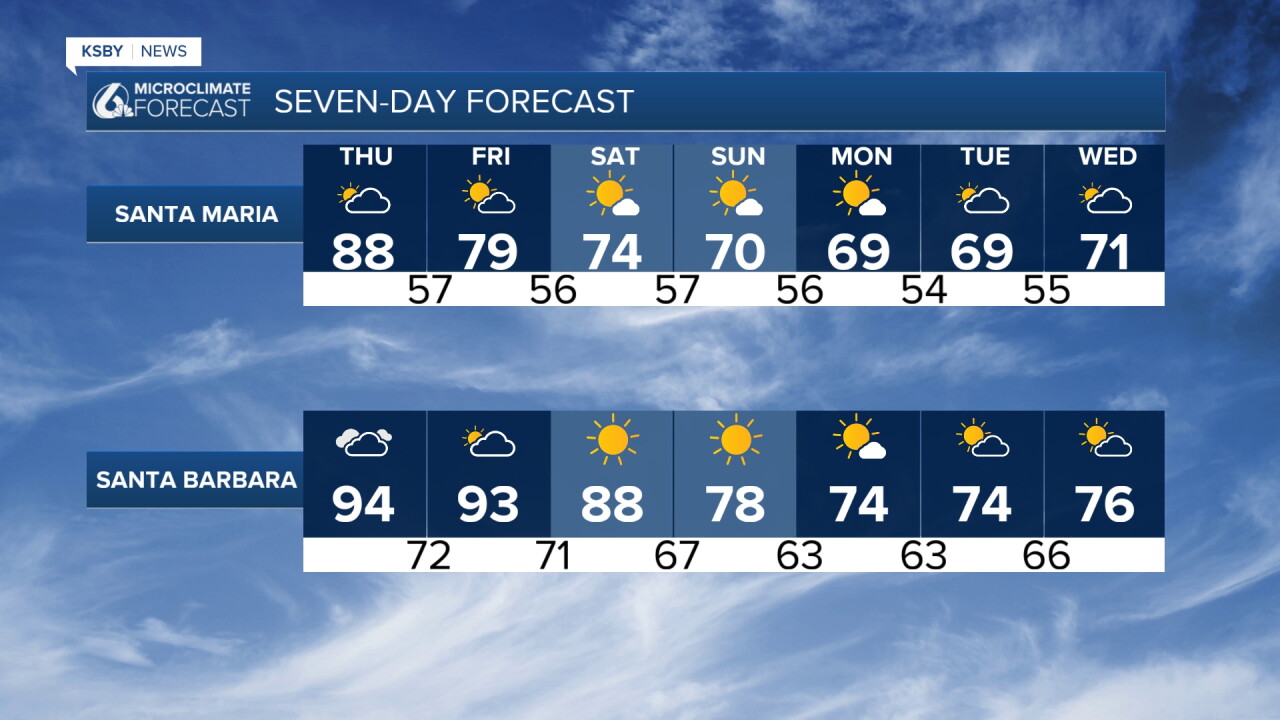
Temperatures remain hot all week, with no significant changes expected through Friday. Even with increasing cloud cover Thursday and Friday, temperatures will stay dangerously hot because the clouds are of tropical origin and there will be embedded sunshine breaks. The added humidity from tropical moisture will actually make conditions feel more oppressive despite any minor temperature drops.
Thursday evening we have a "practically total" lunar eclipse, and it will be mostly clear for it because this strong upper-level high-pressure system brings us heat.
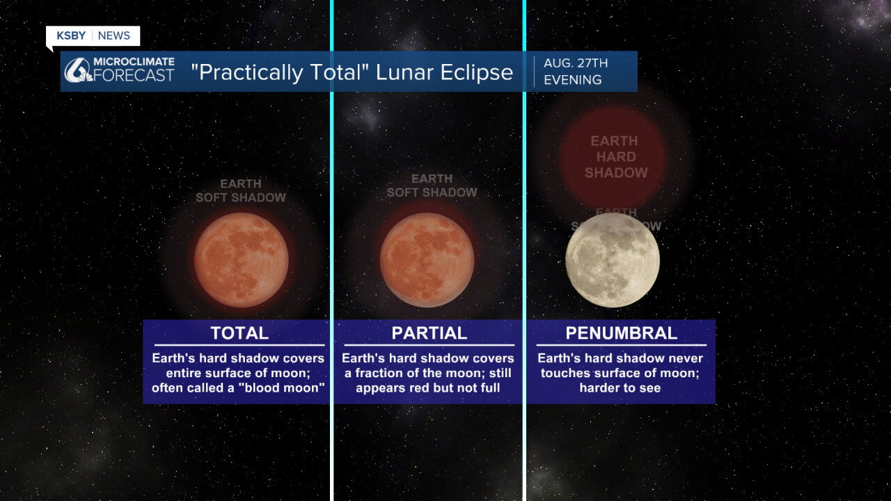
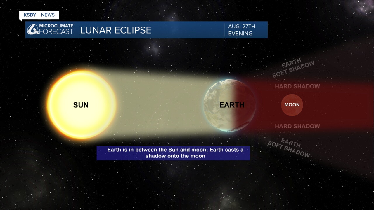
About 96% (roughly 96.2%) of the Moon's surface area will be covered by the Earth's dark inner shadow (the umbra) at maximum eclipse.
While technical terminology lists the umbral magnitude (the fraction of the Moon's diameter) at about 0.93, the actual area obscured comes out to that striking 96%. Because it misses official totality by just a razor-thin margin, it's often called a "practically total" lunar eclipse. Instead of completely vanishing, the bulk of the Moon will take on a deep coppery-red or rusty hue, capped by a single, brilliant bright sliver.
What to Expect Locally
Timing: For the Central Coast, the eclipse will already be underway when the Moon rises on Thursday evening, August 27. Maximum eclipse hits right around 9:12 p.m. PDT, putting the Moon at a comfortable height in the southeastern sky as the peak unfolds.
Weather: Your read on the high pressure is spot on. Strong high pressure building over the region is keeping things remarkably clear across San Luis Obispo and Santa Barbara counties, meaning you shouldn't have to contend with the stubborn coastal marine layer that often plagues spots further north like the Bay Area.
Find a spot with a clear view toward the southeast after sunset tomorrow, let your eyes adjust to the dark, and enjoy the view!
Isolated Storm Activity Possible
Two weather features are bringing moisture and storm potential
Moisture from former Tropical Storm Iselle off the Baja coast will push over California tonight through Friday. An upper-level trough will guide this moisture primarily over Central California.
An organized cluster of thunderstorms moving from northwest Mexico will continue northward overnight into Thursday.
Expect 15-20% chance of light showers anywhere across San Luis Obispo and Santa Barbara Counties Thursday and Friday. While most areas will stay dry, brief big-drop showers could develop anywhere. This represents a classic low probability, potentially high impact scenario.
Wind and Marine Layer Impacts
Santa Lucia Mountains and Santa Ynez Mountains: Sundowner winds will affect southern Santa Barbara County each night through the week. Tonight's winds should be weaker than Tuesday night, but expect them to strengthen Friday or Saturday night again.
Coastal Areas: The marine layer will remain minimal through Friday due to local offshore flow and tropical moisture influx. Marine layer reformation and expansion begins Saturday.
Significant Relief Coming
A large trough approaching the West Coast will push the heat-inducing high pressure eastward and strengthen onshore flow patterns. This will bring quick temperature drops back below normal by Sunday or Monday, providing much-needed relief across both counties.
The marine layer will likely reform and blanket all coastal areas and interior valleys, particularly affecting areas near Los Padres National Forest boundaries.
Next Week's Weather Pattern
Monitor a possible second round of tropical storm remnants Wednesday through Friday of next week. Current model guidance shows mixed signals, with the operational GFS consistently showing moisture and light to moderate rain across southern California. However, ensemble models favor drier conditions with tropical moisture remaining offshore.
Given the low probabilities, this remains a monitoring situation rather than a high-confidence forecast.
Stay hydrated, limit outdoor activities during peak heating hours, and check on vulnerable community members during this dangerous heat.
Have a great night, Central Coast!
-Jim
