



Here's your Central Coast forecast from Meteorologist Jim Castillo: Heat Wave Breakdown to Weekend Cooldown and Tropical Moisture
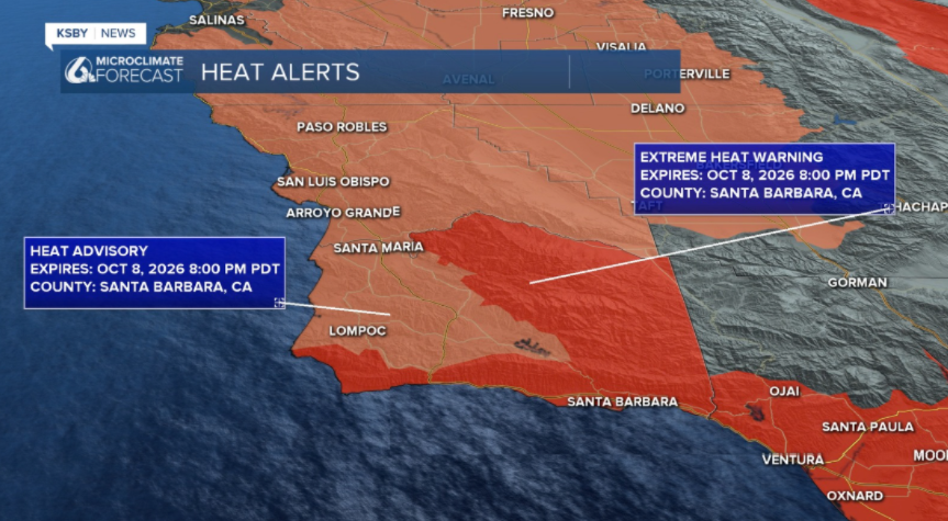
Current Heat Wave & Immediate Trend: The expansive high-pressure ridge responsible for the current dangerous heat wave across San Luis Obispo County and Santa Barbara County will slowly weaken Thursday. While interior locations remain hot, localized cooling is already developing near the coast. All active heat alerts and warnings for the two-county region expire at 8:00 PM Thursday.
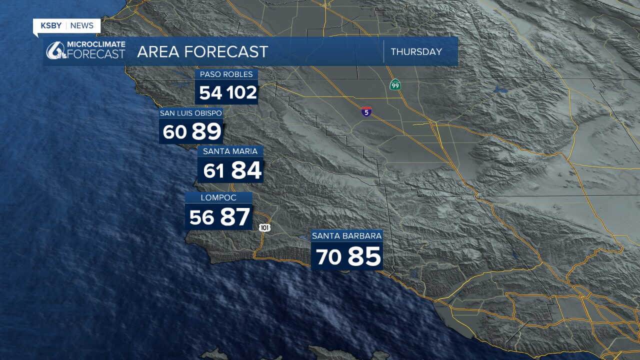
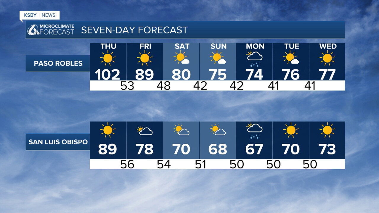
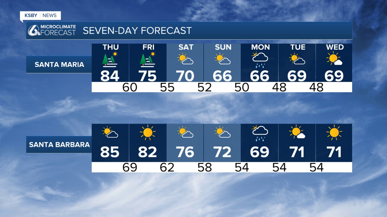
Three-Day Cooling Progression: Lowering heights and increasing onshore flow will drive a steady three-day cooling trend across the Santa Lucia Mountains, the Santa Ynez Mountains, and the interior valleys. Expect most areas to drop a few degrees on Thursday, followed by a much more noticeable 4 to 8 degrees of cooling across the board on Friday.
Marine Layer Expansion: Low clouds and patchy coastal fog will become progressively more extensive through Friday morning, blanketing most coastal stretches of San Luis Obispo and Santa Barbara counties as the marine layer deepens and onshore momentum builds.
Significant Weekend Cooldown: A robust early-season cold upper-level low diving out of British Columbia will carve out a large trough over the West Coast by Sunday. This system will trigger a dramatic temperature drop: maximum temperatures will fall up to 10 degrees on Saturday, followed by more cooling on Sunday. Highs across the Central Coast on Sunday will retreat entirely into the 60s, dropping well below normal for mid-October.
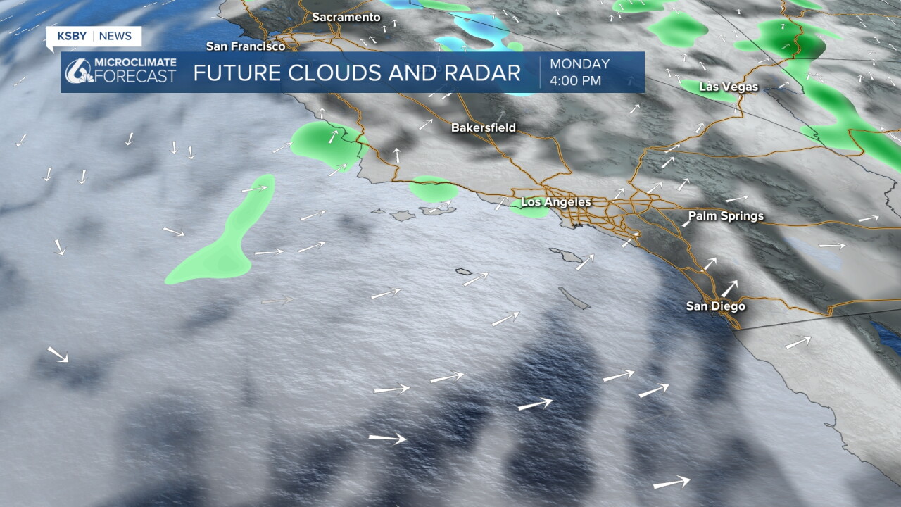
Tropical Moisture & Rain Potential: Attention turns to the remnants of Hurricane Rachel, which are being drawn northward into the approaching trough. This interaction brings an increasing chance of rain showers and isolated thunderstorms to the Los Padres National Forest, coastal zones, and valleys of San Luis Obispo and Santa Barbara counties late Sunday into Monday, as an upper low pinches off overhead. Rainfall amounts across the two-county area are generally projected to stay light (under a quarter of an inch in many spots), before the system clears the region overnight Monday, leaving behind dry and below-normal temperatures next week.
Find cool places to be through Thursday and stay hydrated, Central Coast!
-Jim
