

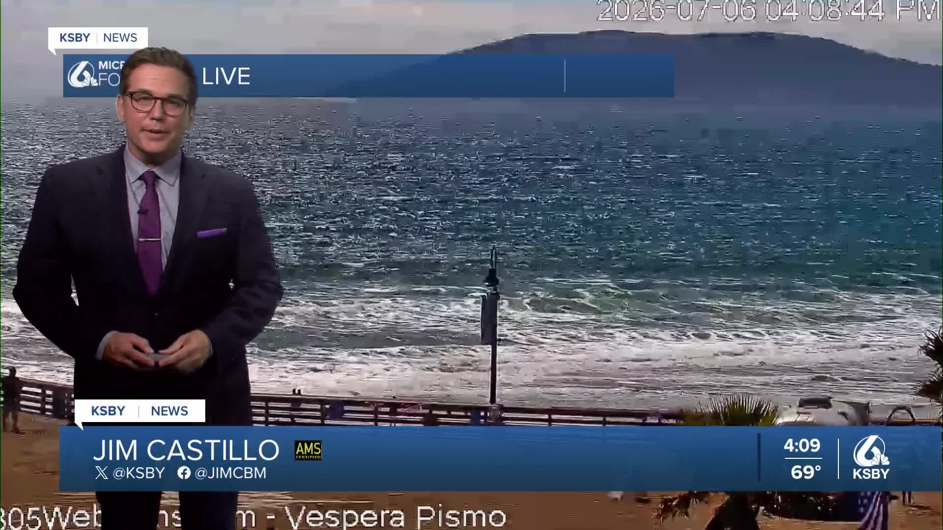


Good Monday evening, Central Coast!
Here's a detailed weather forecast for San Luis Obispo and Santa Barbara Counties
Tonight: Mostly clear conditions continue across San Luis Obispo and Santa Barbara Counties tonight with temperatures running slightly warmer than normal. Tonight, weak onshore flow will bring limited marine layer development to coastal areas and some coastal valleys, but coverage will be much more restricted than we typically see.
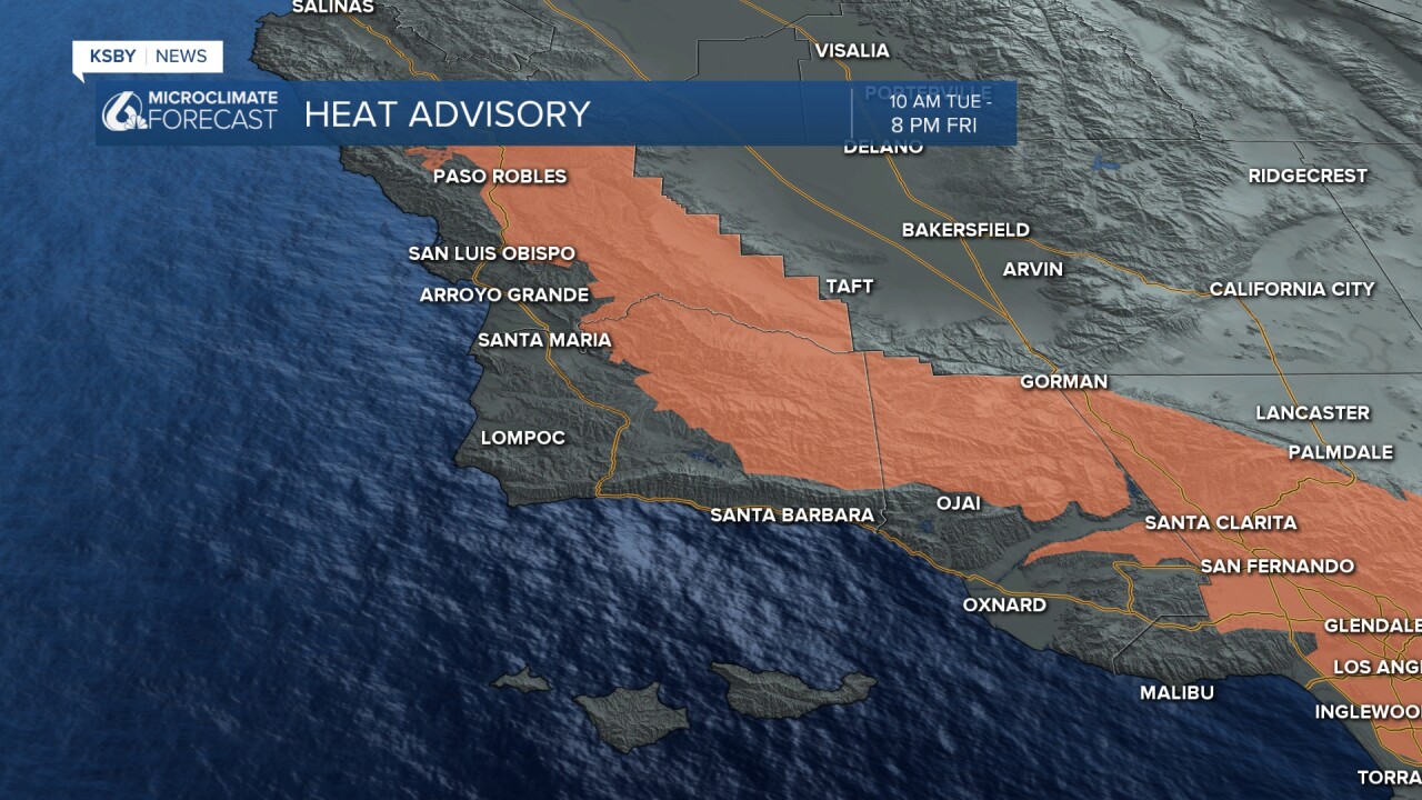
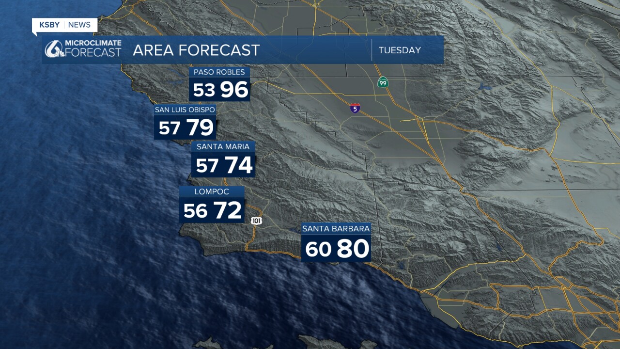
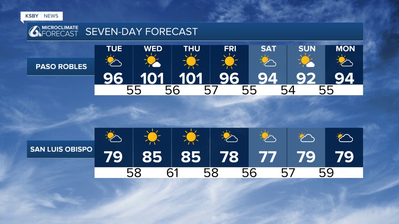
Tuesday Through Friday - Heat Builds: A significant warming trend takes hold as strong high pressure aloft moves west across Southern California. Interior valleys in both counties will see temperatures climb to 100 degrees or higher Tuesday through Friday where a Heat Advisory is in effect. The Santa Ynez and Santa Lucia Mountains will experience elevated fire weather conditions due to the combination of very warm, dry air and gusty evening and overnight winds.
Southwest Santa Barbara County: Sundowner winds are the main concern for the next several evenings, particularly affecting areas near the Santa Ynez Mountains. Tonight, expect northwesterly winds gusting to 45 mph. Tuesday and Wednesday evenings could bring even stronger conditions with gusts potentially exceeding 50 mph and more widespread coverage across southwest Santa Barbara County.
Los Padres National Forest: Fire weather conditions will be elevated to briefly critical across the Los Padres National Forest areas in both counties. The combination of very warm temperatures, low humidity, and gusty winds creates dangerous fire conditions, especially in the higher elevations of the Santa Lucia and Santa Ynez Mountains.
Extended Outlook: The heat continues into Friday before temperatures begin to moderate over the weekend. As high pressure shifts northeast toward the northern Rockies, we'll see a change in the upper-level flow pattern. This could allow some monsoonal moisture to move across the region late weekend into early next week, bringing a slight chance for thunderstorms over the higher terrain areas of both counties, particularly in the Los Padres National Forest.
Bottom Line for Central Coast Residents: Prepare for several days of well-above-normal temperatures, especially away from the immediate coast. Limited marine layer relief means even coastal valleys will be warmer than usual. Stay hydrated, limit outdoor activities during peak afternoon hours, and be extra cautious with any activities that could spark fires, particularly in our mountainous areas.

Have a nice night, Central Coast!
-Jim
